MyTopo
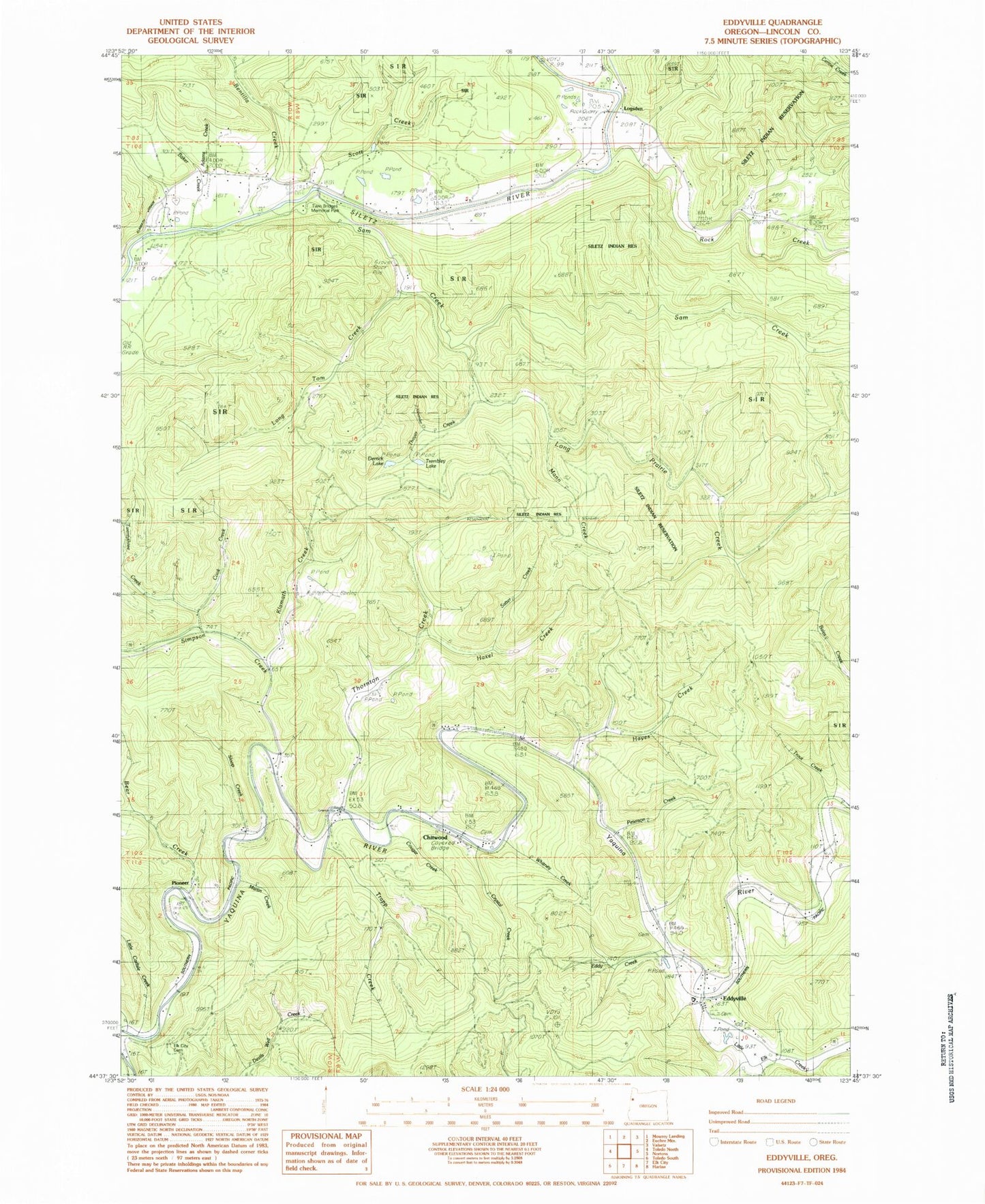
Classic USGS Eddyville Oregon 7.5'x7.5' Topo Map
Couldn't load pickup availability
Historical USGS topographic quad map of Eddyville in the state of Oregon. Map scale may vary for some years, but is generally around 1:24,000. Print size is approximately 24" x 27"
This quadrangle is in the following counties: Lincoln.
The map contains contour lines, roads, rivers, towns, and lakes. Printed on high-quality waterproof paper with UV fade-resistant inks, and shipped rolled.
Contains the following named places: Adams Creek, Baker Creek, Bales Creek, Bear Creek, Bentilla Creek, Bevens Quarry, Chitwood, Chitwood Cemetery, Chitwood Post Office, Cobb, Cook Creek, Cougar Creek, Crystal Creek, Derrick Lake, Eddy Cemetery, Eddy Creek, Eddyville, Eddyville Cemetery, Eddyville Charter School, Eddyville Post Office, Eddyville School, Elk City Cemetery, Haxel Creek, Hayes Creek, Klamath Creek, Little Carlisle Creek, Little Elk, Little Elk Creek, Logsden, Logsden Post Office, Long Prairie Creek, Long Tom Creek, Mann Creek, Martin Creek, Miami Quarry Company, Mill Creek, Morrison, Native American Church of Siletz, Orton Bridge, Peterson Creek, Pioneer, Pioneer City, Pioneer City Post Office, Pioneer Lumber Company, Pioneer Post Office, Rock Creek, Sam Creek, Sams Creek Boat Launch, Satter Creek, Scott Creek, Siletz Rural Fire Protection District Logsden Substation, Simpson Creek, Sloop Creek, Spring Brook, Thayer Creek, Thornton Creek, Toledo Fire and Rescue Department Station 43, Trapp Creek, Trembley Lake, Trout Creek, Twentythree Creek, Twin Bridges County Park, Twin Bridges Park Boat Ramp, Whitney Creek, WOW Log Pond