MyTopo
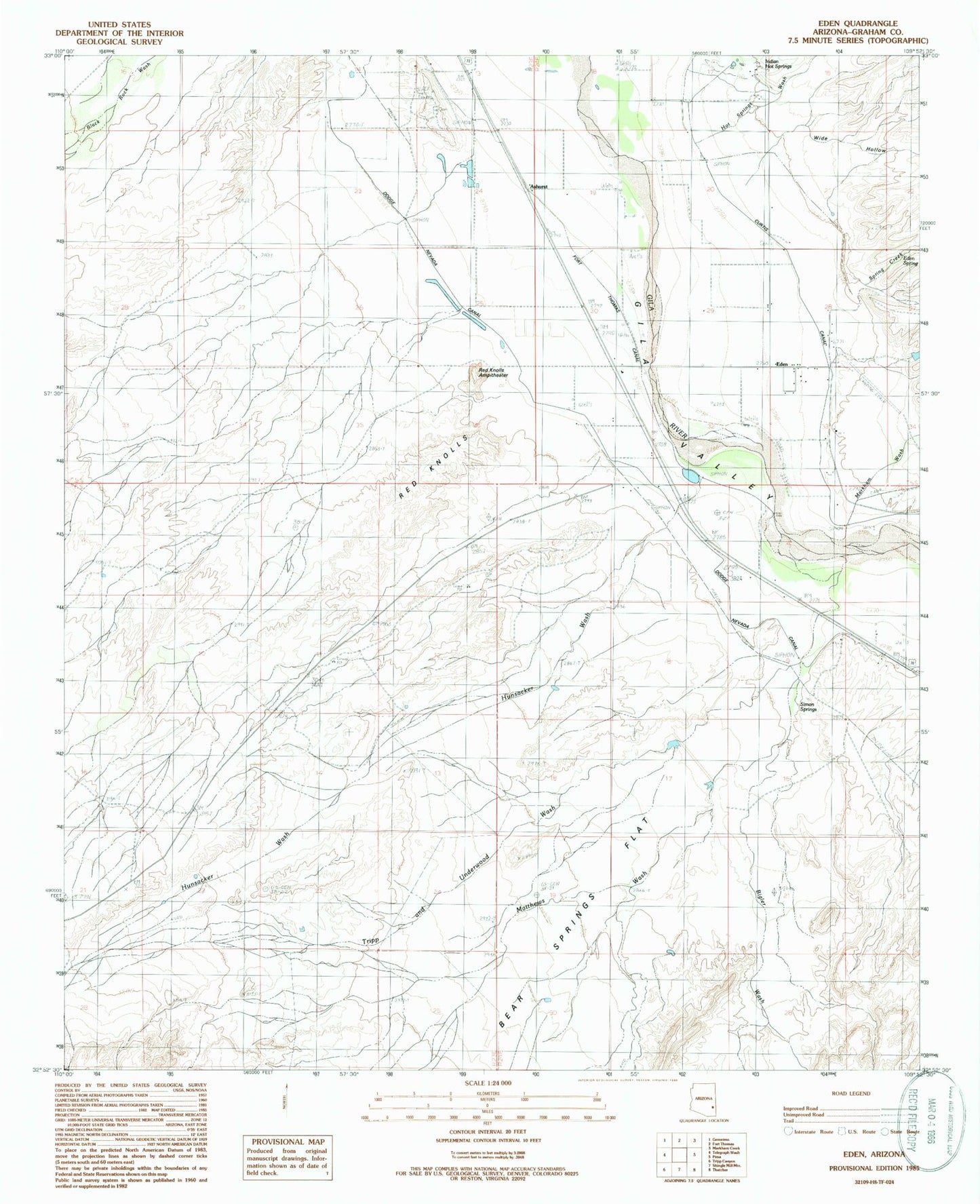
Classic USGS Eden Arizona 7.5'x7.5' Topo Map
Couldn't load pickup availability
Historical USGS topographic quad map of Eden in the state of Arizona. Map scale may vary for some years, but is generally around 1:24,000. Print size is approximately 24" x 27"
This quadrangle is in the following counties: Graham.
The map contains contour lines, roads, rivers, towns, and lakes. Printed on high-quality waterproof paper with UV fade-resistant inks, and shipped rolled.
Contains the following named places: Ashurst, Ashurst Cemetery, Battle Creek Canal, Bear Springs Flat, Bigler Wash, Biglers Reservoir, Cork, Curtis Canal, Dodge Nevada Canal, Eden, Eden Cemetery, Eden Post Office, Eden Spring, Eldon Palmer Reservoir, Gila Well, Graham County, Hot Springs Wash, Hunsacker Wash, Indian Hot Springs, Iron Springs, Magnesium Springs, Markham Wash, Matthews Wash, Mud Springs, Oso Largo Dike Dam, Pima Division, Quarry Reservoir, Red Knolls, Red Knolls Amphitheater, Simon Springs, Spring Creek, Tripp and Underwood Wash, White House, Wide Hollow, ZIP Codes: 85535, 85543