MyTopo
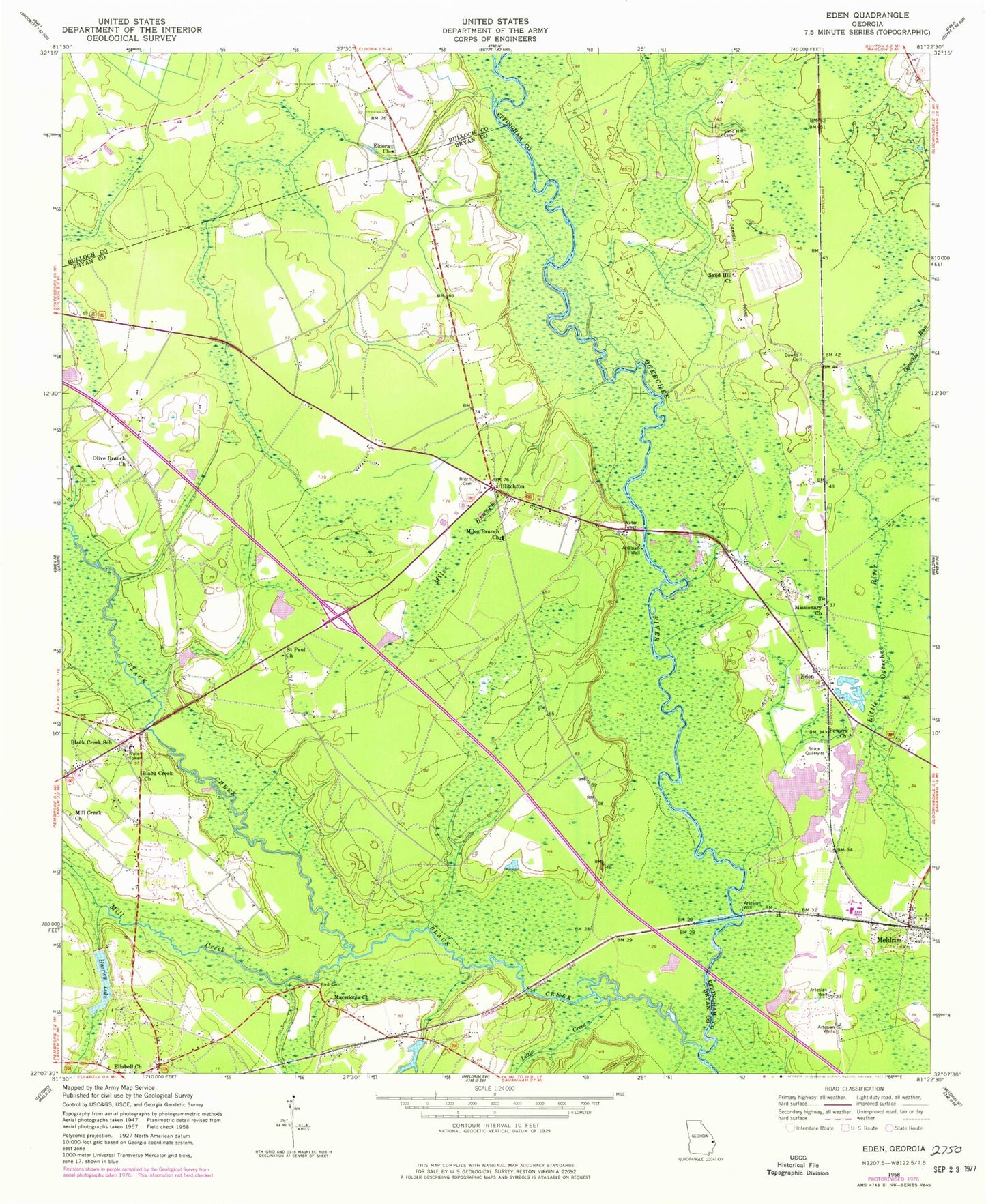
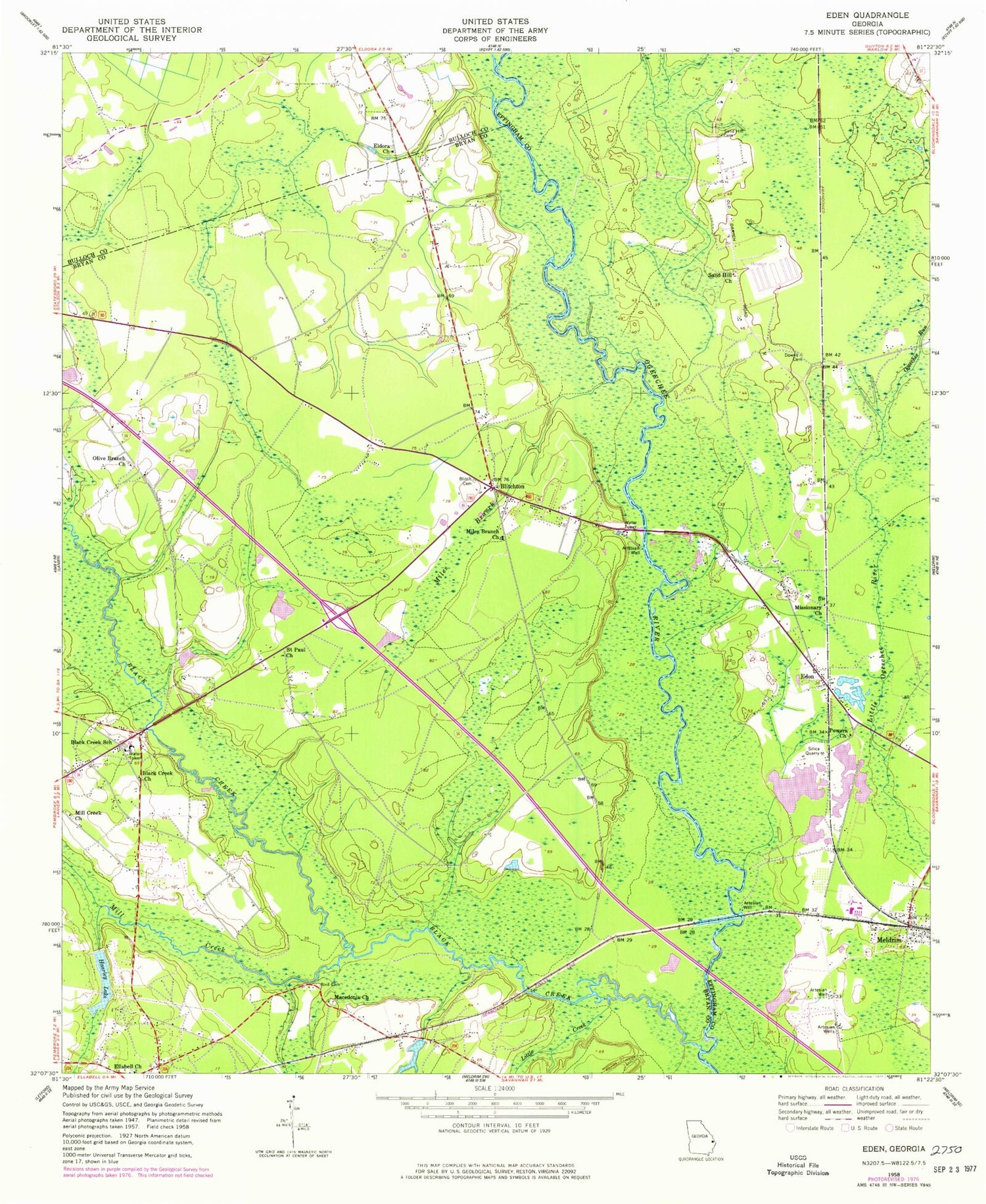
Classic USGS Eden Georgia 7.5'x7.5' Topo Map
Couldn't load pickup availability
Historical USGS topographic quad map of Eden in the state of Georgia. Map scale may vary for some years, but is generally around 1:24,000. Print size is approximately 24" x 27"
This quadrangle is in the following counties: Bryan, Bulloch, Effingham.
The map contains contour lines, roads, rivers, towns, and lakes. Printed on high-quality waterproof paper with UV fade-resistant inks, and shipped rolled.
Contains the following named places: Anderson Temple, Bird - Smith Cemetery, Black Creek, Black Creek Church, Black Creek School, Blitch Cemetery, Blitchon Church, Blitchton, Blitchton Bryan County Volunteer Fire Department Unmanned Station, Bloomingdale Church of the Nazarene, Boyds Temple, Bryan Academy, Campground Cemetery, Church of Christ at Ellabell, Cypress Lakes Airport, Doswell, Downs Cemetery, Eden, Eden Church, Eden Post Office, Eden School, Effingham Fire / Rescue Station 5, Eldora Cemetery, Eldora Church, Ellabell Church, Ellabell Post Office, Gartrell Lake, Haarley Lake, Lake Lorraine Dam, Liberty Church, Little Creek, Lower Black Creek Church, Macedonia Church, Meldrim, Meldrim Baptist Church, Meldrim Christian Church, Meldrim Post Office, Miles Branch, Miles Branch Church, Miles Branch School, Mill Creek, Mill Creek Baptist Church, Mill Creek Church, Missionary Church, Ogeechee Run, Olive Branch Church, Onley School, Powers Church, Saint James Church, Saint Paul Church, Sand Hill Cemetery, Sand Hill Church, Sand Hill Elementary School, ZIP Codes: 31307, 31308