MyTopo
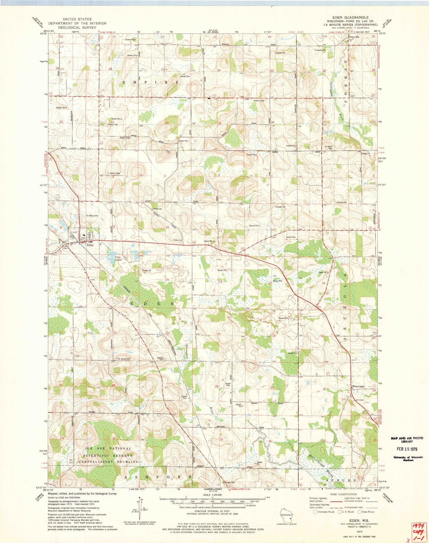
Classic USGS Eden Wisconsin 7.5'x7.5' Topo Map
Couldn't load pickup availability
Historical USGS topographic quad map of Eden in the state of Wisconsin. Map scale may vary for some years, but is generally around 1:24,000. Print size is approximately 24" x 27"
This quadrangle is in the following counties: Fond du Lac.
The map contains contour lines, roads, rivers, towns, and lakes. Printed on high-quality waterproof paper with UV fade-resistant inks, and shipped rolled.
Contains the following named places: Braatz Farms, Broken Bow Dairy, Buena Vista Airport, Dinner Bell Farms, Dinnerbell Airport, Dunisch Farm, Eden, Eden Elementary School, Eden Post Office, Eden Volunteer Fire Department, Edgewood School, Empire Cemetery, Foursome Acres, Gobels Pit, Gudex Cemetery, Guells Dairy Farm, Harcum School, Hayes School, Hill Vu Dairy Farm, Ice Age National Scientific Reserve, Jackson School, Leonard Farms, McCoullough Marsh, Odekirk Cemetery, Saint James Cemetery, Saint James Church, Saint John Cemetery, Saint Mary School, Saint Mary's Cemetery, Saint Michael Cemetery, Tabor Church, Town of Eden, Twin Lakes, Village of Eden, Waucousta, Waucousta Lutheran School, Woodside School, ZIP Code: 53019