MyTopo
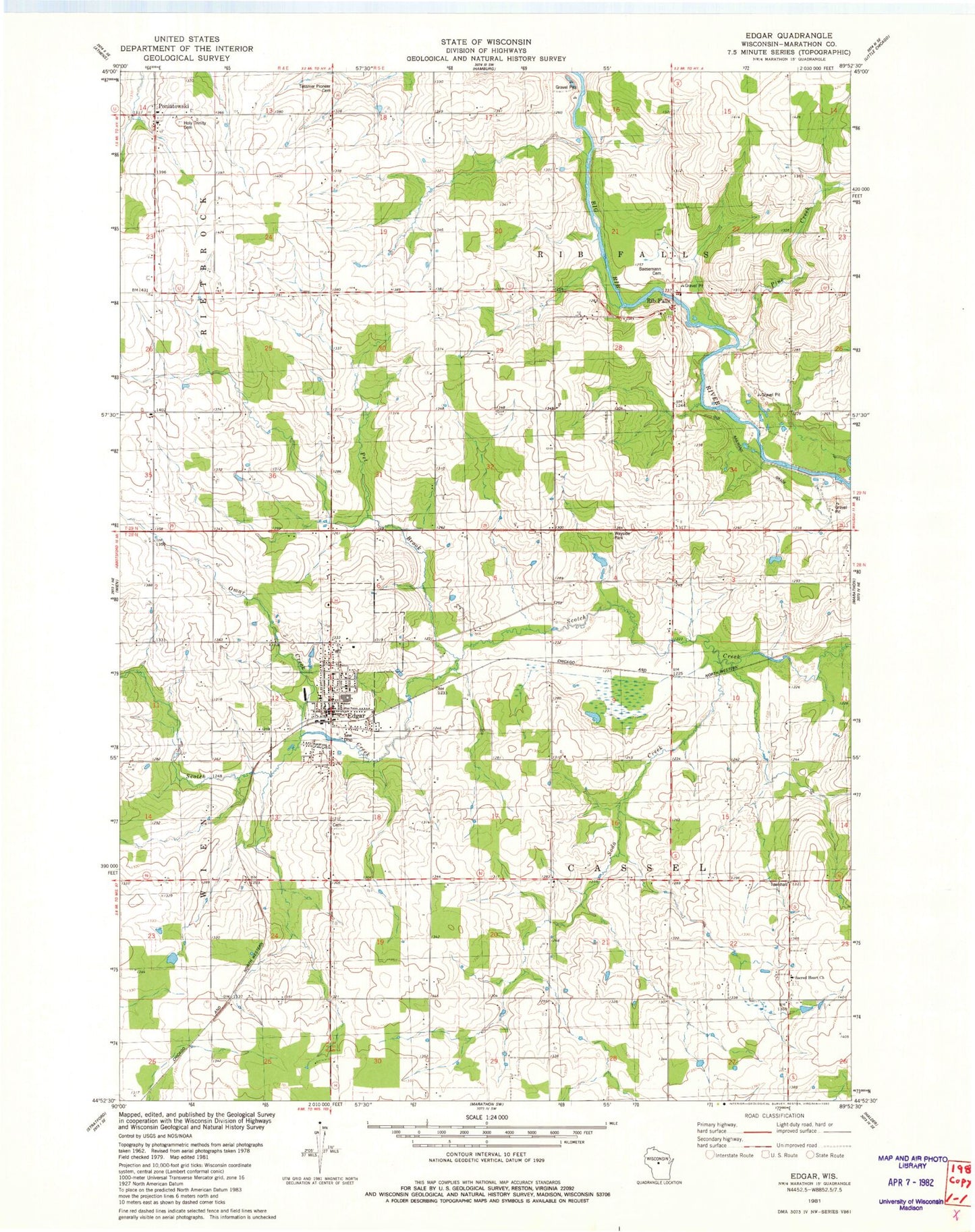
Classic USGS Edgar Wisconsin 7.5'x7.5' Topo Map
Couldn't load pickup availability
Historical USGS topographic quad map of Edgar in the state of Wisconsin. Map scale may vary for some years, but is generally around 1:24,000. Print size is approximately 24" x 27"
This quadrangle is in the following counties: Marathon.
The map contains contour lines, roads, rivers, towns, and lakes. Printed on high-quality waterproof paper with UV fade-resistant inks, and shipped rolled.
Contains the following named places: Baesemann Cemetery, Bonsall Farms, Daisy Dell School, Edgar, Edgar Elementary School, Edgar Middle - High School, Edgar Middle School, Edgar Police Department, Edgar Post Office, Edgar Volunteer Fire Department, Edgar Wastewater Treatment Plant, Elder View School, Findorf School, Holy Trinity Cemetery, Kingdom Haven Farm, Morczynski Farm, Morgan Pit, Omar Creek, Pet Brook, Pine Creek, Poniatowski, Rib Falls, Sacred Heart Church, Sacred Heart School, Saint John the Baptist Catholic School, Soda Creek, Spring Valley Farm, Sunset Acres, Sunshine Dairy, Taylor School, Tessmer Cemetery, Town of Cassel, Town of Rib Falls, Village of Edgar