MyTopo
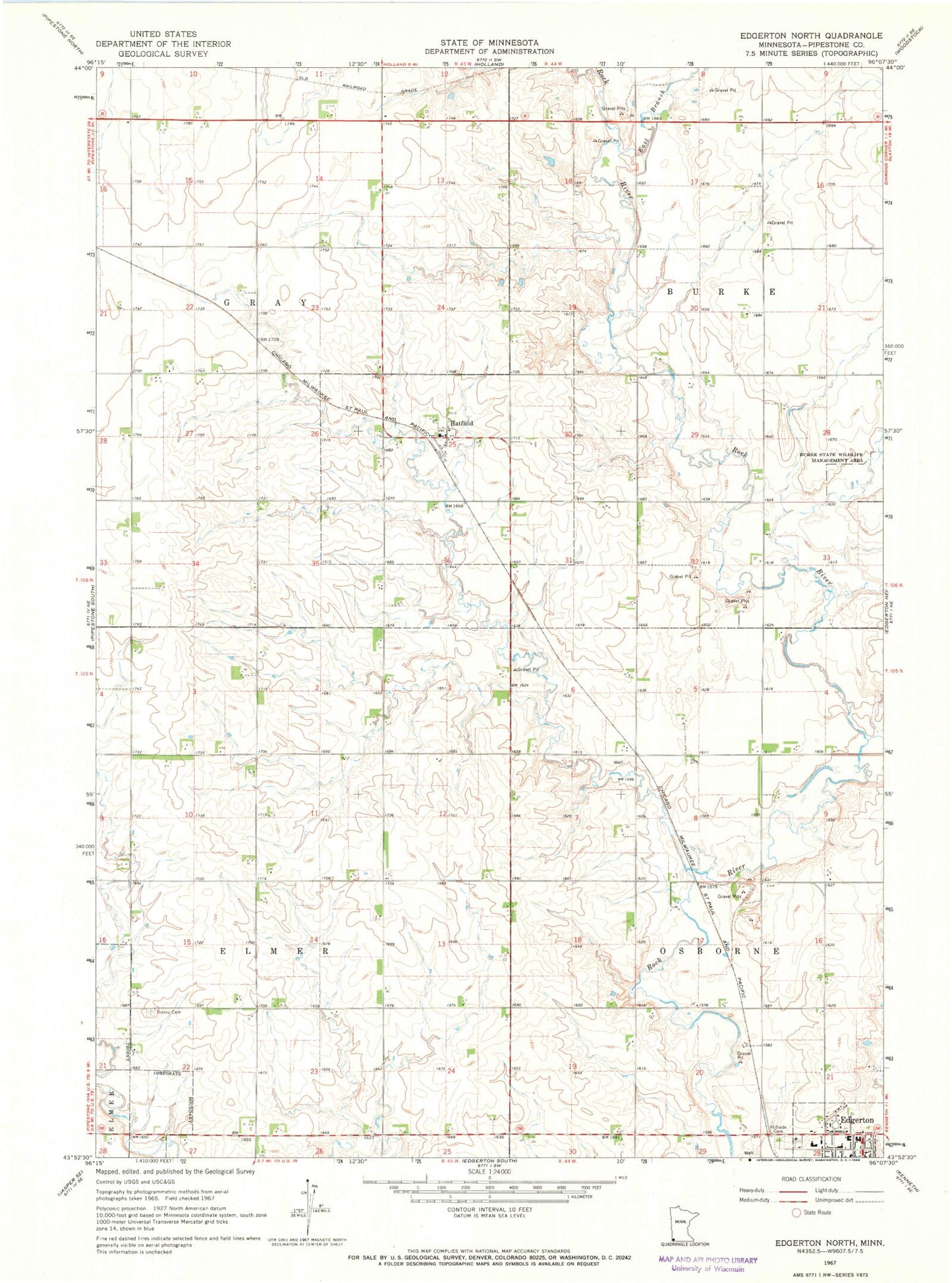
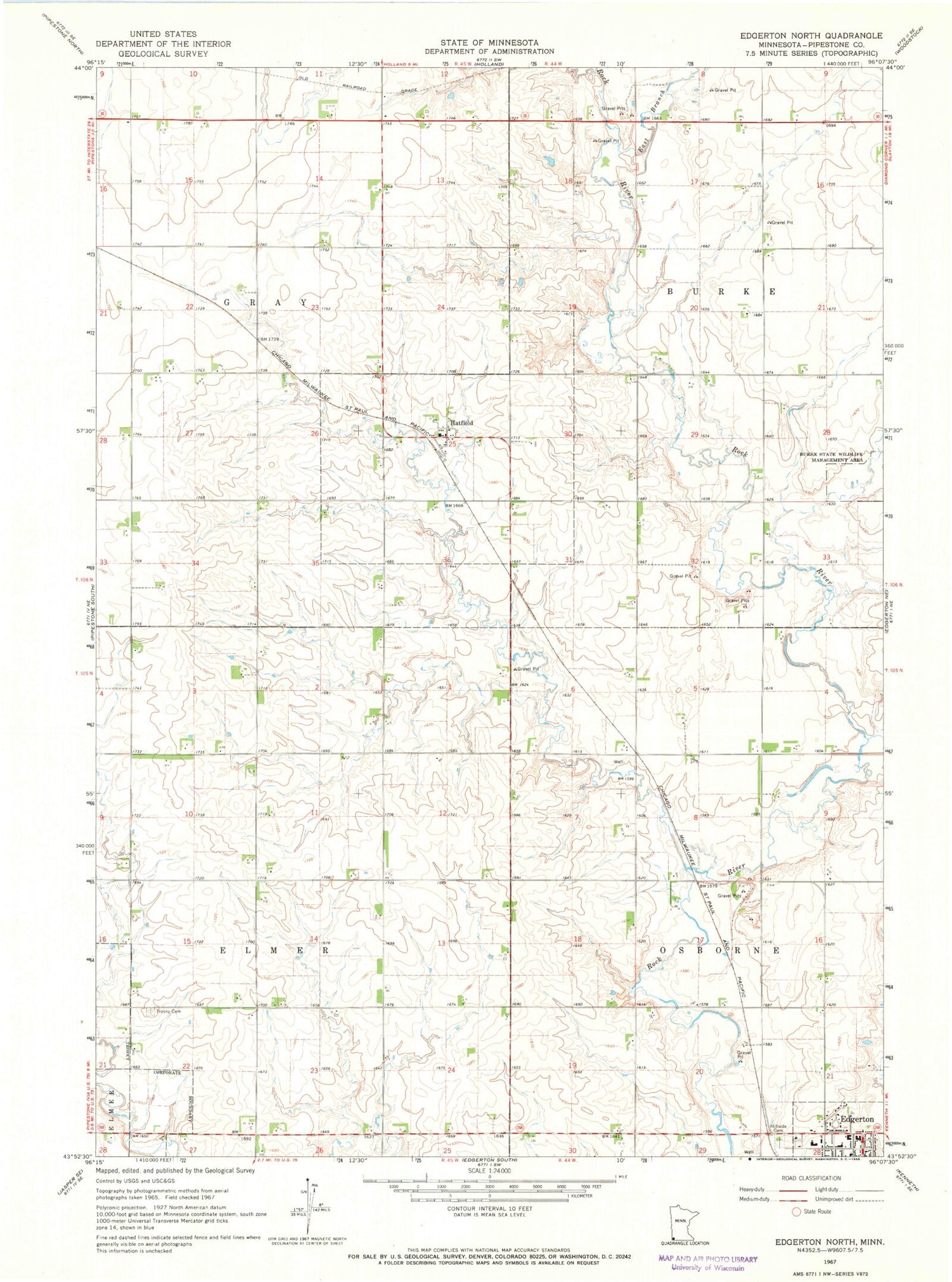
Classic USGS Edgerton North Minnesota 7.5'x7.5' Topo Map
Couldn't load pickup availability
Historical USGS topographic quad map of Edgerton North in the state of Minnesota. Map scale may vary for some years, but is generally around 1:24,000. Print size is approximately 24" x 27"
This quadrangle is in the following counties: Pipestone.
The map contains contour lines, roads, rivers, towns, and lakes. Printed on high-quality waterproof paper with UV fade-resistant inks, and shipped rolled.
Contains the following named places: Bethel Christian Reformed Church, Burke State Wildlife Management Area, City of Edgerton, City of Hatfield, East Branch Rock River, Edgerton Family Medical Clinic, Edgerton Free Christian School, Edgerton Public High School, First Christian Reformed Church, First Presbyterian Church, Hatfield, Hatfield Post Office, Hillside Cemetery, Howard Snyder Farm Pond Dam, Newalta Dairy, R and R Acres, Ranger Farms, Shaffer Farms, Southwest Christian High School, Township of Elmer, Township of Gray, Trosky Cemetery