MyTopo
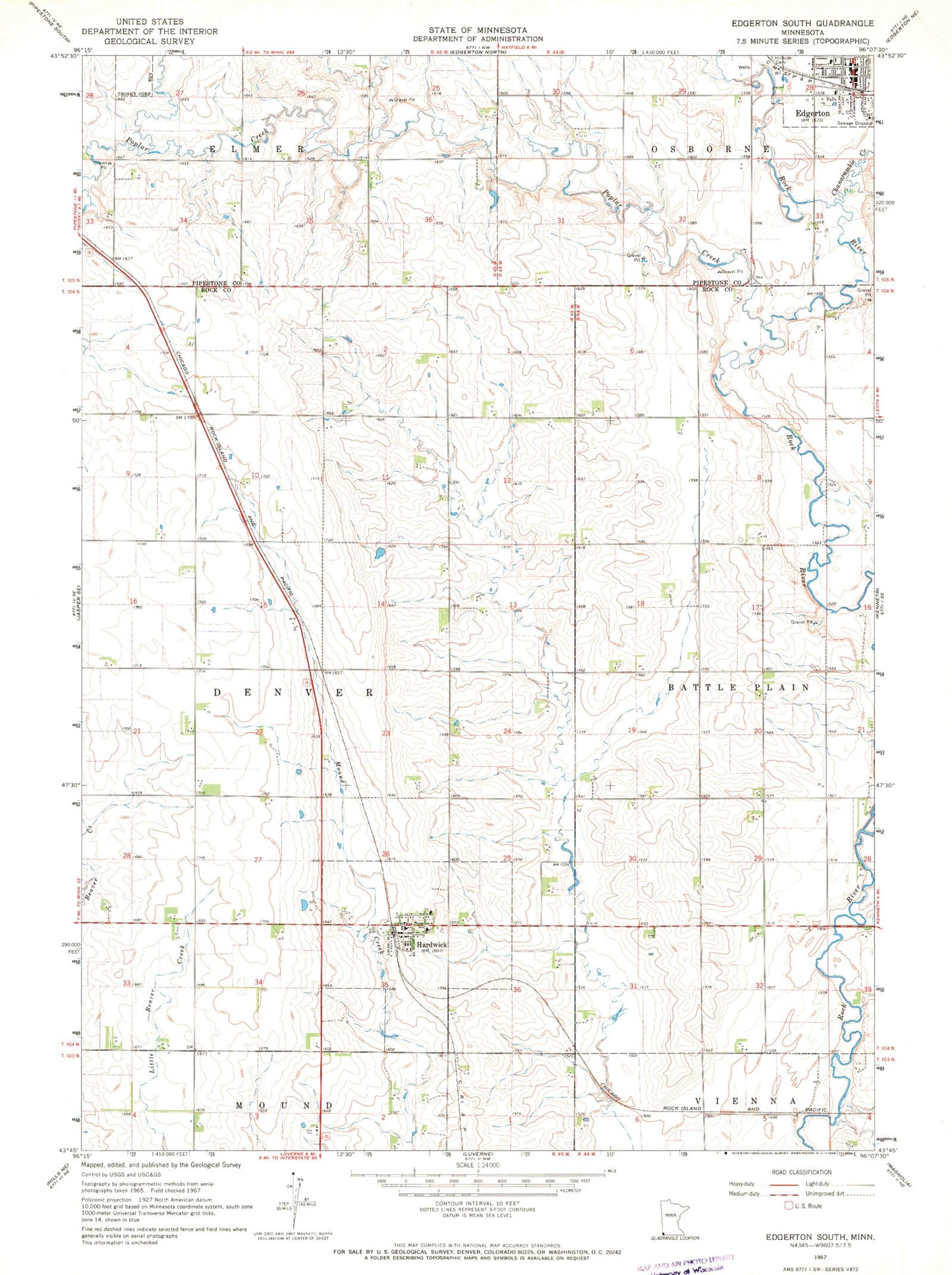
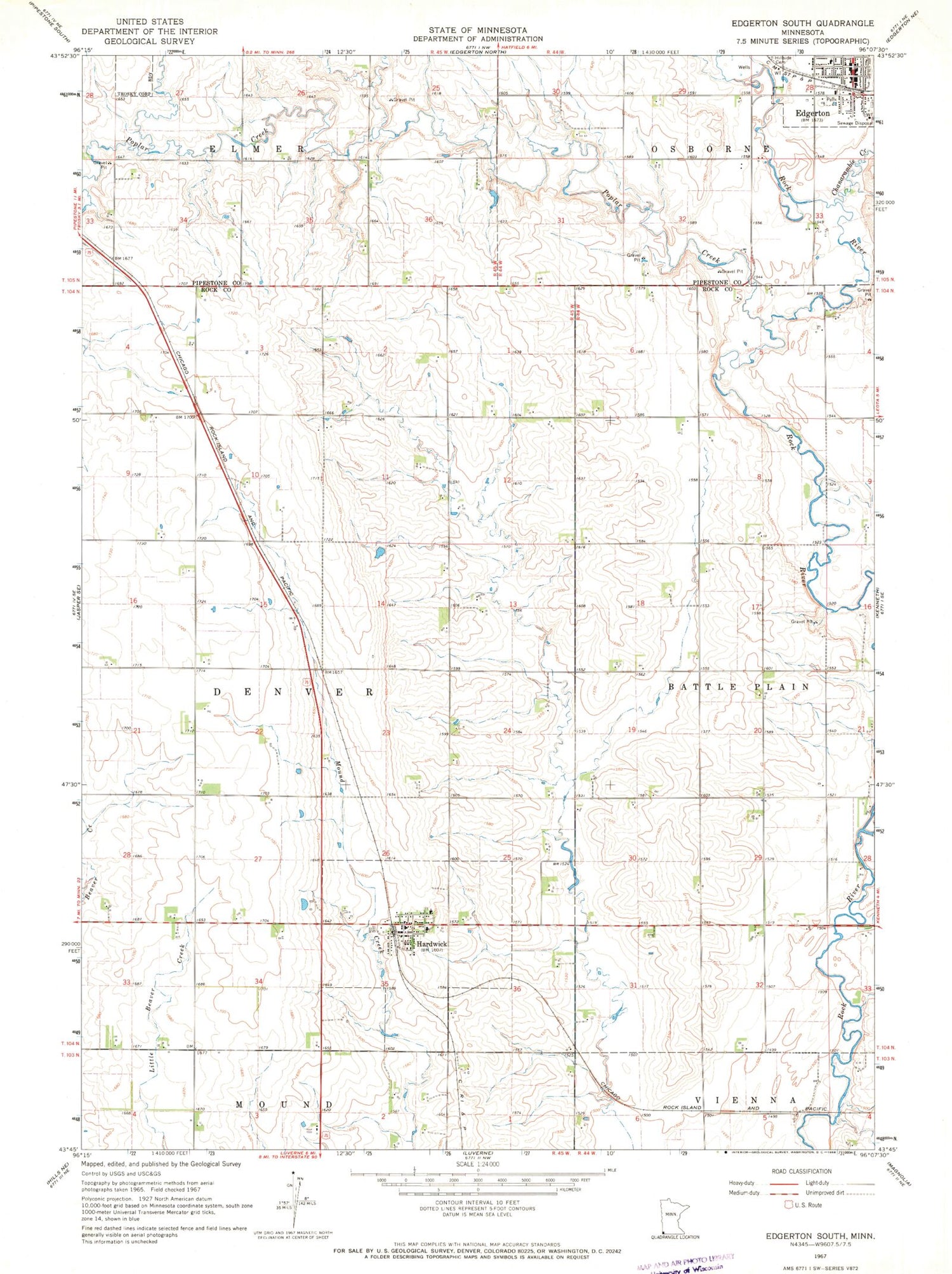
Classic USGS Edgerton South Minnesota 7.5'x7.5' Topo Map
Couldn't load pickup availability
Historical USGS topographic quad map of Edgerton South in the state of Minnesota. Map scale may vary for some years, but is generally around 1:24,000. Print size is approximately 24" x 27"
This quadrangle is in the following counties: Pipestone, Rock.
The map contains contour lines, roads, rivers, towns, and lakes. Printed on high-quality waterproof paper with UV fade-resistant inks, and shipped rolled.
Contains the following named places: Chanarambie Creek, City of Hardwick, Edgerton, Edgerton Post Office, Edgerton Volunteer Ambulance, Edgerton Volunteer Fire Department, First Reformed Church, Hardwick, Hardwick Fire Department, Hardwick Post Office, KLQL-FM (Luverne), Milford Remme Memorial Park, Poplar Creek, Protestant Reformed Church, Runals Memorial Library, Township of Denver, Zion Lutheran Church, ZIP Code: 56134