MyTopo
Classic USGS Edgerton Kansas 7.5'x7.5' Topo Map
Couldn't load pickup availability
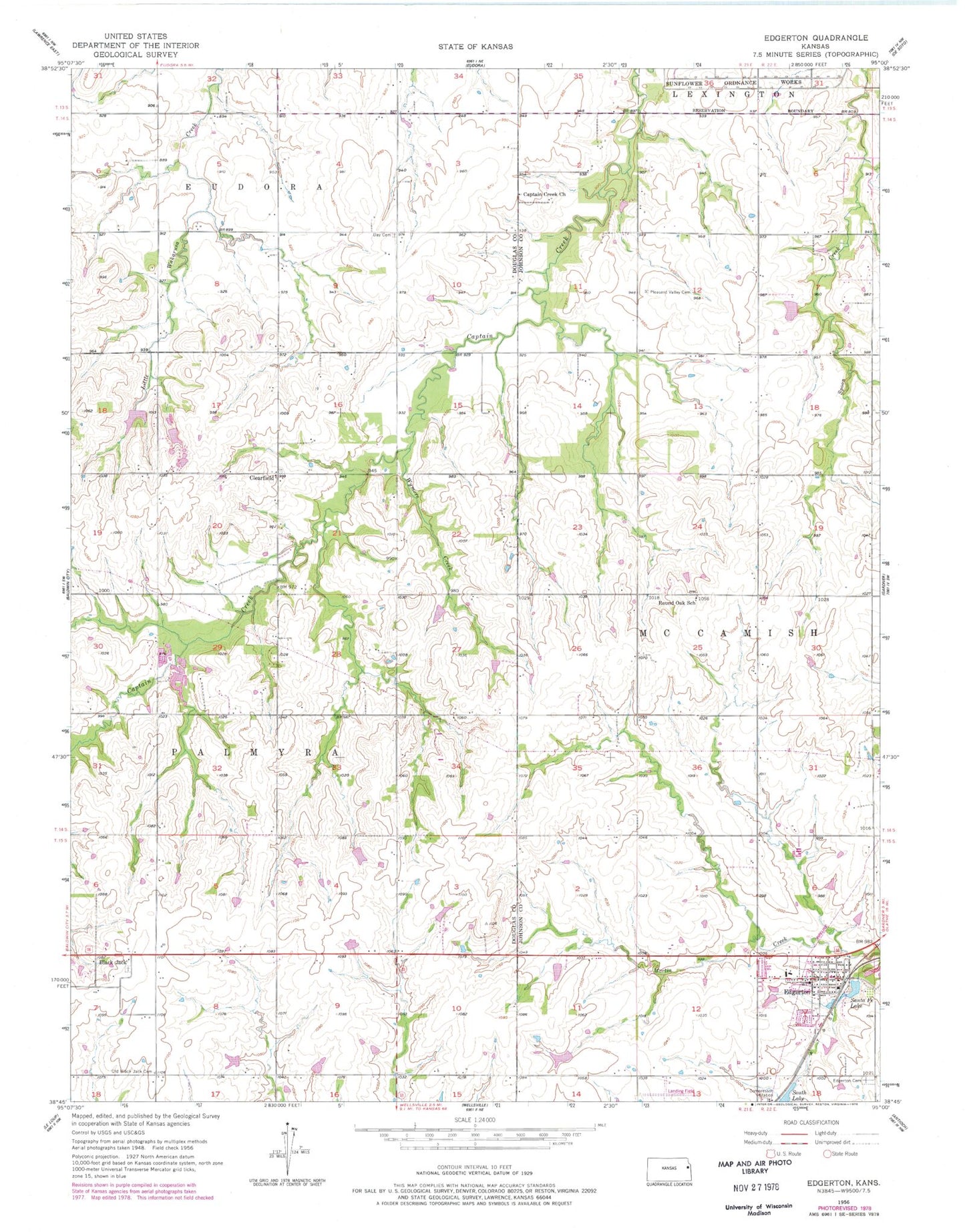
Historical USGS topographic quad map of Edgerton in the state of Kansas. Map scale may vary for some years, but is generally around 1:24,000. Print size is approximately 24" x 27"
This quadrangle is in the following counties: Douglas, Johnson.
The map contains contour lines, roads, rivers, towns, and lakes. Printed on high-quality waterproof paper with UV fade-resistant inks, and shipped rolled.
Contains the following named places: Adams Cemetery, Assumption Catholic Church, Black Jack, Black Jack Cemetery, Captain Creek Church, Clearfield, Clearfield Cemetery, Deay Cemetery, Edgerton, Edgerton Cemetery, Edgerton City Hall, Edgerton City Lake, Edgerton Elementary School, Edgerton Library, Edgerton Mobile Home Park, Edgerton Post Office, Edgerton Southern Baptist Church, Edgerton United Methodist Church, Edgerton Wastewater Plant, Johnson County Fire District 1 Station 2, Konitz Airport, Martin Creek Park, Michael Airport, Old Black Jack Cemetery, Pleasant Valley Cemetery, Prairie Center, Prairie Center Church, Round Oak School, Santa Fe Lake, South Lake, Township of McCamish, Wymore Creek, ZIP Code: 66021