MyTopo
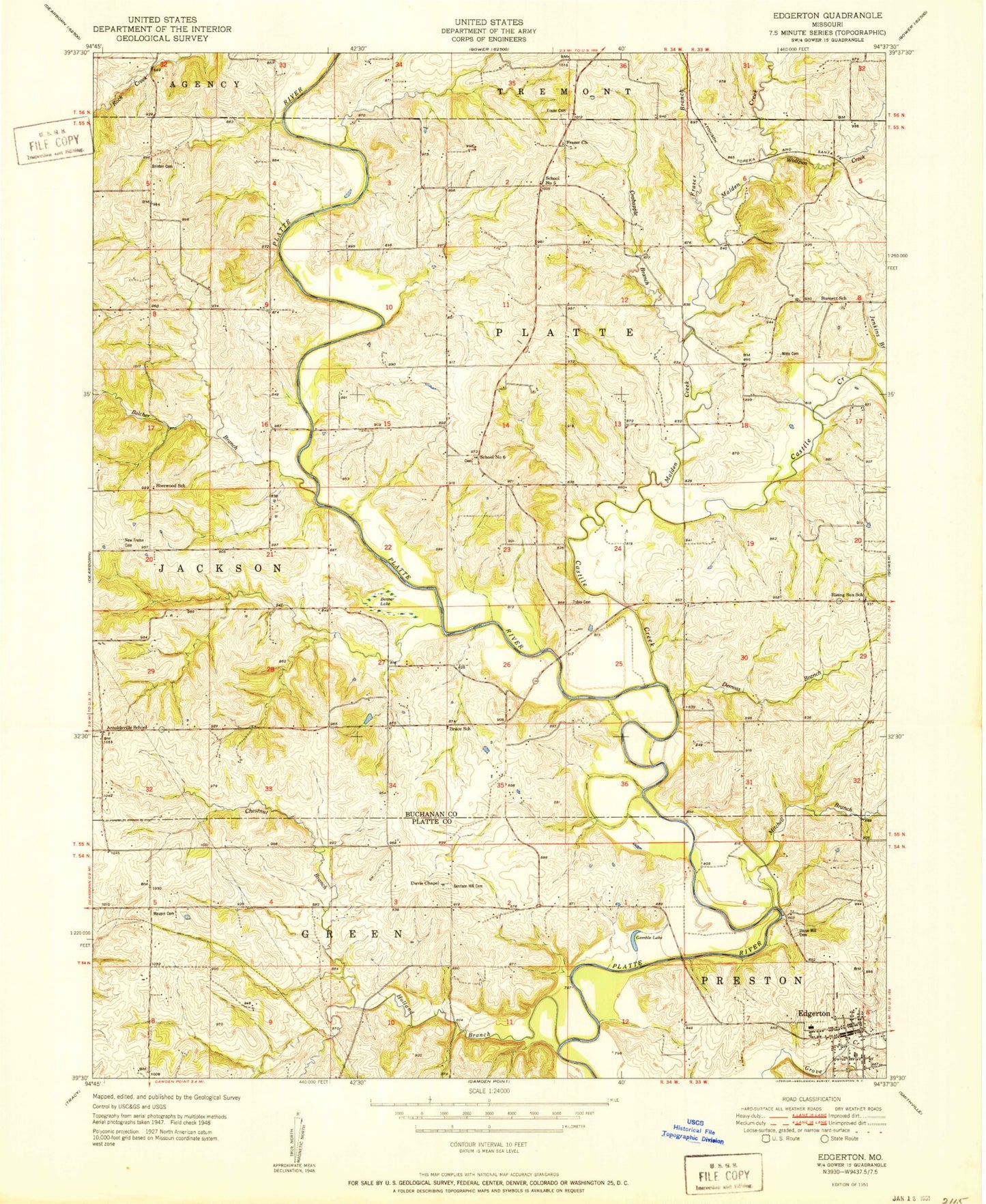
Classic USGS Edgerton Missouri 7.5'x7.5' Topo Map
Couldn't load pickup availability
Historical USGS topographic quad map of Edgerton in the state of Missouri. Map scale may vary for some years, but is generally around 1:24,000. Print size is approximately 24" x 27"
This quadrangle is in the following counties: Buchanan, Platte.
The map contains contour lines, roads, rivers, towns, and lakes. Printed on high-quality waterproof paper with UV fade-resistant inks, and shipped rolled.
Contains the following named places: Arnoldsville School, Belcher Branch, Benner Lake, Brinton Cemetery, Bruce School, Burnett School, Cantrell Dam, Cantrell Lake, Castile Creek, Chestnut Branch, City of Edgerton, Crabapple Branch, Davis Chapel, DeMoss Branch, Edgerton, Edgerton - Trimble Fire Protection District Station 1, Edgerton Post Office, Frazier Branch, Frazier Cemetery, Frazier Church, Gamble Lake, Grant Lake, Grant Lake Dam - North, Grant Lake Dam - South, Hebron Cemetery, Hebron Church, Holland Branch, Jenkins Branch, KSFT-FM (St Joseph), Malden Creek, Matheys Mill, Maupin Cemetery, McGauhey School, Middleton Dam, Middleton Lake, Mitchell Branch, Mount Pleasant Cemetery, New Frame Church, North Platte Intermediate School, Number 6 Cemetery, Phelps School, Platte River, Rising Sun School, School Number 5, School Number 6, Sherwood School, Tobin Cemetery, Township of Jackson, Township of Platte, Union Mill Cemetery, Union Mill School, Witt Cemetery, Wolfpen Creek