MyTopo
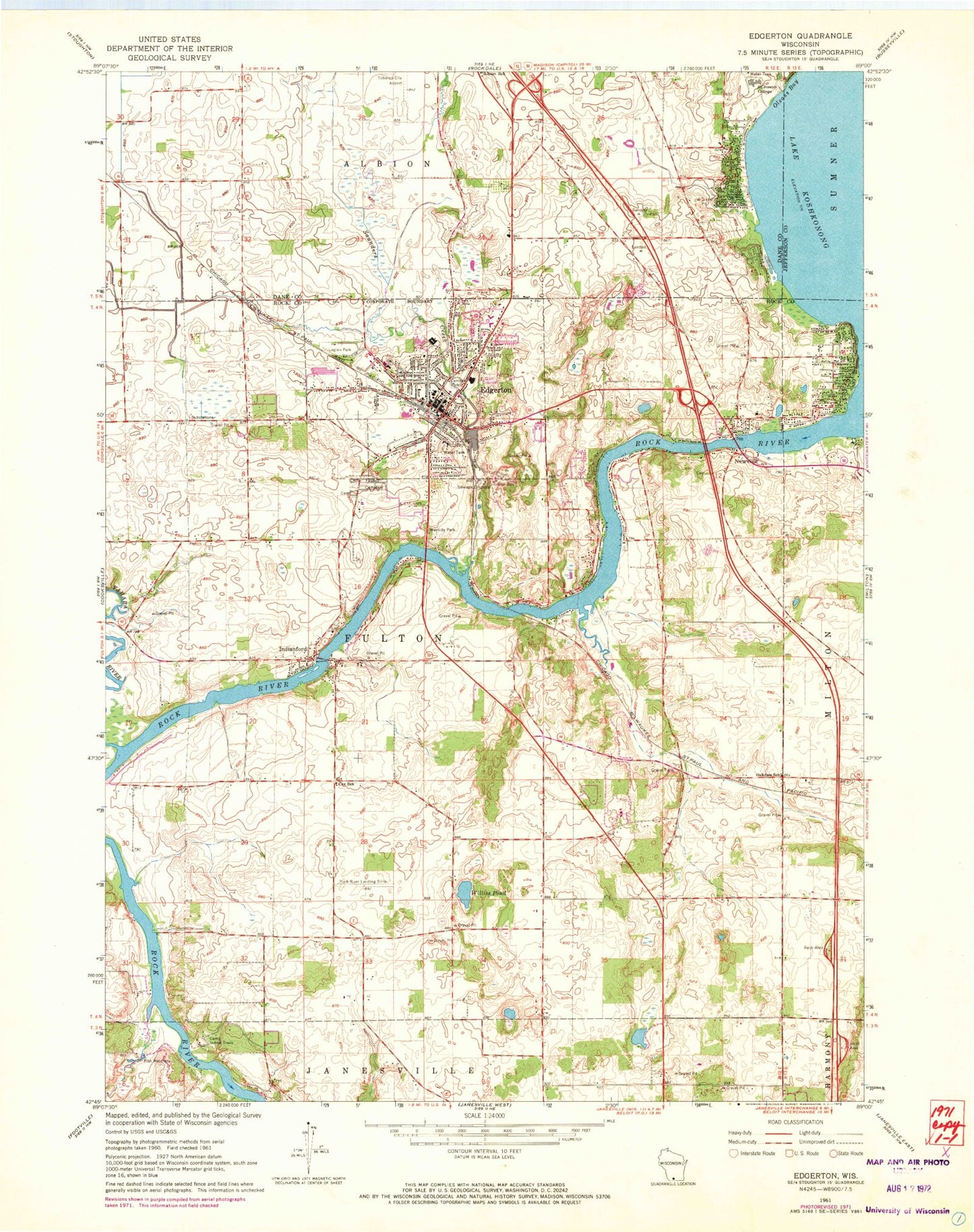
Classic USGS Edgerton Wisconsin 7.5'x7.5' Topo Map
Couldn't load pickup availability
Historical USGS topographic quad map of Edgerton in the state of Wisconsin. Map scale may vary for some years, but is generally around 1:24,000. Print size is approximately 24" x 27"
This quadrangle is in the following counties: Dane, Jefferson, Rock.
The map contains contour lines, roads, rivers, towns, and lakes. Printed on high-quality waterproof paper with UV fade-resistant inks, and shipped rolled.
Contains the following named places: Albion School, Camp Indian Trails, Central Lutheran Church, Central Park, Child High School, City of Edgerton, Coopers Shores, Cox School, Curtis Universal Ambulance Service Edgerton, Edgerton, Edgerton Beach Park, Edgerton City Hall, Edgerton Community Elementary School, Edgerton Fire Protection District, Edgerton High School, Edgerton Hospital, Edgerton Middle School, Edgerton Police Department, Edgerton Pond, Edgerton Post Office, Edgerton Public Library, Edgerton Wastewater Treatment Plant, Fassett Cemetery, First Congregational Church, Fulton Town Police Department, Hans Addition, Hickory Hills, Highwood, Indian Heights, Indianford, Indianford WD-60 Dam, Jana Airport, Jenson Cemetery, Lake Koshkonong 2594, Legion Park, Mallwood, Maple Beach, Newville, Oakdale School, Oaklawn Academy, Rock River Landing Strip, Saint Johns Evangelical Lutheran Church, Saint Johns School, Saint Joseph Catholic Church, Saint Joseph College, Saint Joseph Parish Cemetery, Saunders Creek, Tobacco City Museum, Town of Fulton, Towne Country Club, Tri-County Community Center, Trinity Lutheran Church, Veterans Memorial Building, Willies Pond, WSJY-FM (Fort Atkinson), Yahara Elementary School, Yahara River, ZIP Code: 53534