MyTopo
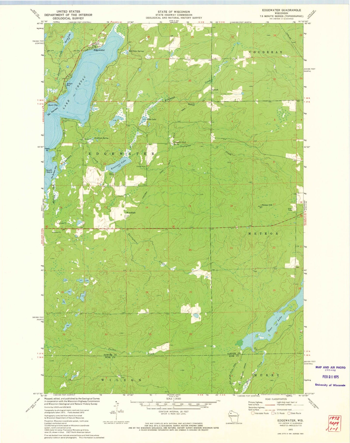
Classic USGS Edgewater Wisconsin 7.5'x7.5' Topo Map
Couldn't load pickup availability
Historical USGS topographic quad map of Edgewater in the state of Wisconsin. Map scale may vary for some years, but is generally around 1:24,000. Print size is approximately 24" x 27"
This quadrangle is in the following counties: Rusk, Sawyer.
The map contains contour lines, roads, rivers, towns, and lakes. Printed on high-quality waterproof paper with UV fade-resistant inks, and shipped rolled.
Contains the following named places: Badger Bay, Benson Creek, Deer Creek 2WP1328 Dam, Deer Lake, Deer Lake 10, Edgewater, Edgewater Post Office, Edgewater Town Hall, Fortyone Creek, Fortyone Creek Spring, Heron Creek, Heron Lake, Indian Point, Knuteson Creek, Knuteson Lake, Knuteson Spring, Lake Chetac, Malviney Creek, Meteor Hill, Pigeon Creek Flowage, Pigeon Creek Flowage G129 Dam, Pikes Point, Red Cedar Springs, Squaw Bay, The Bullpen Bay, The Narrows, Thirty-three Creek, Town of Edgewater, Wise Lake, Wooddale, Yarnell, Yarnell Creek