MyTopo
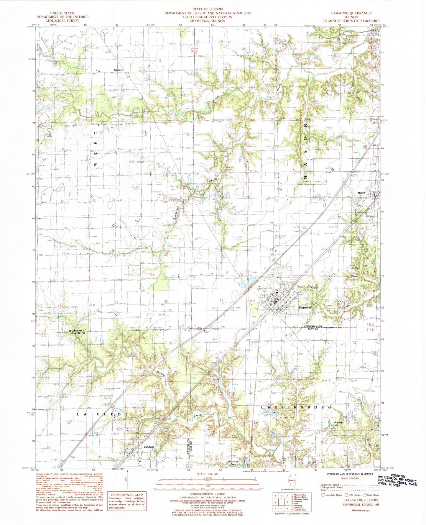
Classic USGS Edgewood Illinois 7.5'x7.5' Topo Map
Couldn't load pickup availability
Historical USGS topographic quad map of Edgewood in the state of Illinois. Map scale may vary for some years, but is generally around 1:24,000. Print size is approximately 24" x 27"
This quadrangle is in the following counties: Clay, Effingham, Fayette.
The map contains contour lines, roads, rivers, towns, and lakes. Printed on high-quality waterproof paper with UV fade-resistant inks, and shipped rolled.
Contains the following named places: Bailey Cemetery, Beck William Cemetery, Bristol, Brockett Cemetery, Brown Cemetery, Davidson Cemetery, Edgewood, Edgewood Bi - County Fire Department, Edgewood Cemetery, Edgewood Grade School, Edgewood Post Office, Faulk Cemetery, Gilmore, Kavanaugh Cemetery, La Clede, La Clede Census Designated Place, Laclede Post Office, Limestone Creek, Locust Grove School, Mahon Cemetery, Mason Cemetery, McArthur Lake, New Hope Cemetery, Old Mason Cemetery, Patterson Lake Dam, Price Cemetery, Robinson Cemetery, Saint Annes Cemetery, Town of Mason, Township of Mason, Township of West, Village of Edgewood, Wabash Cemetery, ZIP Codes: 62426, 62443, 62838