MyTopo
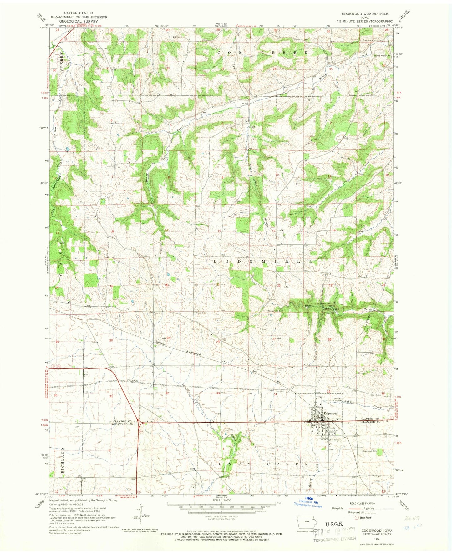
Classic USGS Edgewood Iowa 7.5'x7.5' Topo Map
Couldn't load pickup availability
Historical USGS topographic quad map of Edgewood in the state of Iowa. Map scale may vary for some years, but is generally around 1:24,000. Print size is approximately 24" x 27"
This quadrangle is in the following counties: Clayton, Delaware.
The map contains contour lines, roads, rivers, towns, and lakes. Printed on high-quality waterproof paper with UV fade-resistant inks, and shipped rolled.
Contains the following named places: Alderson Hollow, Bixby State Park, City of Edgewood, Edgewood, Edgewood - Colesburg Junior / Senior High School, Edgewood Ambulance Service, Edgewood Bible Church, Edgewood Cemetery, Edgewood Chiropractic and Sports Medicine Center, Edgewood City Hall, Edgewood Clinic, Edgewood Convalescent Home, Edgewood Fire Department, Edgewood Library, Edgewood Post Office, Green Hill Cemetery, Honey Creek Post Office, Kleinlein Creek, Lloyd Kelchen Grain Elevator, Lodomillo Post Office, Mossy Glen Hollow, Mossy Glen State Preserve, Noble Cemetery, Sacred Heart Cemetery, Saint Mark's Catholic Church, Saint Marks Cemetery, Stone's Plantation, Sylvan Post Office, Township of Lodomillo, Trinity United Methodist Church, Union Cemetery, United Methodist Church, Woods Edge Golf Course, York, York Post Office