MyTopo
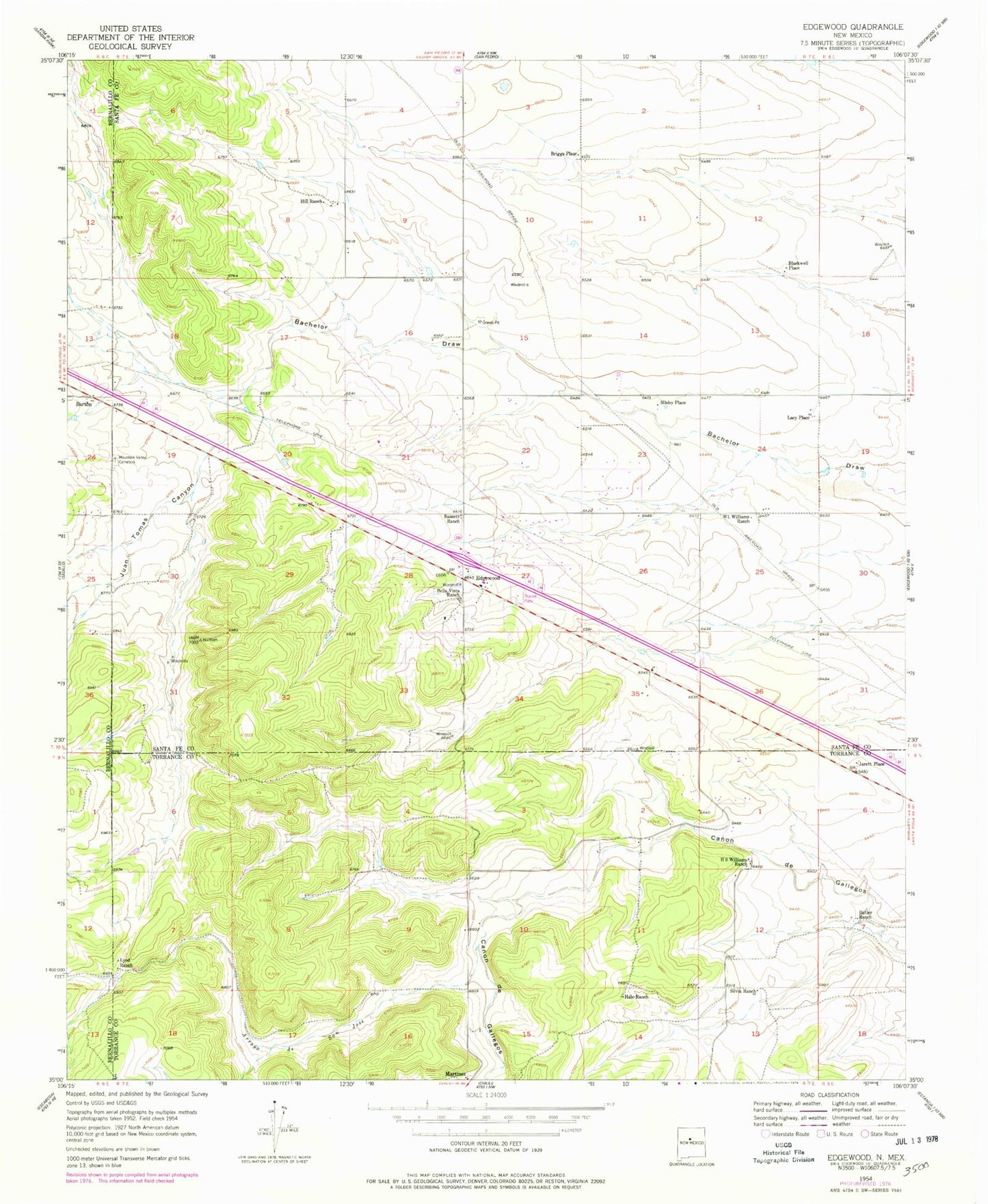
Classic USGS Edgewood New Mexico 7.5'x7.5' Topo Map
Couldn't load pickup availability
Historical USGS topographic quad map of Edgewood in the state of New Mexico. Map scale may vary for some years, but is generally around 1:24,000. Print size is approximately 24" x 27"
This quadrangle is in the following counties: Bernalillo, Santa Fe, Torrance.
The map contains contour lines, roads, rivers, towns, and lakes. Printed on high-quality waterproof paper with UV fade-resistant inks, and shipped rolled.
Contains the following named places: 100613224 Water Well, 10064 Water Well, 110724121 Water Well, 253 Water Well, 451 Water Well, 454 Water Well, 457 Water Well, 458 Water Well, 459 Water Well, 460 Water Well, 461 Water Well, 463 Water Well, 465 Water Well, 466 Water Well, 473 Water Well, 474 Water Well, 535 Water Well, 87015, Arroyo de San Jose, Barton, Barton Post Office, Bassett Ranch, Bella Vista Ranch, Blackwell Place, Briggs Place, Butler Ranch, Canon de Gallegos, Christ Unity at the Edge of the Woods, E-1175 Water Well, E1723-S-2 Water Well, E-2291 Water Well, E-2772 Water Well, E-2779 Water Well, E-286-S Water Well, E-3042 Water Well, E-3493 Water Well, E-3522 Water Well, E-3806 Water Well, E-3909 Water Well, E-483 Water Well, E-761 Water Well, E-761-S-2 Water Well, East Mountain Assembly of God Church, Edgewood, Edgewood Believers Fellowship Church, Edgewood Christian School, Edgewood Elementary School, Edgewood Post Office, Gallegos, Grace Baptist Church, H S Williams Ranch, Hale Ranch, Hill Ranch, Jarett Place, Jarett Place Census Designated Place, Juan Tomas Canyon, La Don Mine, Lacy Place, Learning Institute, Loyd Ranch, McClendon, Moriarty Elementary School, Moriarty High School, Moriarty Middle School, Mosley Place, Mountain Valley Cemetery, Mountainview Elementary School, New Mexico Soaring Ranch Airport, New Mexico State Police District 5 Edgewood, Sandia Airpark Estates East, Santa Fe County Volunteer Fire Edgewood District Station 1, Santa Fe County Volunteer Fire Edgewood District Station 4, Santa Fe County Volunteer Fire Mountain Hills Station, Schockley, Silvia Ranch, Thunder Mountain, Thunder Mountain Census Designated Place, Tina, Tina Barite Deposit, Valley View Christian Church, Water Well 10000, WL Williams Ranch, YMCA Camp