MyTopo
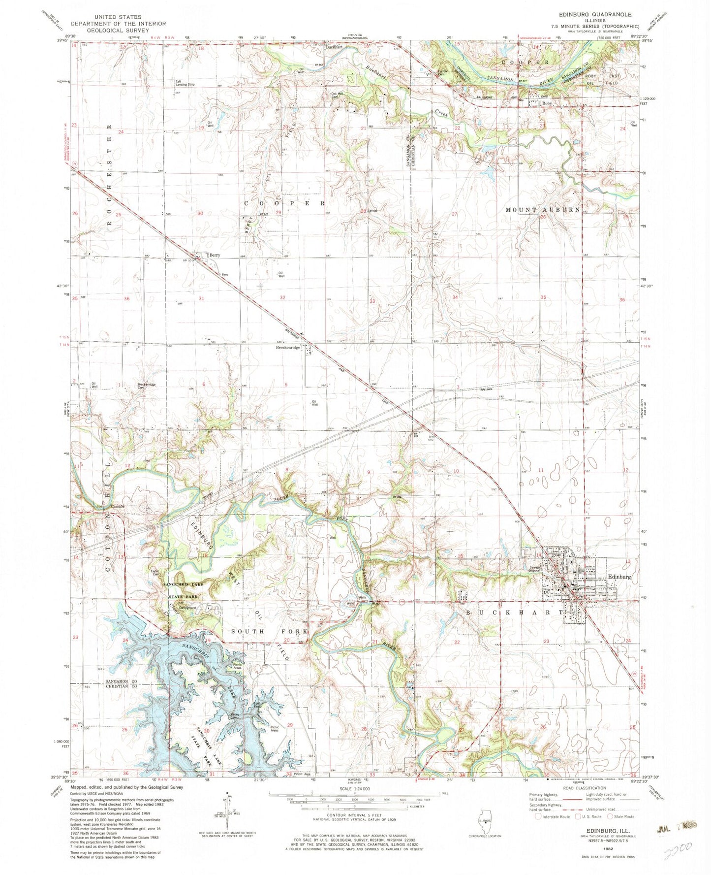
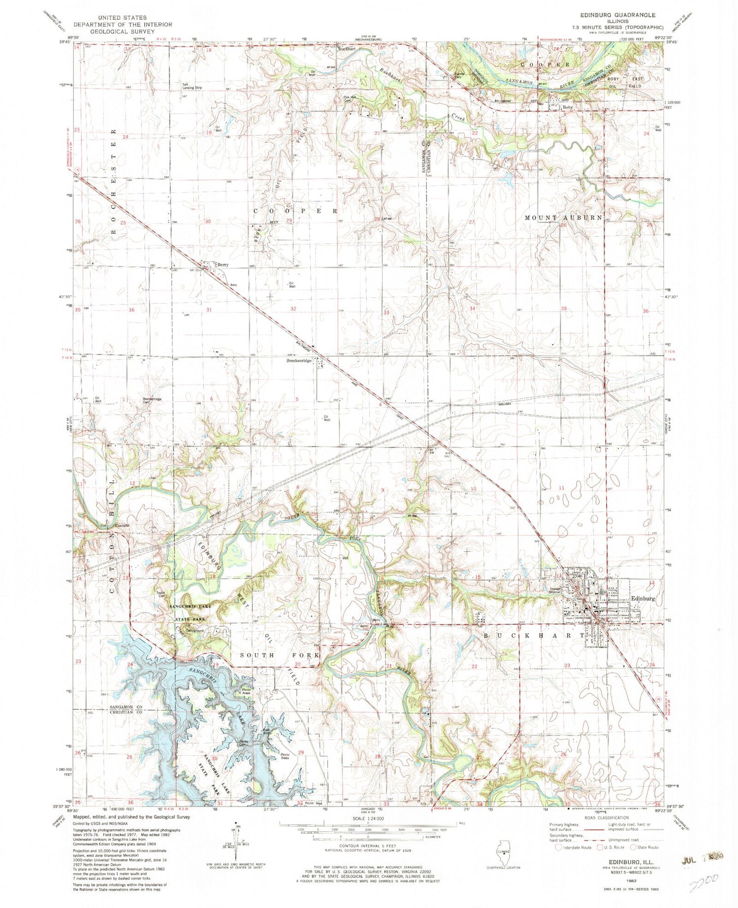
Classic USGS Edinburg Illinois 7.5'x7.5' Topo Map
Couldn't load pickup availability
Historical USGS topographic quad map of Edinburg in the state of Illinois. Typical map scale is 1:24,000, but may vary for certain years, if available. Print size: 24" x 27"
This quadrangle is in the following counties: Christian, Sangamon.
The map contains contour lines, roads, rivers, towns, and lakes. Printed on high-quality waterproof paper with UV fade-resistant inks, and shipped rolled.
Contains the following named places: American School (historical), Buckhart, Camelsburg School (historical), Cascade School (historical), Clear Creek, Clear Creek, Cooper School (historical), Edinburg, George School (historical), Greenwood School (historical), Greer School (historical), Harts Park (historical), Liberty School (historical), Martin School (historical), Roby, Star School (historical), Sudduth School (historical), Breckenridge, Cascade, Taft Airport (historical), Township of Cooper, Sangchris Lake Dam, Berry Oil Field, Breckenridge Cemetery, Oak Hill Cemetery, Sangchris Lake State Park, Taylor Cemetery, Edinburg West Oil Field, Finley Cemetery, Furrow Cemetery, Blueville, Campbellsburg (historical), Deer Run Campground, Edinburg High School, Hickory Point Campground, Pheasant Run Access Area, Roby Post Office (historical), Berry, Edinburg Cemetery, Village of Edinburg, Edinburg Fire Protection District, Tommy's Airpark, Hundley Airport (historical), Edinburg Police Department, Edinburg Post Office