MyTopo
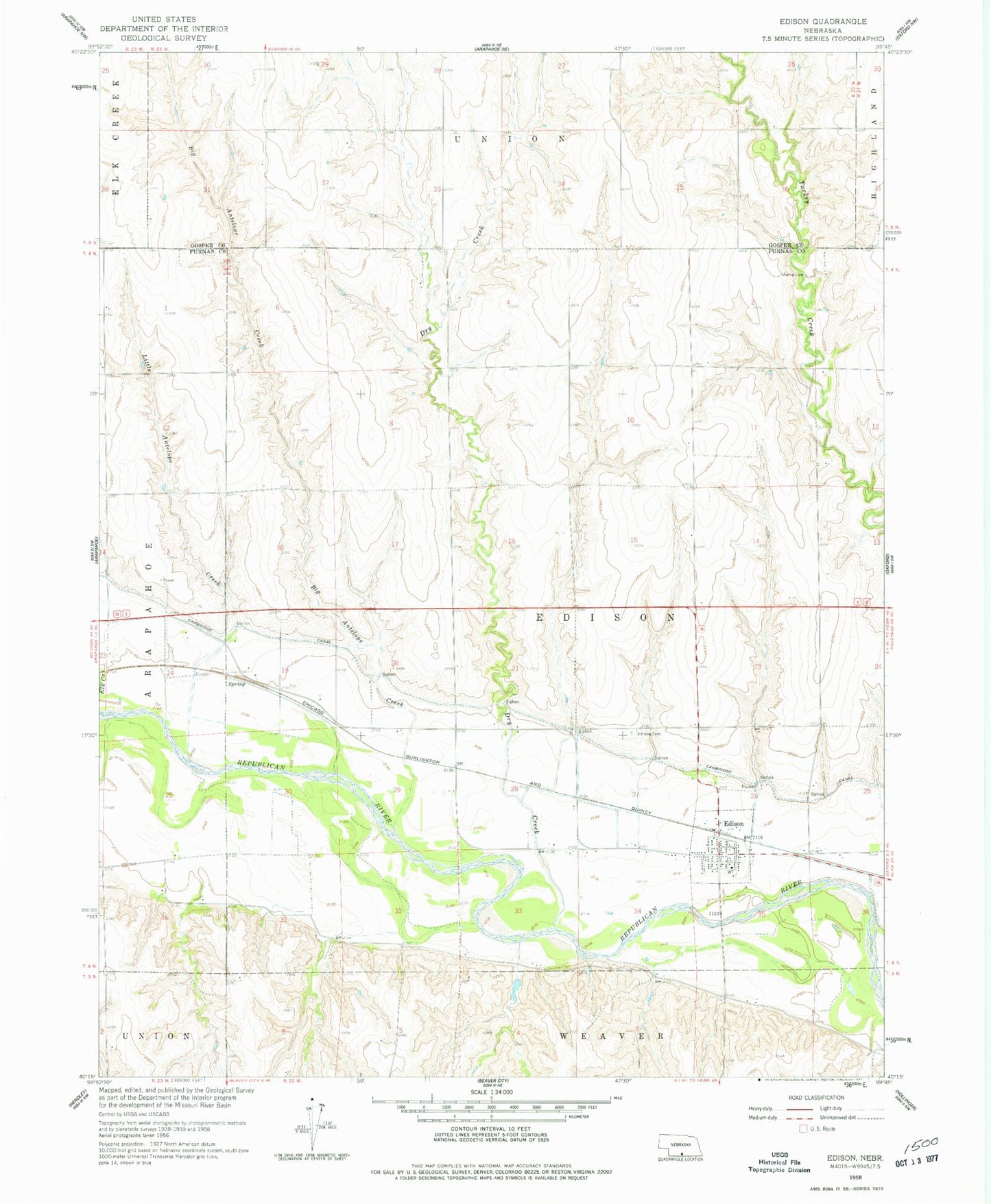
Classic USGS Edison Nebraska 7.5'x7.5' Topo Map
Couldn't load pickup availability
Historical USGS topographic quad map of Edison in the state of Nebraska. Map scale may vary for some years, but is generally around 1:24,000. Print size is approximately 24" x 27"
This quadrangle is in the following counties: Furnas, Gosper.
The map contains contour lines, roads, rivers, towns, and lakes. Printed on high-quality waterproof paper with UV fade-resistant inks, and shipped rolled.
Contains the following named places: Big Antelope Creek, Broeker Dam, Broeker Reservoir, Dry Creek, Edison, Edison Cemetery, Edison Christian Church, Edison Election Precinct, Edison Non-Stock Co-op Elevator, Edison Post Office, Edison Volunteer Fire Department, Gregg Dam, Gregg Reservoir, Little Antelope Creek, Lueking Dam, Lueking Reservoir, Paine Reservoir, Paine Reservoir Dam, Small Schoolhouse Historical Marker, Stump Cemetery, Township of Edison, Village of Edison, Ziebell Dam, Ziebell Reservoir, ZIP Code: 68936