MyTopo
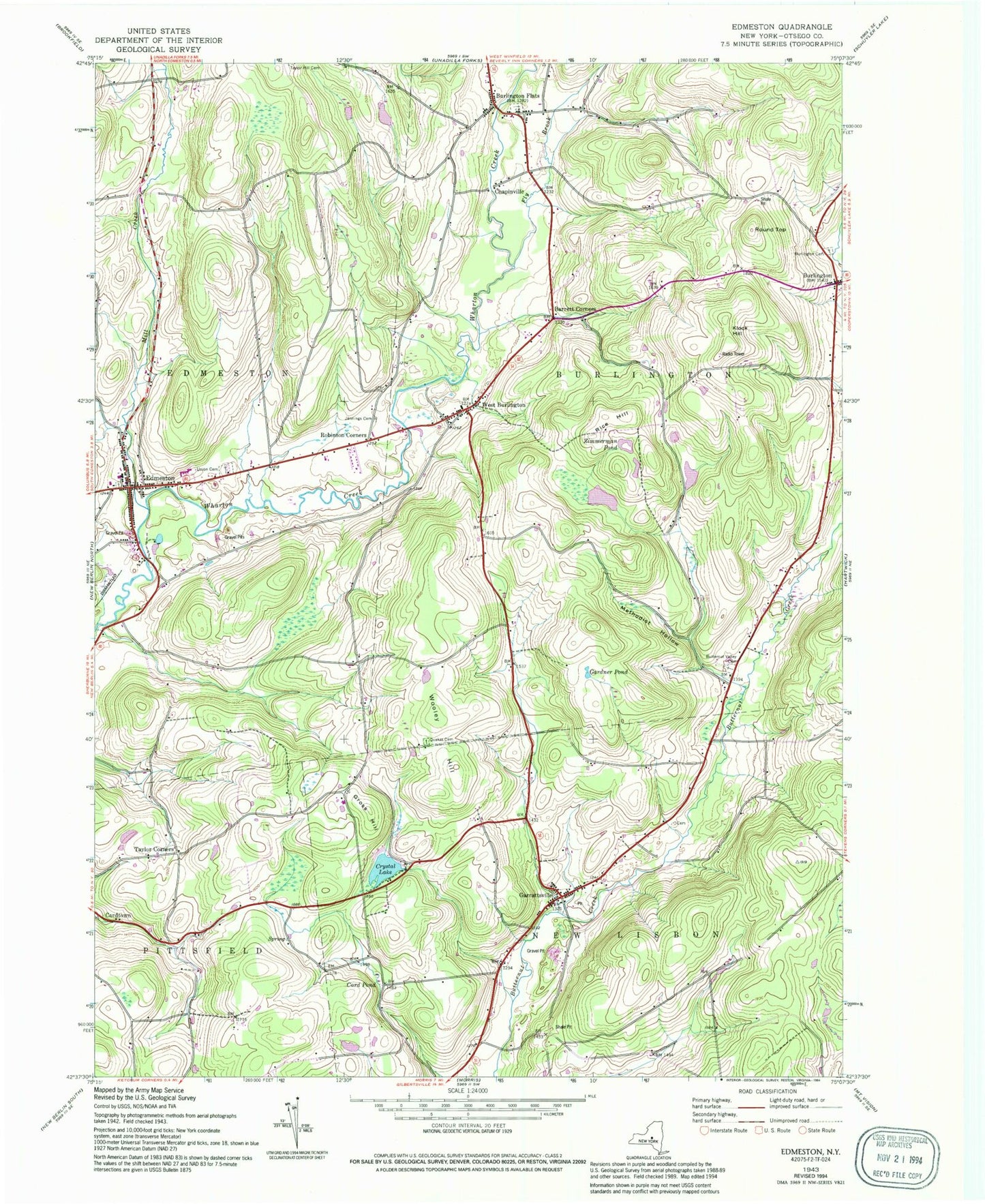
Classic USGS Edmeston New York 7.5'x7.5' Topo Map
Couldn't load pickup availability
Historical USGS topographic quad map of Edmeston in the state of New York. Map scale may vary for some years, but is generally around 1:24,000. Print size is approximately 24" x 27"
This quadrangle is in the following counties: Otsego.
The map contains contour lines, roads, rivers, towns, and lakes. Printed on high-quality waterproof paper with UV fade-resistant inks, and shipped rolled.
Contains the following named places: All Faiths Chapel, Barrett Corners, Buckhill Farm, Burlington, Burlington Cemetery, Burlington Flats, Burlington Flats Baptist Church, Burlington Flats Cemetery, Burlington Flats Census Designated Place, Burlington Flats Post Office, Butternut Valley Cemetery, Card Pond, Cardtown, Chapinville, Church of Christ, Church of the Nativity, Crystal Lake, Crystal Lake Park and Campground, Demming Cemetery, Edmeston, Edmeston Central School, Edmeston Free Library, Edmeston Post Office, Edmeston Volunteer Fire Department, First Baptist Church of Burlington, Fly Brook, Gardner Pond, Garrattsville, Garrattsville Census Designated Place, Garrattsville Volunteer Fire Company, Gross Hill, Gross Hill School, Jackson School, Jennings Cemetery, Klock Hill, Methodist Hollow, Mill Creek, Quaker Cemetery, Rice Hill, Robinson Corners, Rosa Mystica Marian Center, Round Top, Saint Johns Lutheran Church, Salo's Tree Farm, School Number 12, School Number 7, Second Baptist Church of Edmeston, Suntime Airport, Taylor Corners, The United Methodist Church, Town of Burlington, Union Cemetery, United Methodist Church, West Burlington, West Burlington Post Office, Wooley Hill, Zimmerman Pond, ZIP Codes: 13315, 13335, 13342