MyTopo
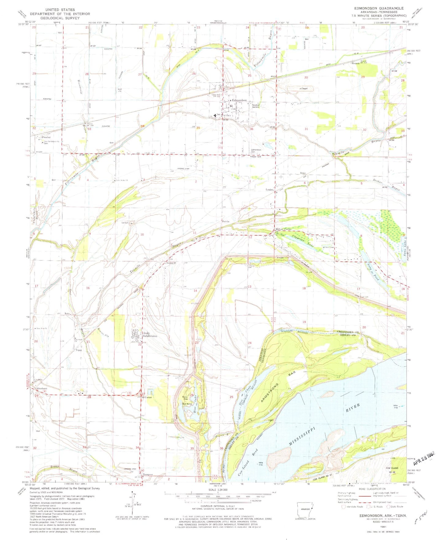
Classic USGS Edmondson Arkansas 7.5'x7.5' Topo Map
Couldn't load pickup availability
Historical USGS topographic quad map of Edmondson in the states of Arkansas, Tennessee. Map scale may vary for some years, but is generally around 1:24,000. Print size is approximately 24" x 27"
This quadrangle is in the following counties: Crittenden, Shelby.
The map contains contour lines, roads, rivers, towns, and lakes. Printed on high-quality waterproof paper with UV fade-resistant inks, and shipped rolled.
Contains the following named places: Anthony Subdivision, Anthonyville, Anthonyville Volunteer Fire Department, Armstrong Bar, Beaver Slough, Bell Meade Church, Bell Meade School, Bellmeade Church, Bellmeade School, Blue Lake, Blue Point Towhead, Brice, Clay Brook School, Claybrook Church, Copperas Lake, Cow Island Bend, Cut-off Bayou, Decker Bayou, Ditch Number 12, Edmondson, Edmondson Cemetery, Edmondson Police Department, Edmondson Volunteer Fire Department, Edmonson Post Office, Friendship School, Graves Bayou, Kate, Long Pond, Lost Creek, Louise, Midway Corner, Mounds, Mount Olive Church, Neuhardt, New Bethel Church, Ninetysix Corner, Ninetysix Landing, Patoka, Proctor, Proctor Post Office, Proctor Volunteer Fire Department, Simsboro, Sunrise Church, Swan Lake, Swan Lake Dam, Tenmile Bayou, Thompson, Topaz, Town of Anthonyville, Town of Edmondson, Township of Bob Ward, True Vine Missionary Baptist Church Cemetery, Truevine Church, Twentymile Bayou, Warehouse Bayou, Wedlock Elementary School, ZIP Codes: 72332, 72376