MyTopo
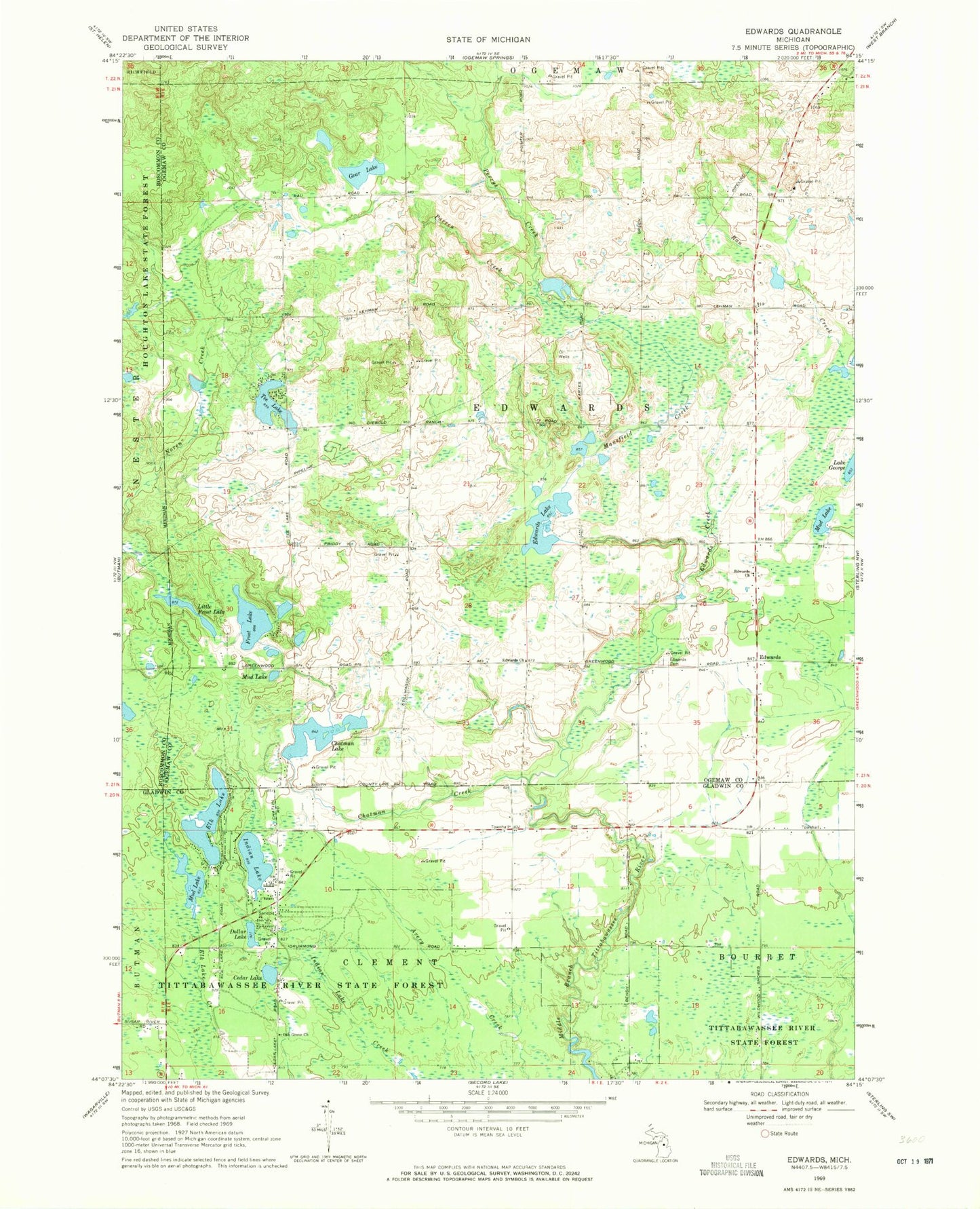
Classic USGS Edwards Michigan 7.5'x7.5' Topo Map
Couldn't load pickup availability
Historical USGS topographic quad map of Edwards in the state of Michigan. Map scale may vary for some years, but is generally around 1:24,000. Print size is approximately 24" x 27"
This quadrangle is in the following counties: Gladwin, Ogemaw, Roscommon.
The map contains contour lines, roads, rivers, towns, and lakes. Printed on high-quality waterproof paper with UV fade-resistant inks, and shipped rolled.
Contains the following named places: Cedar Lake, Chatman Creek, Chatman Lake, Circle K Farms, Clement Township Fire Department, Dollar Lake, Edward Post Office, Edwards, Edwards Cemetery, Edwards Church, Edwards Creek, Edwards Lake, Elk Lake, Frost Lake, Gear Lake, Indian Lake, Little Frost Lake, Mansfield Creek, Mount Zion Tabernacle Church, Mud Lake, New Life Christian Church, Oak Grove Church, Parren Creek, Perrys Creek, Ray Creek, Tee Lake, Township of Edwards