MyTopo
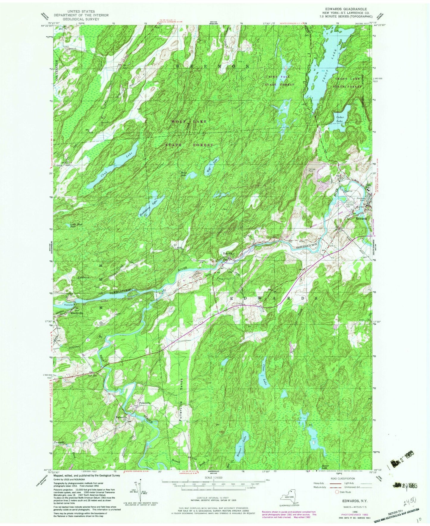
Classic USGS Edwards New York 7.5'x7.5' Topo Map
Couldn't load pickup availability
Historical USGS topographic quad map of Edwards in the state of New York. Map scale may vary for some years, but is generally around 1:24,000. Print size is approximately 24" x 27"
This quadrangle is in the following counties: St. Lawrence.
The map contains contour lines, roads, rivers, towns, and lakes. Printed on high-quality waterproof paper with UV fade-resistant inks, and shipped rolled.
Contains the following named places: Bennett Brook, Bonner Lake, Cedar Lake, Chub Lake, Clear Lake, Edwards, Edwards Census Designated Place, Edwards Volunteer Fire Department, Emeryville, Emeryville Falls, Fairview Cemetery, Fullerville, Fullerville Church, Fullerville Falls, Fullerville Sands, Gulf Cemetery, Hall Creek, Hazleton Falls, Huckleberry Lake, Little Mud Pond, Moon Lake, Mott Creek, Pork Creek, Riverside Cemetery, Talcville, Town of Edwards, Trout Lake, Village of Edwards, West Branch Oswegatchie River, Wolf Lake, ZIP Code: 13635