MyTopo
Classic USGS Edwardsville New York 7.5'x7.5' Topo Map
Couldn't load pickup availability
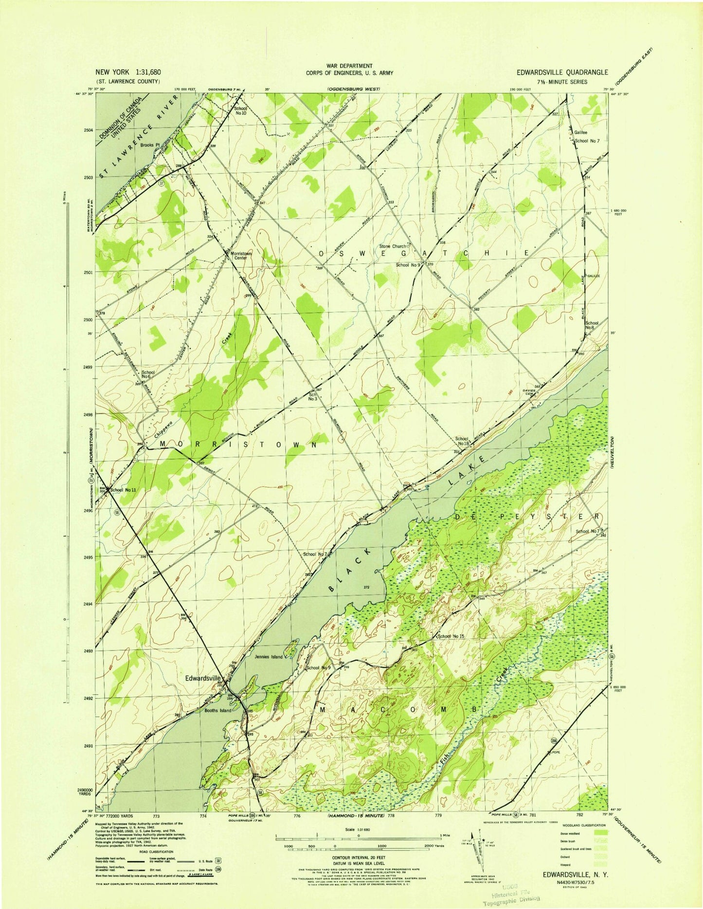
Historical USGS topographic quad map of Edwardsville in the state of New York. Map scale may vary for some years, but is generally around 1:24,000. Print size is approximately 24" x 27"
This quadrangle is in the following counties: St. Lawrence.
The map contains contour lines, roads, rivers, towns, and lakes. Printed on high-quality waterproof paper with UV fade-resistant inks, and shipped rolled.
Contains the following named places: Beggs Dairy Farms, Black Lake, Booths Island, Brooks Point, Catamaran Shoal, Davies Cemetery, Edwardsville, Galilee, Galilee Farms, Jennies Island, Longs Corners, Mitchell Bay, Morristown Center, Oak Point, School Number 10, School Number 11, School Number 15, School Number 18, School Number 3, School Number 6, School Number 7, School Number 8, School Number 9, Scotch Bush Grange, Snake Island, Stone Church, Upper Big Bay, Wilson Dairy