MyTopo
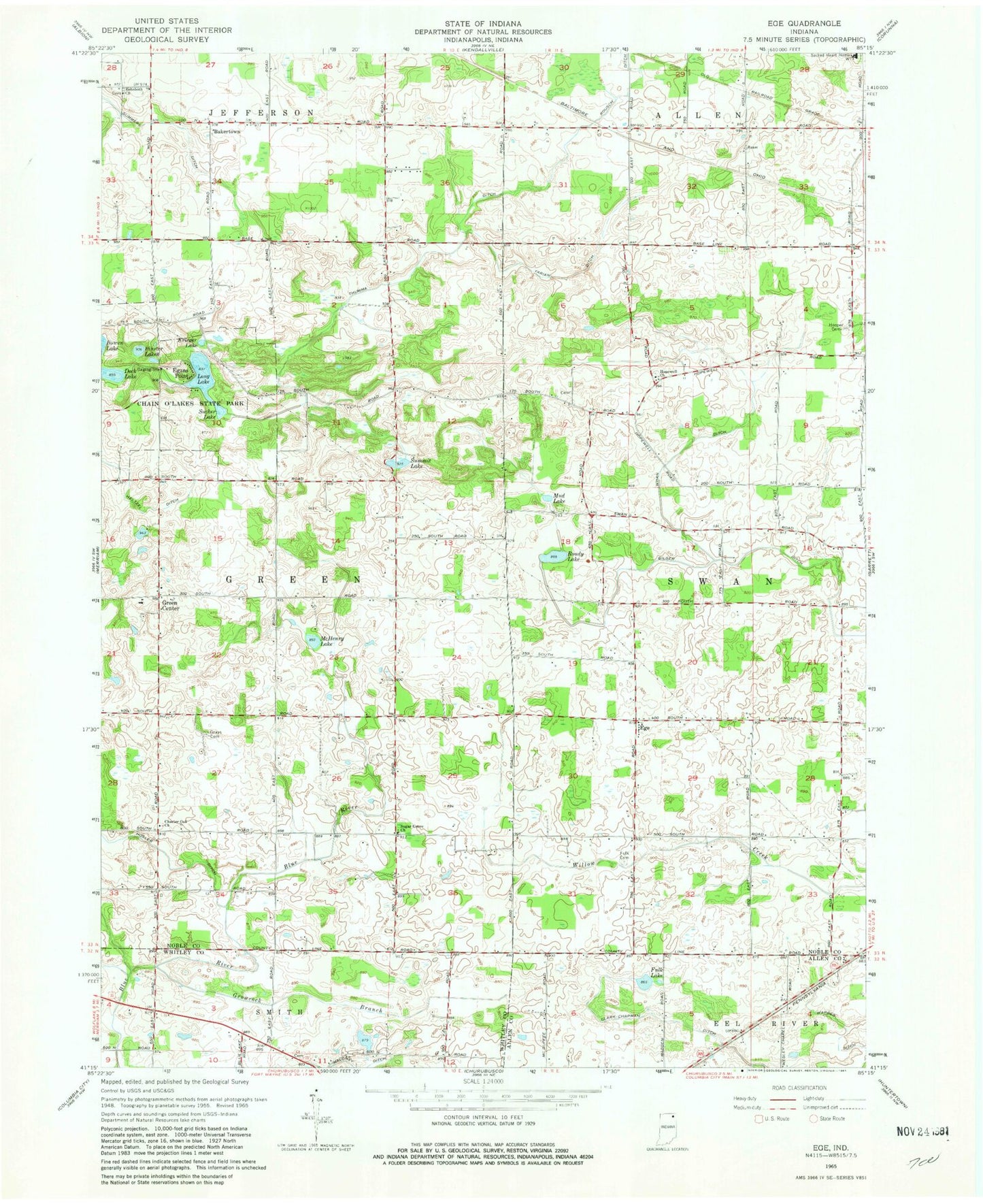
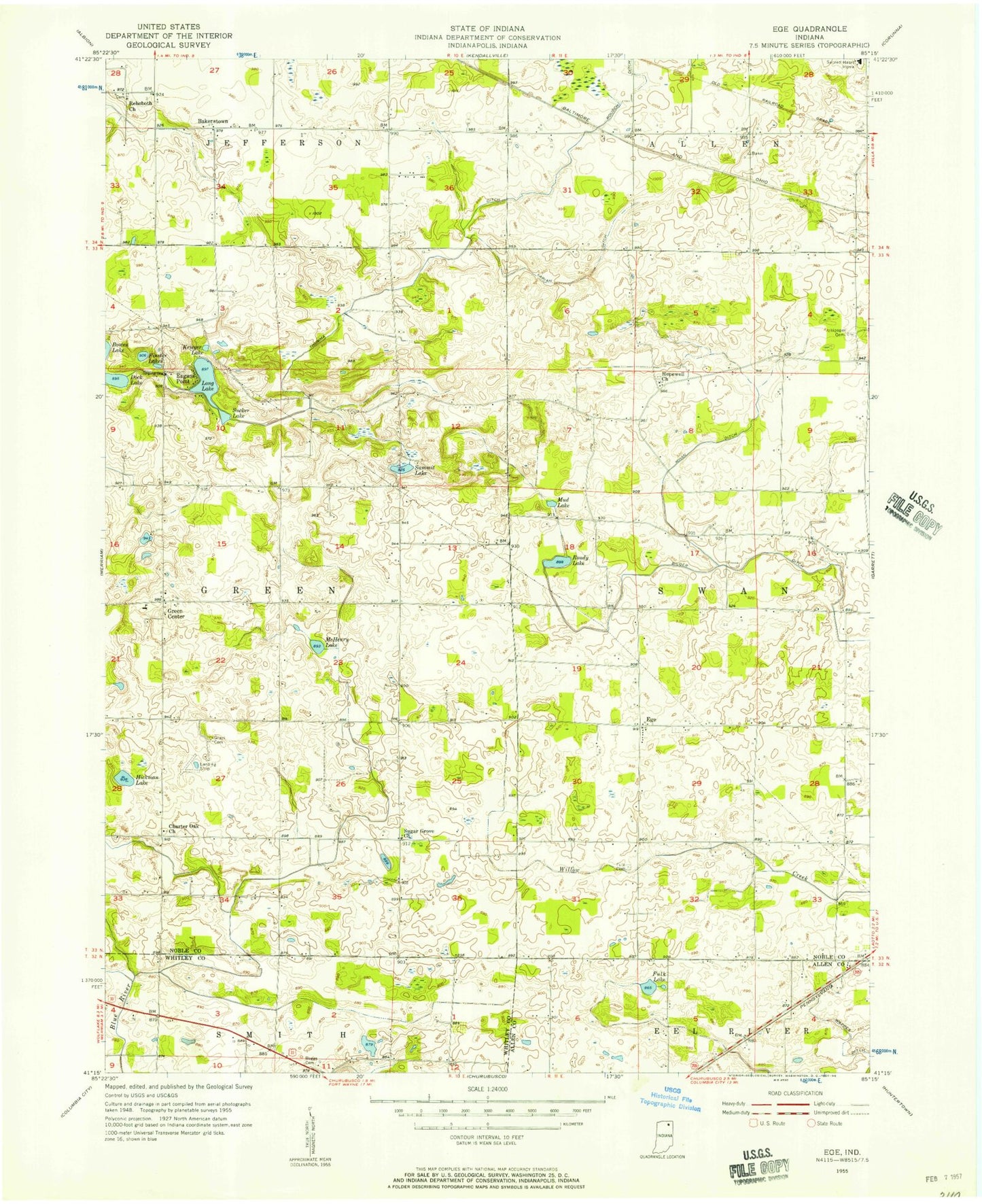
Classic USGS Ege Indiana 7.5'x7.5' Topo Map
Couldn't load pickup availability
Historical USGS topographic quad map of Ege in the state of Indiana. Map scale may vary for some years, but is generally around 1:24,000. Print size is approximately 24" x 27"
This quadrangle is in the following counties: Allen, Noble, Whitley.
The map contains contour lines, roads, rivers, towns, and lakes. Printed on high-quality waterproof paper with UV fade-resistant inks, and shipped rolled.
Contains the following named places: Bakertown, Bilger Ditch, Charter Oak Church, Clark-Chapman Ditch, Dock Lake, Egans Point, Ege, Finster Lakes, Fulk Cemetery, Fulk Lake, Grays Cemetery, Green Center, Growcock Branch, Heltzel Ditch, Hooper Cemetery, Hopewell Church, Hosler Ditch, Krieger Lake, Long Lake, McHenry Lake, Mud Lake, Pippenger Airport, Rehoboth Church, Resler Airport, Ries Airport, Roudy Lake, Rousch Ditch, Sacred Heart Home, Sucker Lake, Sugar Grove Church, Summit Lake, Thumma Ditch, Township of Green, Township of Swan, Wappes Ditch, Whan Ditch, Yarian Ditch