MyTopo
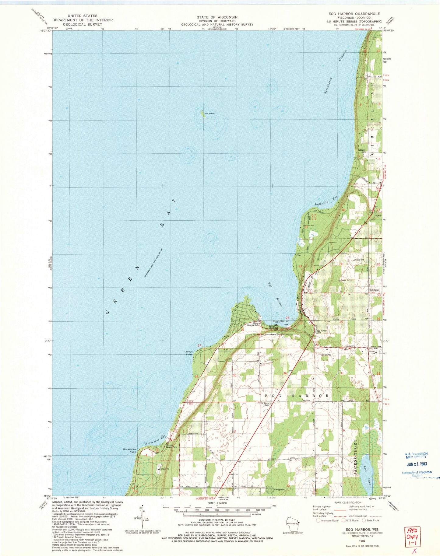
Classic USGS Egg Harbor Wisconsin 7.5'x7.5' Topo Map
Couldn't load pickup availability
Historical USGS topographic quad map of Egg Harbor in the state of Wisconsin. Map scale may vary for some years, but is generally around 1:24,000. Print size is approximately 24" x 27"
This quadrangle is in the following counties: Door.
The map contains contour lines, roads, rivers, towns, and lakes. Printed on high-quality waterproof paper with UV fade-resistant inks, and shipped rolled.
Contains the following named places: Alpine Country Club, Door County Library Egg Harbor Branch, Egg Harbor, Egg Harbor Cemetery, Egg Harbor Fire Department Station 1, Egg Harbor Post Office, Egg Harbor Wastewater Treatment Plant, Evangelical Church, Hat Island, Hillcrest Orchard, Horseshoe Bay, Horseshoe Point, Juddville Bay, Juddville Cemetery, Leroys Point, Lost Lake, Murphy County Park, Orchards Golf Course, Saint John the Baptist Cemetery, School Number One, Sunny Point School, Sunnypoint Gardens, Tanck Family Dairy, Town of Egg Harbor, Upper Lost Lake, Village of Egg Harbor, White Cliff Fen And Forest State Natural Area, ZIP Code: 54209