MyTopo
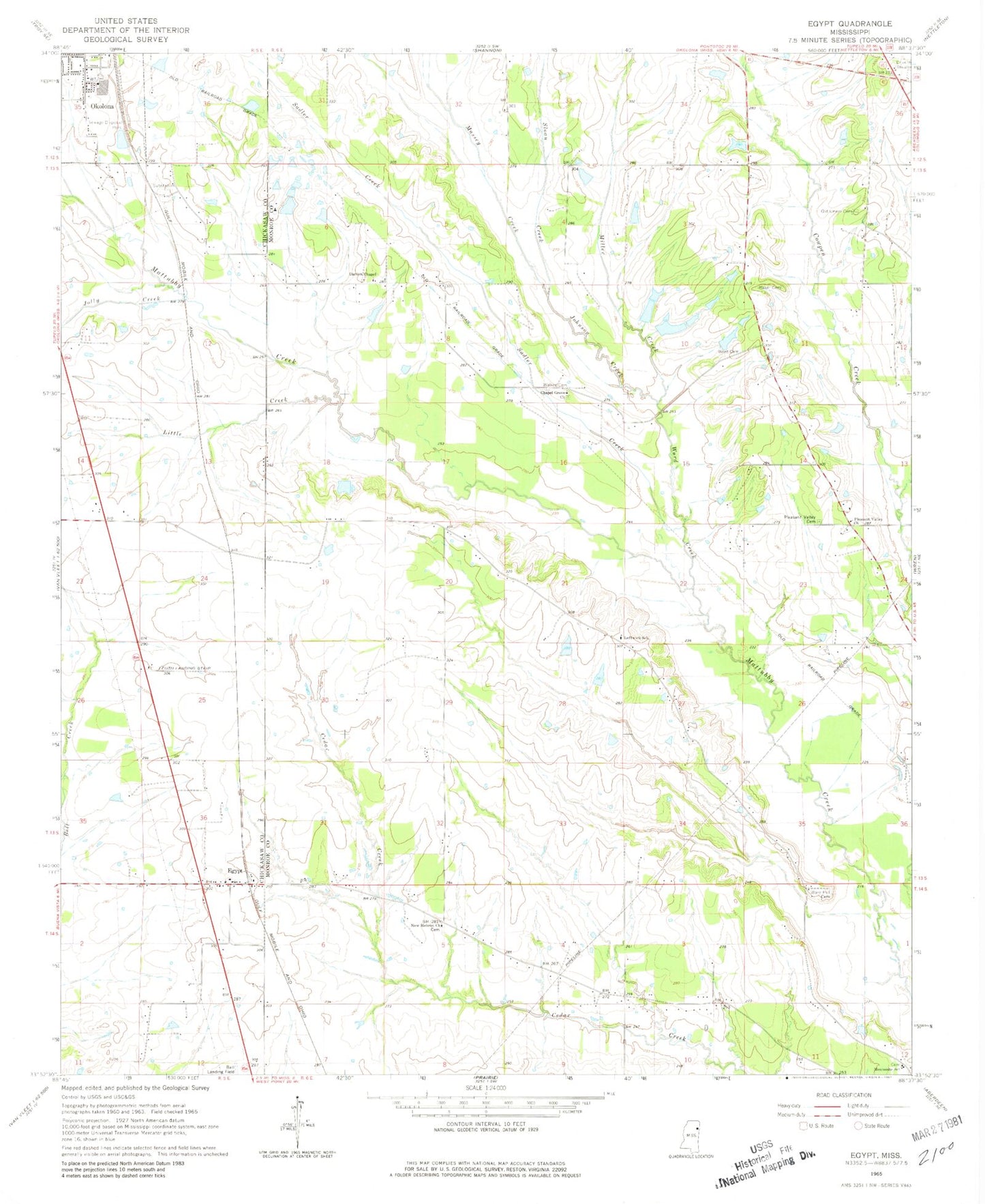
Classic USGS Egypt Mississippi 7.5'x7.5' Topo Map
Couldn't load pickup availability
Historical USGS topographic quad map of Egypt in the state of Mississippi. Map scale may vary for some years, but is generally around 1:24,000. Print size is approximately 24" x 27"
This quadrangle is in the following counties: Chickasaw, Monroe.
The map contains contour lines, roads, rivers, towns, and lakes. Printed on high-quality waterproof paper with UV fade-resistant inks, and shipped rolled.
Contains the following named places: Baker Cemetery, Black Belt, Chapel Grove Baptist Church, Church of God in Christ, Darden Chapel Baptist Church, Egypt, Egypt Baptist Church, Egypt Hedgerow College, Egypt High School, Egypt Mennonite School, Egypt United Methodist Church, Goose Pond, Hales Lake Dam, Johnson Creek, Jolly Creek, Leftwich School, Leuth Flying Service Airport, Little Creek, Massey Creek, Mennonite School, Miller Creek, New Hebron Missionary Baptist Church, Old Union Cemetery, Pleasant Valley Cemetery, Pleasant Valley Church, Sadler Creek, Sloan Creek, Union Presbyterian Church, Walker Cemetery, Ware Hill Cemetery, Word Cemetery, Word Creek