MyTopo
Classic USGS El Capitan Mountain Arizona 7.5'x7.5' Topo Map
Couldn't load pickup availability
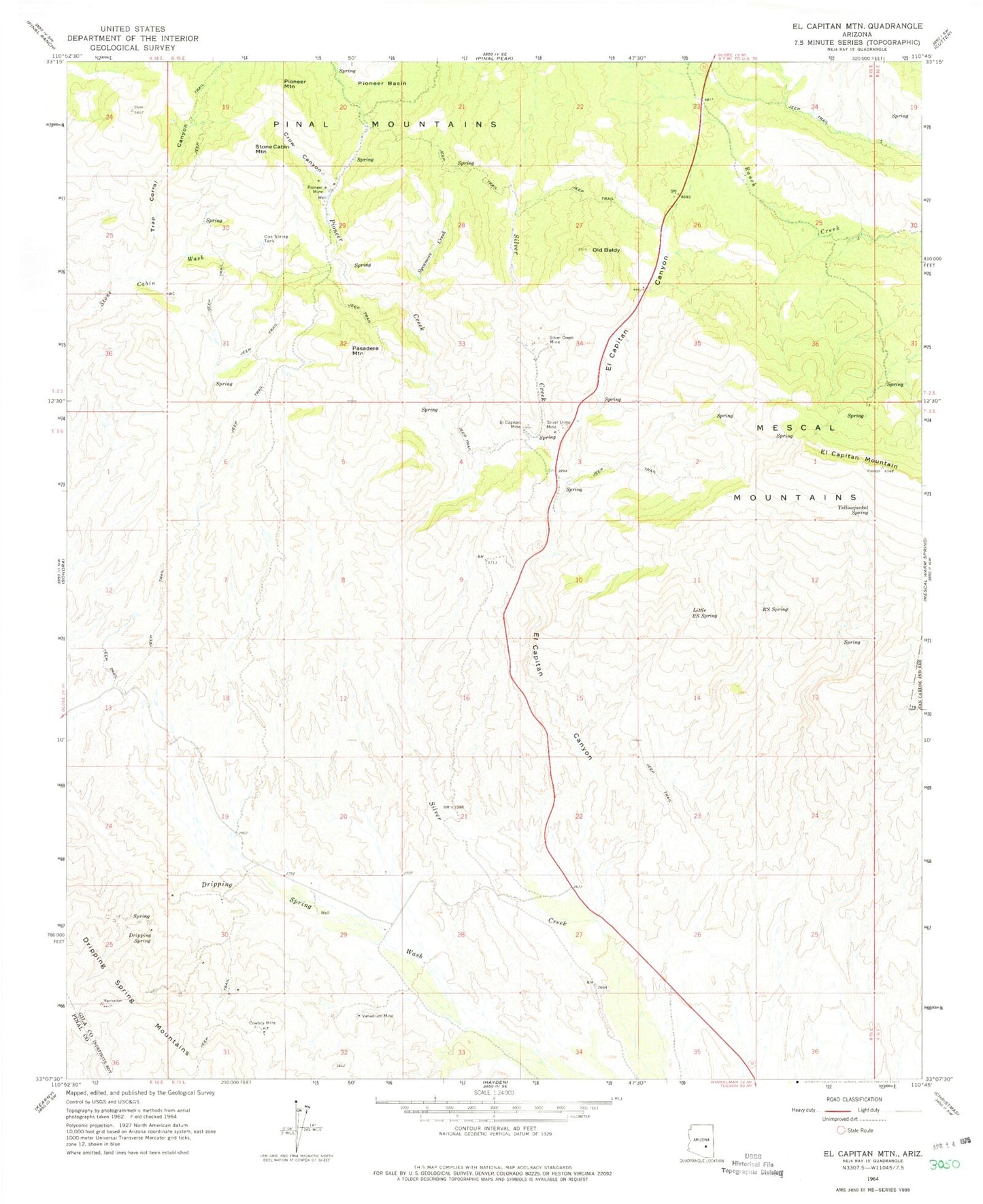
Historical USGS topographic quad map of El Capitan Mountain in the state of Arizona. Map scale may vary for some years, but is generally around 1:24,000. Print size is approximately 24" x 27"
This quadrangle is in the following counties: Gila, Pinal.
The map contains contour lines, roads, rivers, towns, and lakes. Printed on high-quality waterproof paper with UV fade-resistant inks, and shipped rolled.
Contains the following named places: Cowboy Mine, Crow Canyon, Dripping Spring, Dripping Springs, El Capitan, El Capitan Canyon, El Capitan Census Designated Place, El Capitan Mine, El Capitan Mountain, Gilson Wash, Little RS Spring, Oak Spring Tank, Old Baldy, Pasadera Mountain, Pioneer Creek, Pioneer Mine, Pioneer Mountain, RS Spring, Silver Creek Mine, Silver Dime Mine, Stone Cabin Mountain, Sycamore Creek, Trap Corral Canyon, Vanadium Mine, Winkelman Division, Yellowjacket Spring