MyTopo
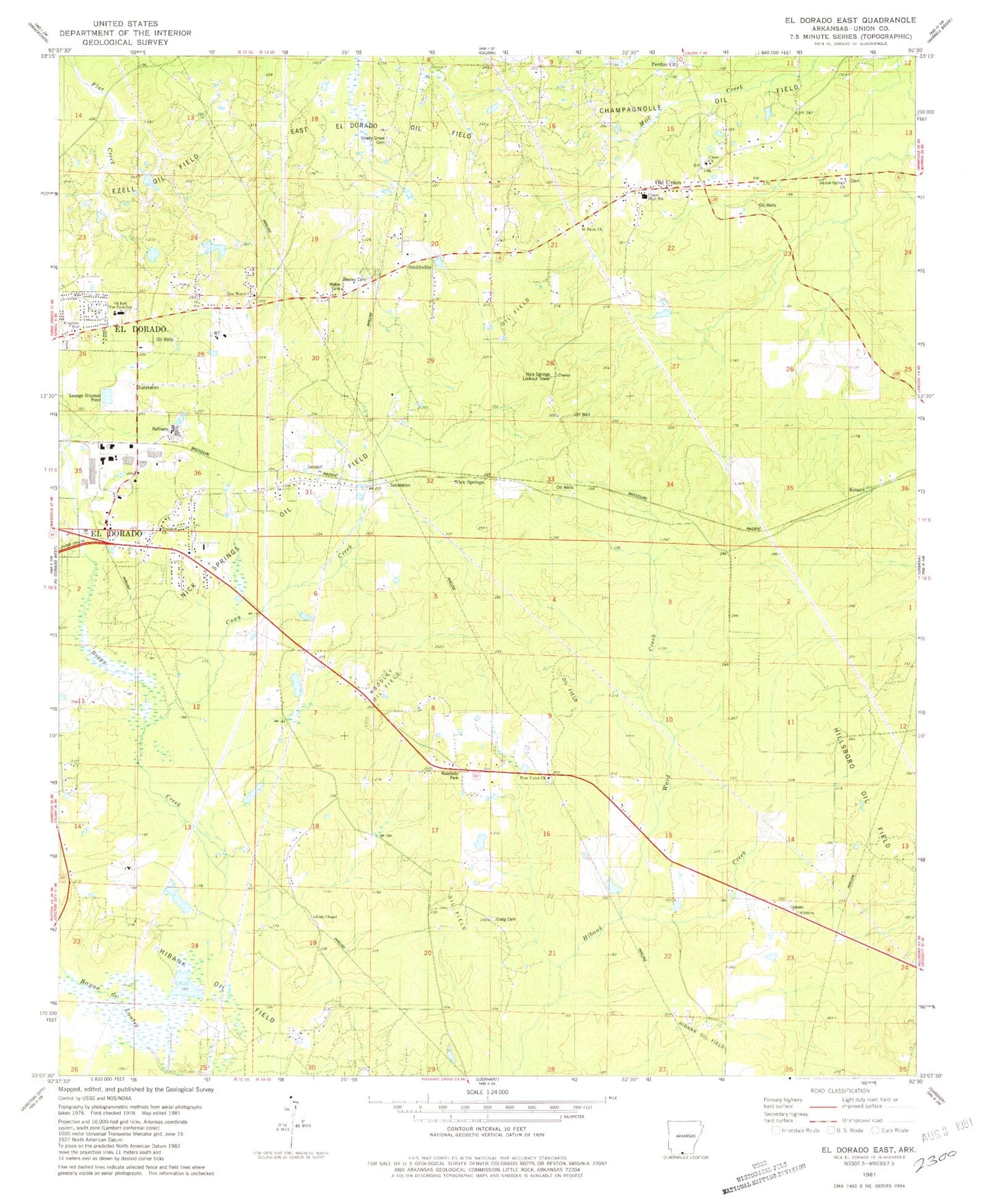
Classic USGS El Dorado East Arkansas 7.5'x7.5' Topo Map
Couldn't load pickup availability
Historical USGS topographic quad map of El Dorado East in the state of Arkansas. Map scale may vary for some years, but is generally around 1:24,000. Print size is approximately 24" x 27"
This quadrangle is in the following counties: Union.
The map contains contour lines, roads, rivers, towns, and lakes. Printed on high-quality waterproof paper with UV fade-resistant inks, and shipped rolled.
Contains the following named places: Beulah Springs Baptist Church, Beulah Springs Cemetery, Bogay Creek, Brock Cemetery, Cany Creek, Craig Cemetery, East El Dorado Oil Field, Ezell Oil Field, Free Union Cemetery, Free Union Church, Hillsboro Oil Field, Kinard, Kingdom Hall of Jehovahs Witnesses, Newton Cemetery, Nick Springs, Nick Springs Lookout Tower, Nick Springs Oil Field, Oil Belt Vocational Technical School, Old Union, Old Union Cemetery, Old Union Volunteer Fire Department, Perdue City, ProMed Ambulance El Dorado, Saint Paul Cemetery, Saint Pauls Church, Shady Grove Cemetery, Smithville, Souls Chapel Church of Christ, Temple Baptist Church, Union Baptist Chucch, Union County, Union Elementary School, Union High School, Union School, Ward Creek, Wesley Cemetery, Wesley Chapel Methodist Church, Woodley Oil Field, Zion Watch Baptist Church, Zion Watch Cemetery