
MyTopo
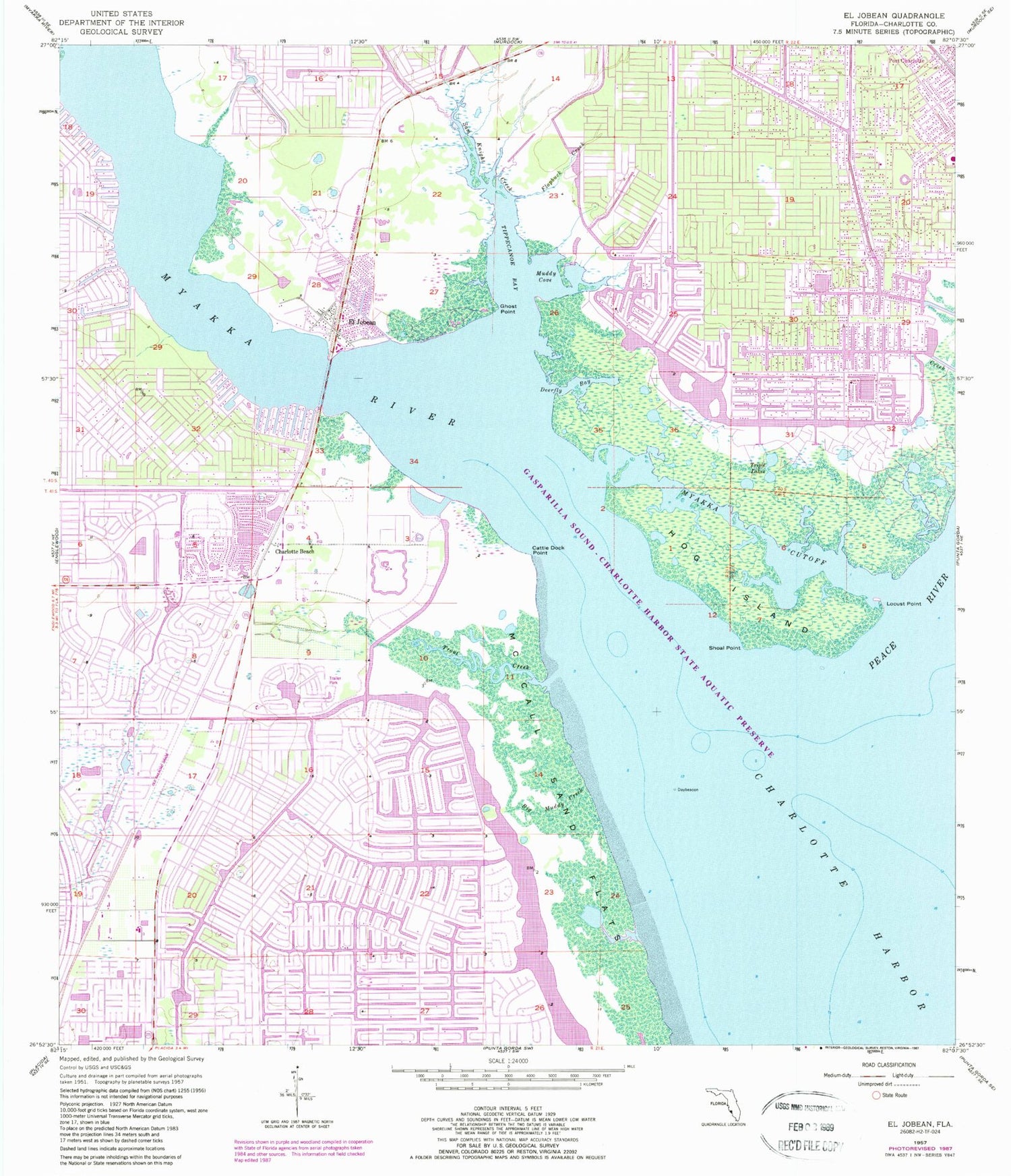
Classic USGS El Jobean Florida 7.5'x7.5' Topo Map
Couldn't load pickup availability
Historical USGS topographic quad map of El Jobean in the state of Florida. Map scale may vary for some years, but is generally around 1:24,000. Print size is approximately 24" x 27"
This quadrangle is in the following counties: Charlotte.
The map contains contour lines, roads, rivers, towns, and lakes. Printed on high-quality waterproof paper with UV fade-resistant inks, and shipped rolled.
Contains the following named places: Big Muddy Creek, Cattle Dock Point, Charlotte Beach, Charlotte County Fire and Emergency Medical Services Station 3, Charlotte County Fire and Emergency Medical Services Station 4, Charlotte Sports Park, Deerfly Bay, El Jobean, El Jobean Post Office, Flopbuck Creek, Frizzell Tower, Ghost Point, Harbor Lakes Mobile Home Park, Hog Island, Huckaby Creek, Locust Point, Mangrove Point, McCall Sand Flats, Muddy Cove, Myakka Cutoff, Myakka River, Peace River, Point Lonesom, Sam Knight Creek, Shoal Point, Sioux Waterway, Sombrero Country Club, Southland Station Railroad Station, Tippecanoe Bay, Triple Lakes, Trout Creek, Vizcaya Lakes, ZIP Codes: 33948, 33953, 33981


