
MyTopo
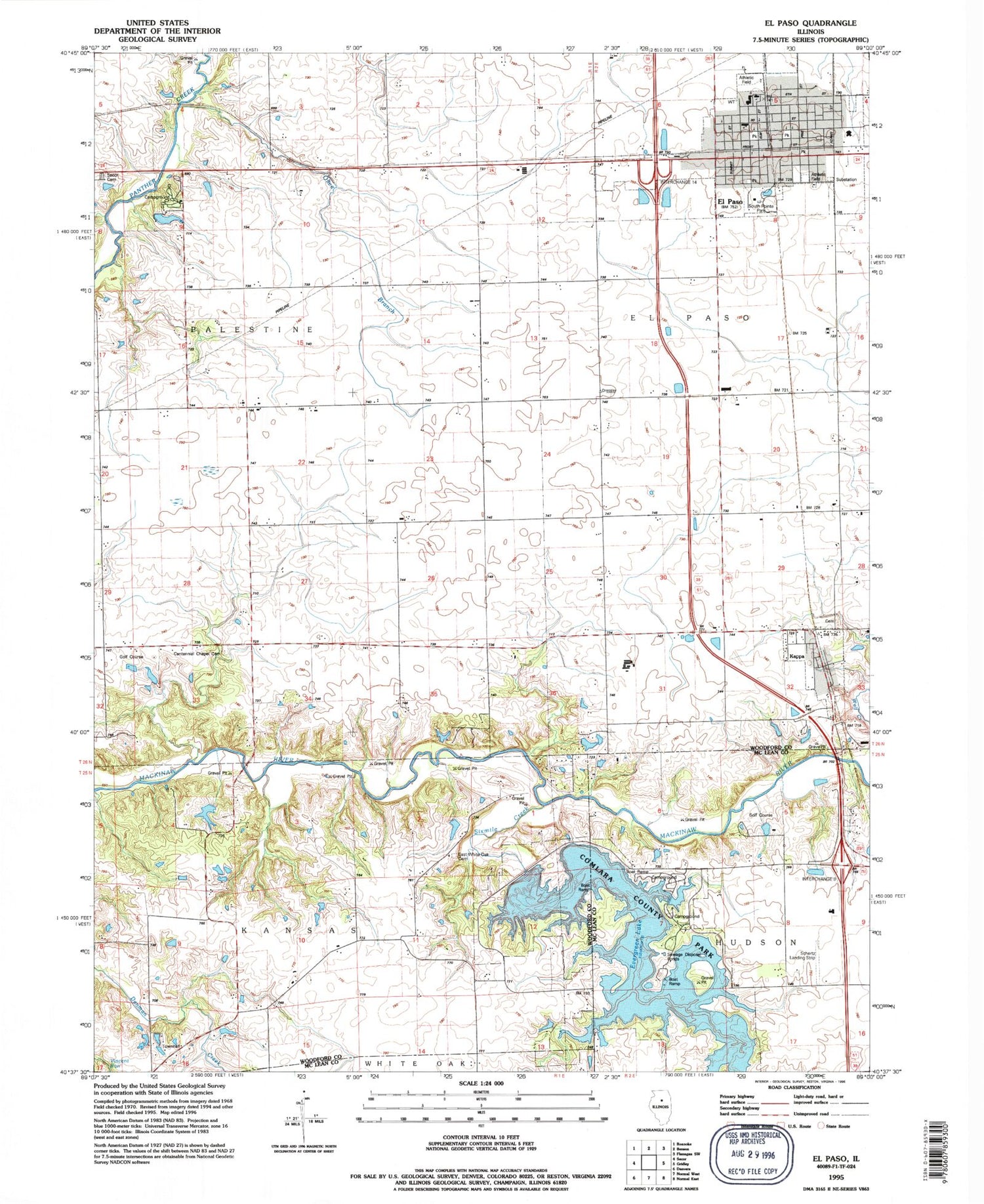
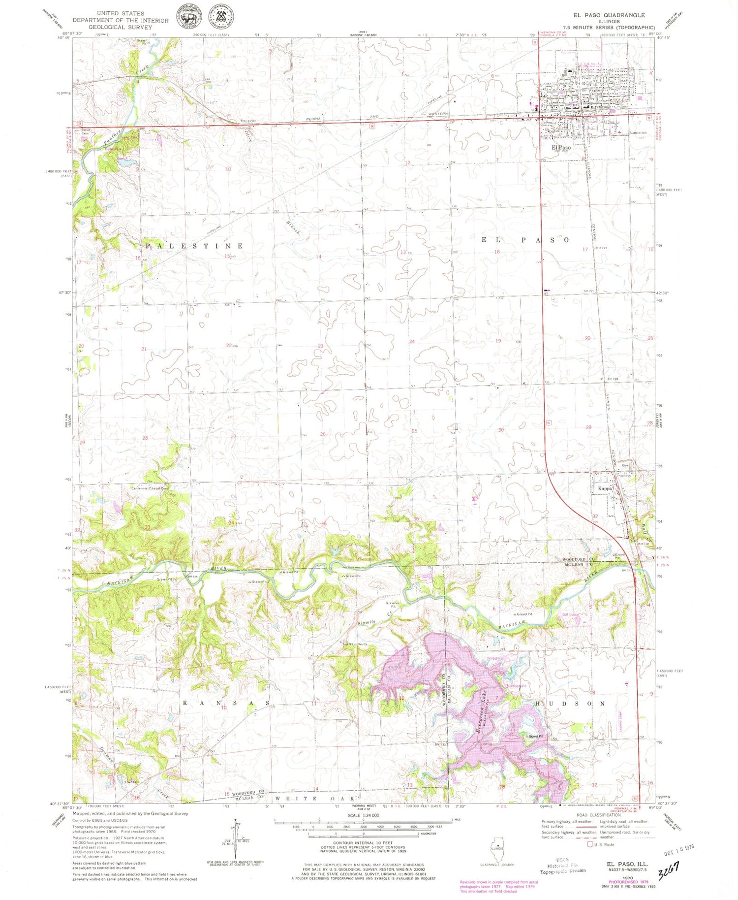
Classic USGS El Paso Illinois 7.5'x7.5' Topo Map
Couldn't load pickup availability
Historical USGS topographic quad map of El Paso in the state of Illinois. Map scale may vary for some years, but is generally around 1:24,000. Print size is approximately 24" x 27"
This quadrangle is in the following counties: McLean, Woodford.
The map contains contour lines, roads, rivers, towns, and lakes. Printed on high-quality waterproof paper with UV fade-resistant inks, and shipped rolled.
Contains the following named places: Bethel School, Centennial Chapel, Centennial Chapel Cemetery, Centennial Elementary School, Centennial Gymnasium, Charlottes Trailer Court, Church of the Nazarene, City of El Paso, Colburn Farms, Community Bible Fellowship of El Paso, Delaney Farms, East White Oak Church, El Paso, El Paso Christian Church, El Paso City Hall, El Paso Emergency Squad, El Paso Fire Department, El Paso High School, El Paso Police Department, El Paso Post Office, El Paso Public Library, El Paso United Methodist Church, Evergreen Lake, Evergreen Lake Dam, First Baptist Church, Glenwood School, Grand View School, Harvest Chapel Assembly of God Church, Hazy Hills Golf Course, Hopewell School, Jefferson Park Elementary School, Kansas Townhall, Kappa, Kappa Cemetery, Kilpatricks Mobile Home Park, Lewis School, Longview Farms, Olive Branch, Olive Branch School, Oneida School, Saint Andrews Episcopal Church, Saint Marys Catholic Church, Schertz Aerial Service - Hudson Airport, Shepherd School, Sixmile Creek, Spring Hill School, Stark Pond, Stark Pond Dam, Township of El Paso, Township of Kansas, Township of Palestine, Trinity Lutheran Church, Tucker School, Village of Kappa, Walnut Grove School, Wolf Creek, ZIP Code: 61738


