MyTopo
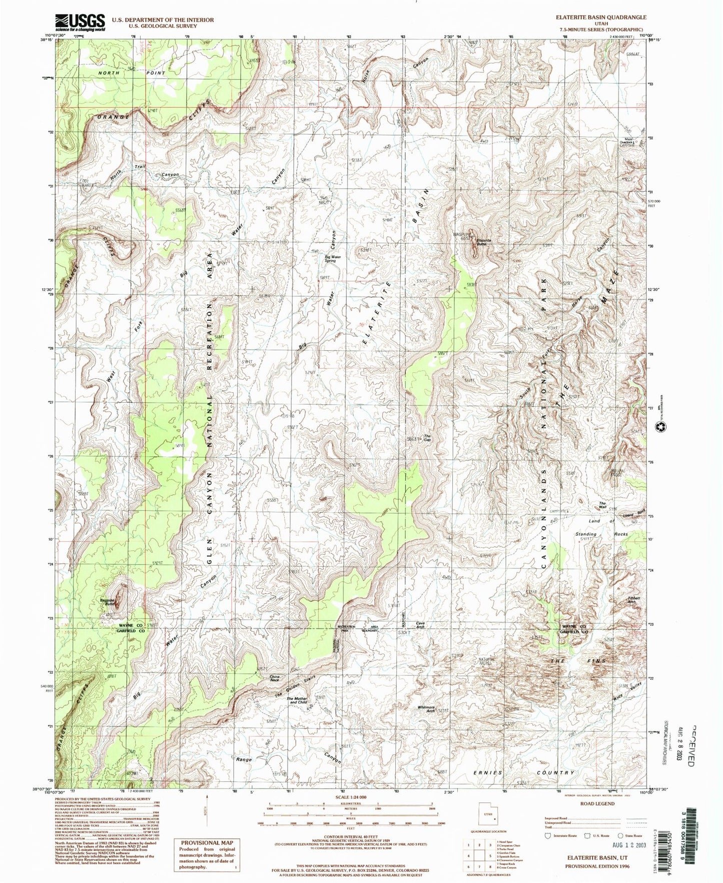
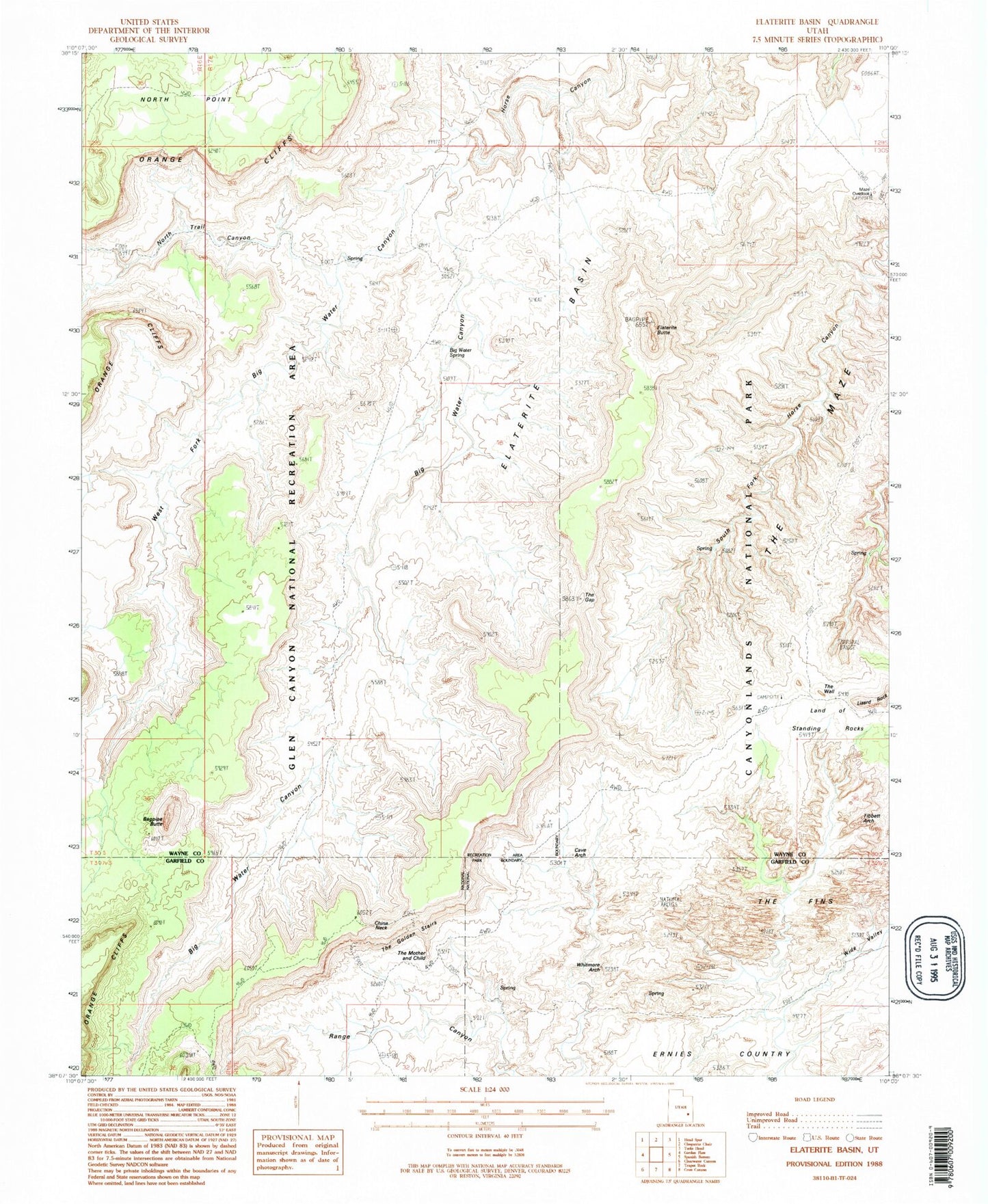
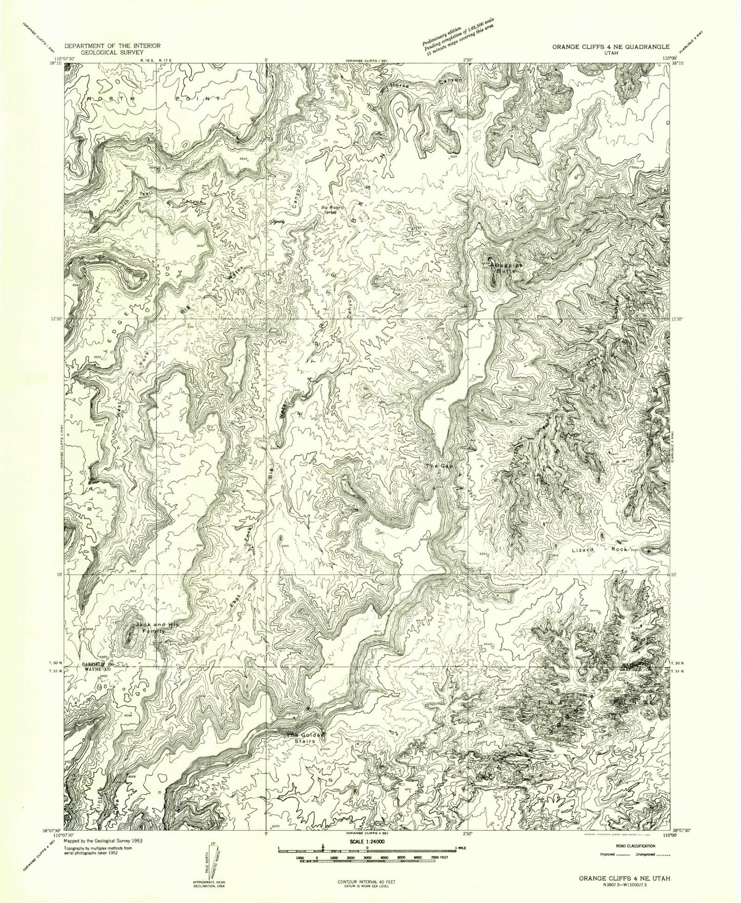
Classic USGS Elaterite Basin Utah 7.5'x7.5' Topo Map
Couldn't load pickup availability
Historical USGS topographic quad map of Elaterite Basin in the state of Utah. Typical map scale is 1:24,000, but may vary for certain years, if available. Print size: 24" x 27"
This quadrangle is in the following counties: Garfield, Wayne.
The map contains contour lines, roads, rivers, towns, and lakes. Printed on high-quality waterproof paper with UV fade-resistant inks, and shipped rolled.
Contains the following named places: Elaterite Butte, Big Water Spring, Black Ledge, Brimhall Point, Big Water Canyon, Elaterite Basin, Ernies Country, Bagpipe Butte, North Trail Canyon, The Fins, The Gap, The Golden Stairs, The Maze, West Fork Big Water Canyon, Maze Overlook, Cave Arch, The Mother and Child, Whitmore Arch, Wide Valley, The Wall, The Wall, North Trail, China Neck, Tapestry Slab, Tibbett Arch, Elaterite Butte, Big Water Spring, Black Ledge, Brimhall Point, Big Water Canyon, Elaterite Basin, Ernies Country, Bagpipe Butte, North Trail Canyon, The Fins, The Gap, The Golden Stairs, The Maze, West Fork Big Water Canyon, Maze Overlook, Cave Arch, The Mother and Child, Whitmore Arch, Wide Valley, The Wall, The Wall, North Trail, China Neck, Tapestry Slab, Tibbett Arch