MyTopo
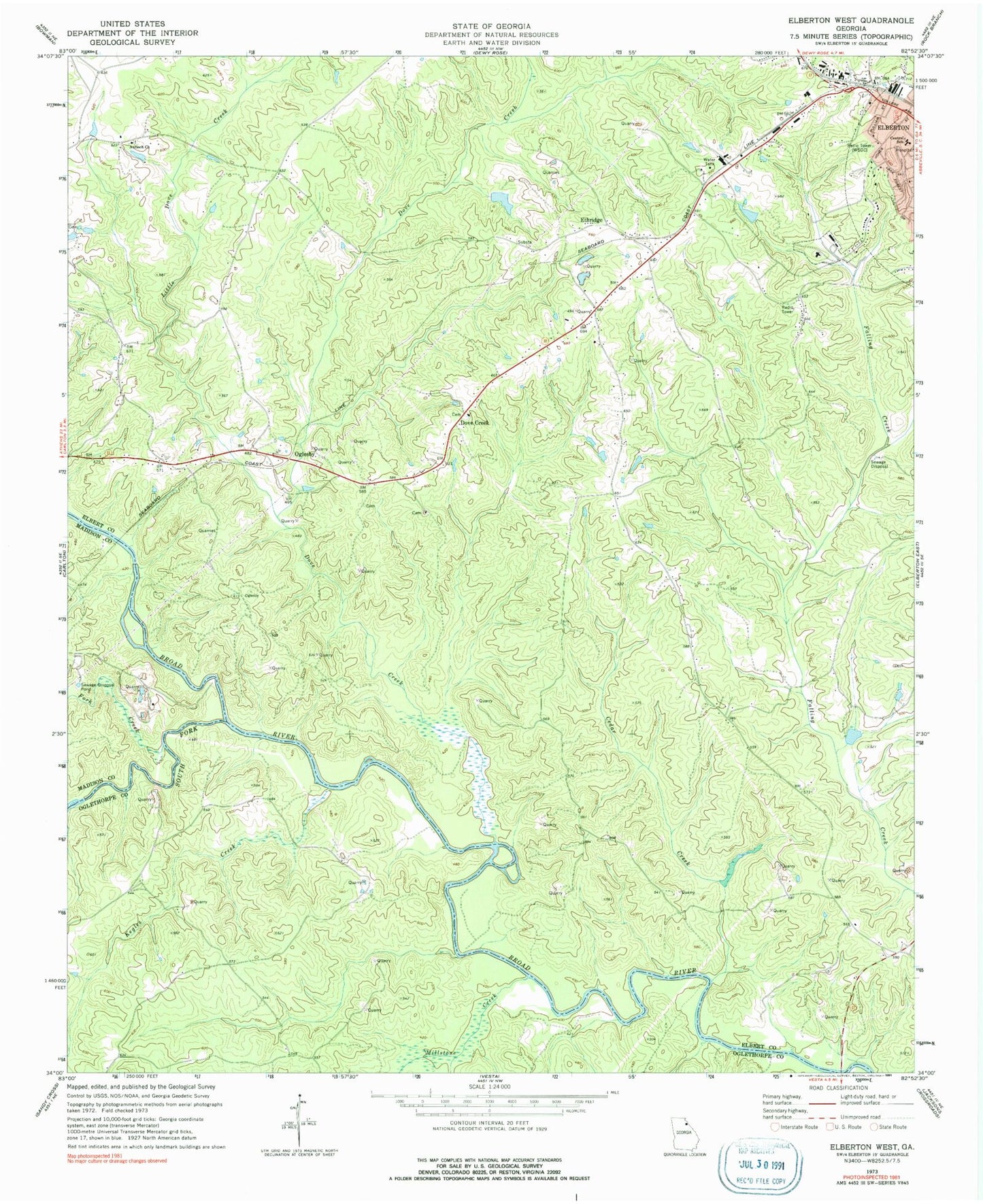
Classic USGS Elberton West Georgia 7.5'x7.5' Topo Map
Couldn't load pickup availability
Historical USGS topographic quad map of Elberton West in the state of Georgia. Typical map scale is 1:24,000, but may vary for certain years, if available. Print size: 24" x 27"
This quadrangle is in the following counties: Elbert, Madison, Oglethorpe.
The map contains contour lines, roads, rivers, towns, and lakes. Printed on high-quality waterproof paper with UV fade-resistant inks, and shipped rolled.
Contains the following named places: Cedar Creek, Central School, Fork Creek, Kegles Creek, Little Dove Creek, Millstone Creek, South Fork Broad River, Ethridge, Oglesby, Dove Creek Church, Dove Creek School (historical), Jones Ferry (historical), Martins Ferry (historical), Mill Branch, Coggins Lake Dam, Coggins Lake, Rome Kraft Lake Dam, Rome Kraft Lake, Antioch Cemetery, Deadwylers Ferry (historical), Detwiler Ferry (historical), Dove Creek Cemetery, Elbert County Comprehensive High School, Elbert County Middle School, Jones Street School (historical), Kingdom Hall, Limo Church (historical), Mattox Bridge, Saint Mary Catholic Church, Samuel Elbert Academy, Union Grove Church (historical), West End Church, WWRK-AM (Elberton), WWRK-FM (Elberton), Antioch Church, Dove Creek, Dove Creek, Doves Creek Elementary School, New Doves Creek Cemetery