MyTopo
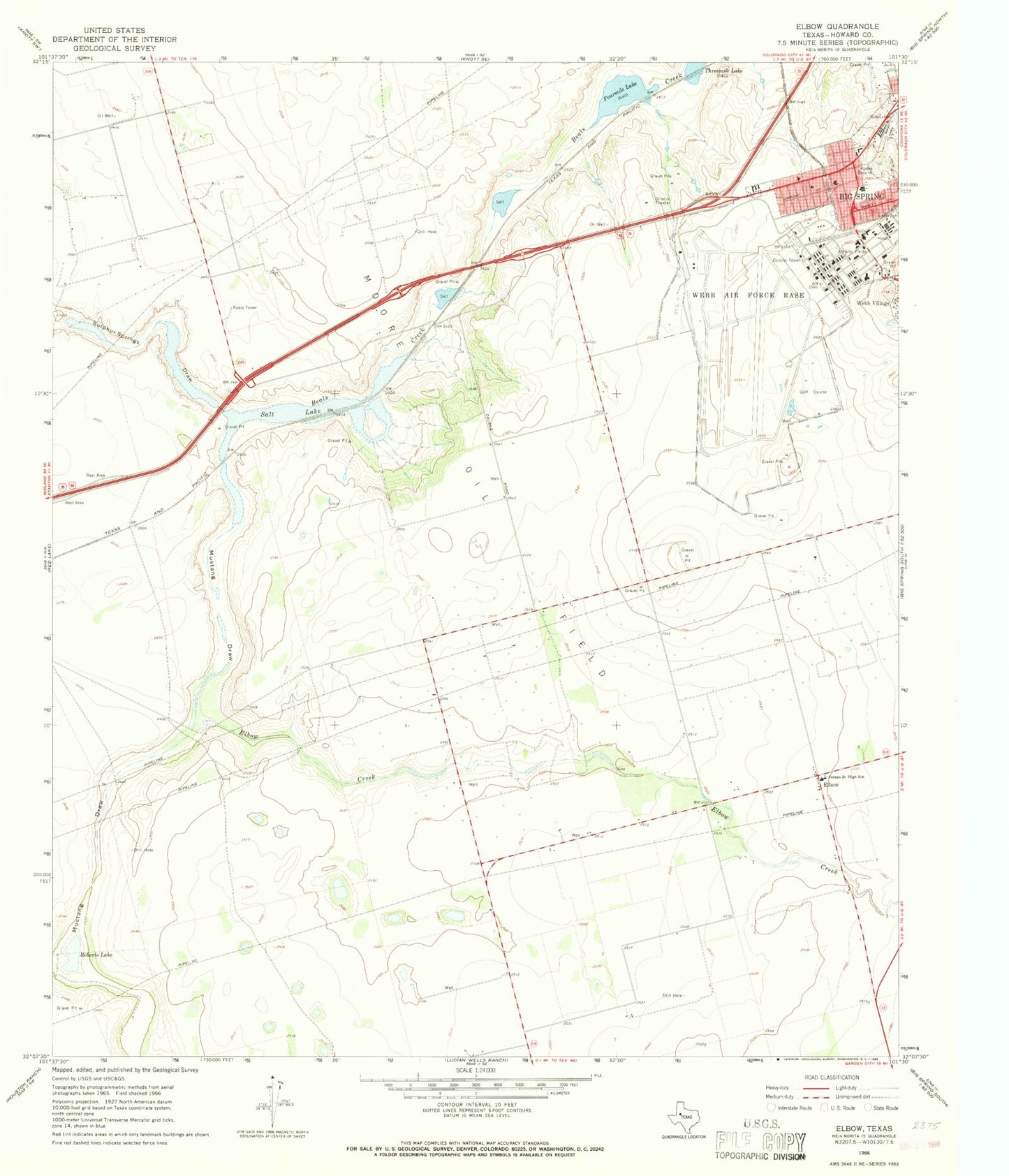
Classic USGS Elbow Texas 7.5'x7.5' Topo Map
Couldn't load pickup availability
Historical USGS topographic quad map of Elbow in the state of Texas. Map scale may vary for some years, but is generally around 1:24,000. Print size is approximately 24" x 27"
This quadrangle is in the following counties: Howard.
The map contains contour lines, roads, rivers, towns, and lakes. Printed on high-quality waterproof paper with UV fade-resistant inks, and shipped rolled.
Contains the following named places: Air Evac Lifeteam 54, Big Spring Army Air Field, Big Spring Fire Department Station 1, Big Spring Mc Mahon-Wrinkle Airport, Big Spring Police Department, Elbow, Elbow Creek, Federal Correctional Institution Big Spring Facility, Fourmile Lake, Howard County Sheriff's Office, Howard County Volunteer Fire Department Lomax, Moore Oil Field, Mustang Draw, Roberts Lake, Salt Lake, Sulphur Springs Draw, Webb Air Force Base