
MyTopo
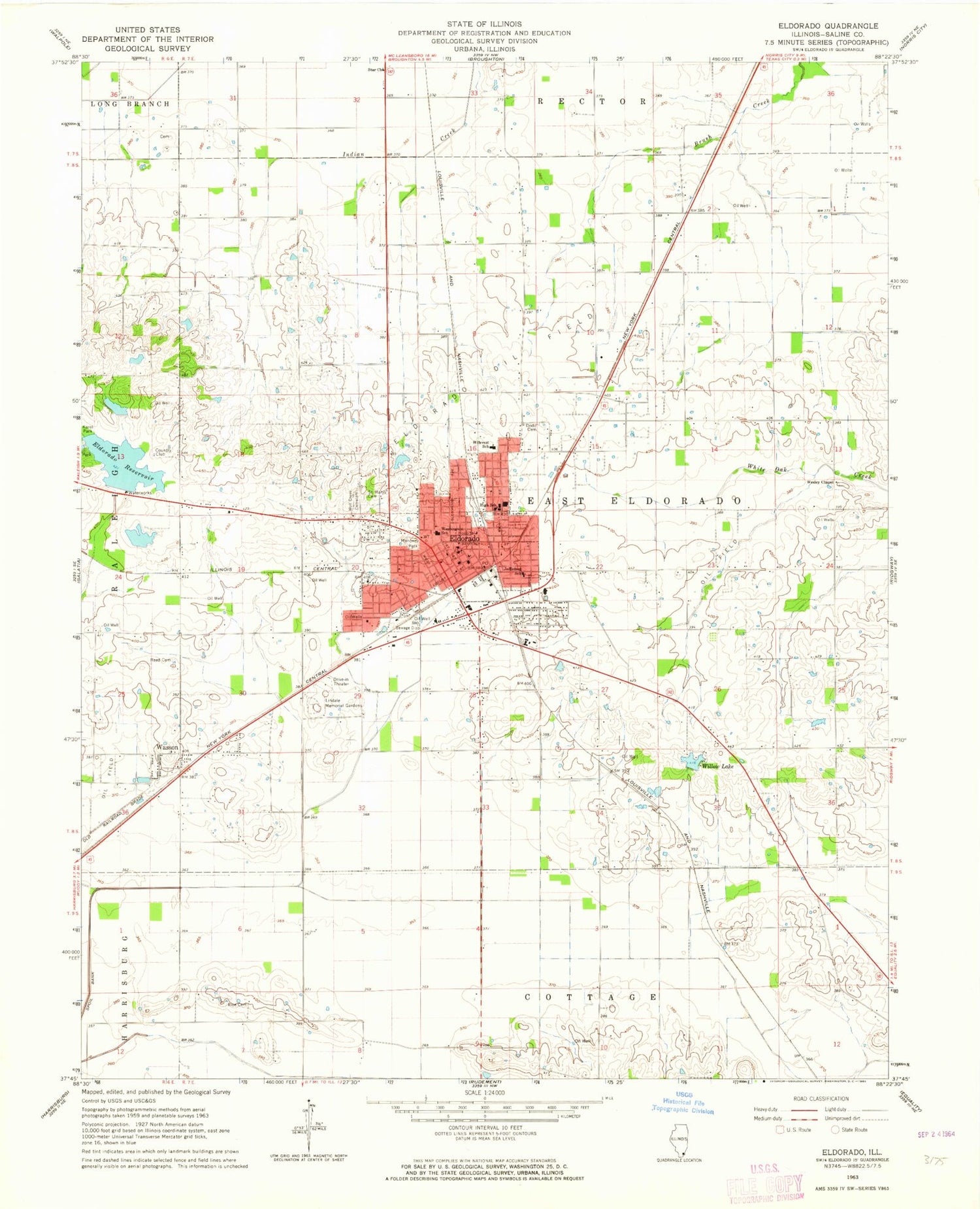
Classic USGS Eldorado Illinois 7.5'x7.5' Topo Map
Couldn't load pickup availability
Historical USGS topographic quad map of Eldorado in the state of Illinois. Map scale may vary for some years, but is generally around 1:24,000. Print size is approximately 24" x 27"
This quadrangle is in the following counties: Saline.
The map contains contour lines, roads, rivers, towns, and lakes. Printed on high-quality waterproof paper with UV fade-resistant inks, and shipped rolled.
Contains the following named places: Beulah Heights, Beulah Heights Methodist Church, Beulah Heights Public School, Calvary Baptist Church, Church of God of Eldorado, City of Eldorado, College Heights Baptist Church, Dodd Cemetery, Eldorado, Eldorado City Hall, Eldorado Fire Department, Eldorado High School, Eldorado Middle School, Eldorado Oil Field, Eldorado Police Department, Eldorado Post Office, Eldorado Reservoir, Eldorado Reservoir Dam, Ferrell Hospital, First Baptist Church, First Church of Christ, First Presbyterian Church, First United Methodist Church, Free Methodist Church, Gospel Assembly Church, Hillcrest School, Holy Bible Mission, Jefferson School, Lake Murphysboro, Lake Murphysboro Dam, Lincoln Public School, Lindale Memorial Gardens, Mahoney Park, Miller Emergency Medical Services, Read Family Cemetery, Red Bud, Rice Cemetery, Saint Mary Catholic Church, Saint Mary Cemetery, Saint Marys School, Saline City, Scott Street Baptist Church, Star Church, Township of East Eldorado, Wasson, WEBQ-FM (Eldorado), Wesley Chapel, Willow Lake, Wolf Creek Cemetery, WUBS-AM (Harrisburg), ZIP Code: 62930


