MyTopo
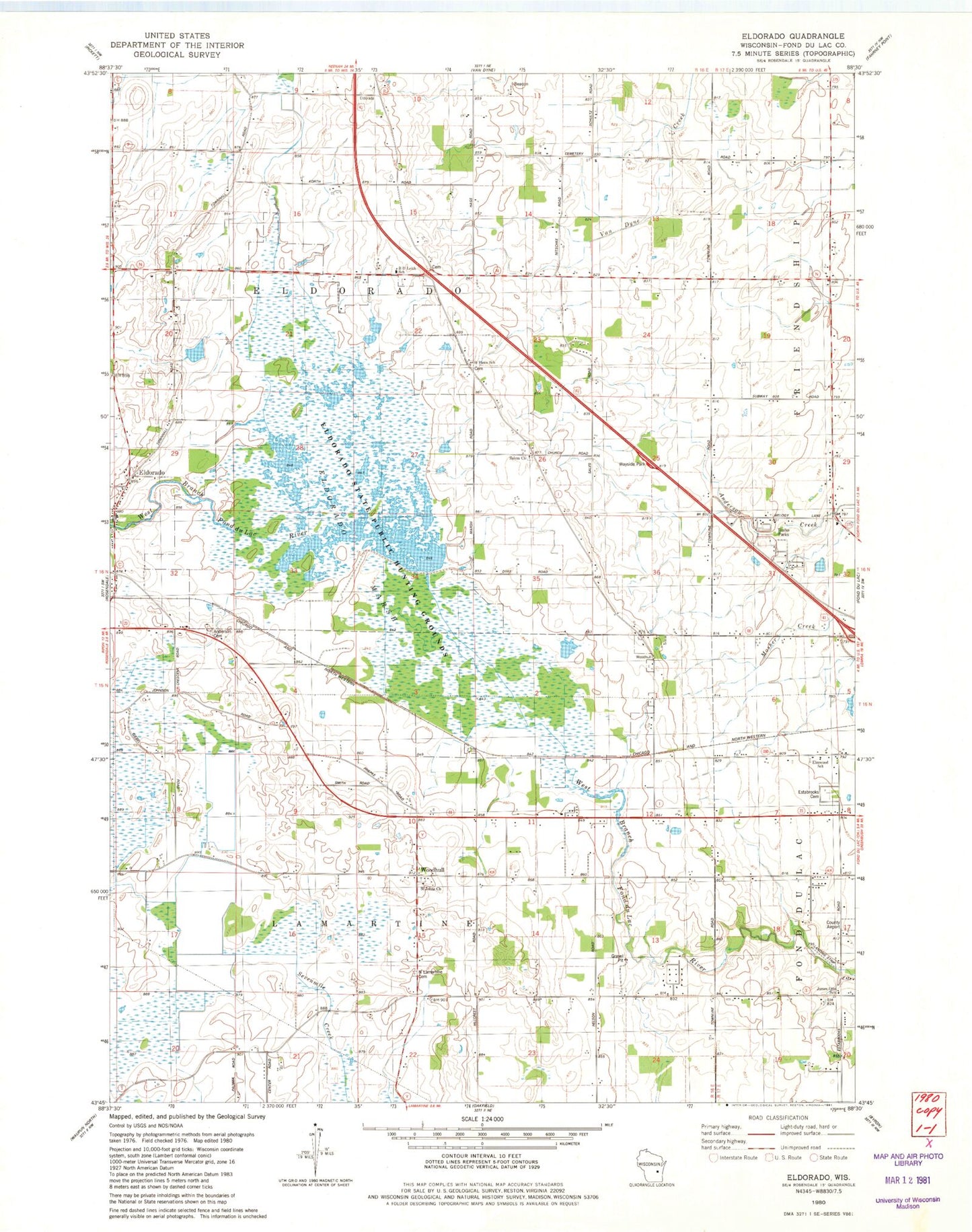
Classic USGS Eldorado Wisconsin 7.5'x7.5' Topo Map
Couldn't load pickup availability
Historical USGS topographic quad map of Eldorado in the state of Wisconsin. Map scale may vary for some years, but is generally around 1:24,000. Print size is approximately 24" x 27"
This quadrangle is in the following counties: Fond du Lac.
The map contains contour lines, roads, rivers, towns, and lakes. Printed on high-quality waterproof paper with UV fade-resistant inks, and shipped rolled.
Contains the following named places: Anderson Cemetery, Ash Grove School, B D Leith School, Boxelder Line School, Century Farms, Clark School, Crescent School, Eldorado, Eldorado Marsh, Eldorado Post Office, Eldorado State Public Hunting Grounds, Eldorado Volunteer Fire Department, Elmwood School, Estabrooks Cemetery, Franklin School, Gallitz Farms, High Ridge School, James Otis School, Longfellow School, Maple Grove School, Methodist Episcopal Cemetery, North Lamartine Cemetery, Our Risen Savior Catholic Church Cemetery, Pine Drive Dairy, Randolph School, Ridge Road School, Saint Johns Church, Saint Pauls Church, Saint Pauls School, Salem Church, Town Hall School, Town of Eldorado, Town of Fond du Lac, Town of Lamartine, West Terrace Farm, Woodhull, Woodhull Station, ZIP Codes: 54932, 54979