MyTopo
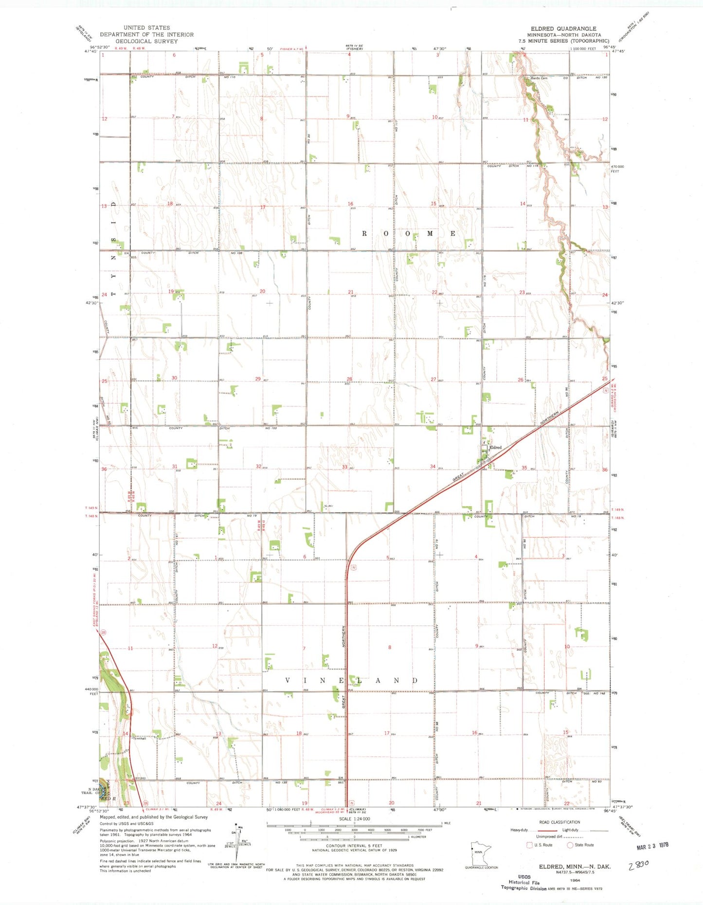
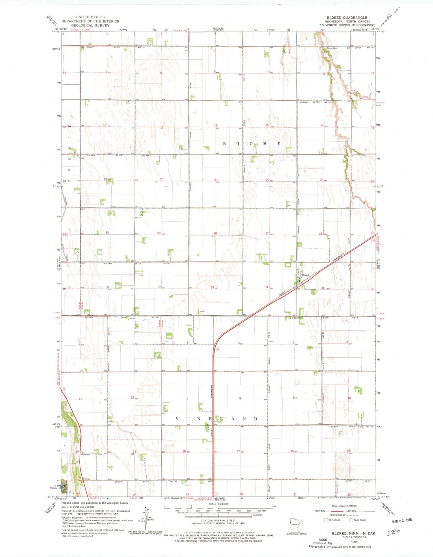
Classic USGS Eldred Minnesota 7.5'x7.5' Topo Map
Couldn't load pickup availability
Historical USGS topographic quad map of Eldred in the state of Minnesota. Map scale may vary for some years, but is generally around 1:24,000. Print size is approximately 24" x 27"
This quadrangle is in the following counties: Polk, Traill.
The map contains contour lines, roads, rivers, towns, and lakes. Printed on high-quality waterproof paper with UV fade-resistant inks, and shipped rolled.
Contains the following named places: Bardo Cemetery, County Ditch Number Nineteen, County Ditch Number Ninetyeight, County Ditch Number Ninetysix, County Ditch Number One Hundred Eight, County Ditch Number One Hundred Seventeen, County Ditch Number One Hundred Sixteen, County Ditch Number One Hundred Sixtyone, County Ditch Number One Hundred Ten, County Ditch Number One Hundred Thirtyfive, County Ditch Number One Hundred Three, County Ditch Number One Hundred Twenty, County Ditch Number Twenty, Eldred, Eldred Post Office, Township of Roome, Township of Vineland, ZIP Code: 56523