MyTopo
Classic USGS Eldred New York 7.5'x7.5' Topo Map
Couldn't load pickup availability
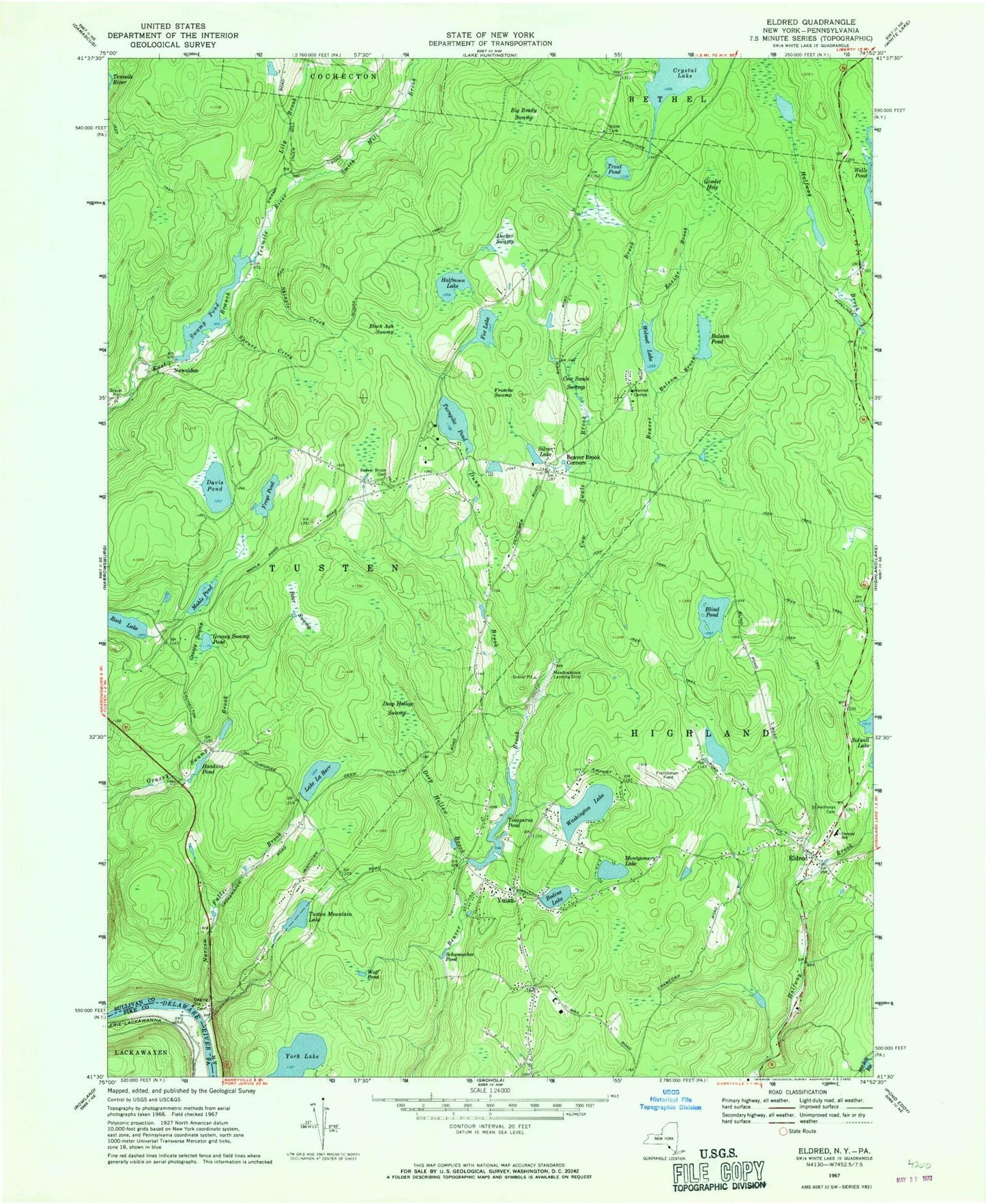
Historical USGS topographic quad map of Eldred in the state of New York. Typical map scale is 1:24,000, but may vary for certain years, if available. Print size: 24" x 27"
This quadrangle is in the following counties: Pike, Sullivan.
The map contains contour lines, roads, rivers, towns, and lakes. Printed on high-quality waterproof paper with UV fade-resistant inks, and shipped rolled.
Contains the following named places: Balsam Brook, Balsam Pond, Bear Swamp, Beaver Brook Cemetery, Beaver Brook Corners, Big Brady Swamp, Black Ash Swamp, Blind Pond, Bodine Lake, Eldred Junior - Senior High School, Cow Swale Brook, Cow Swale Swamp, Davis Pond, Decker Swamp, Deep Hollow Brook, Deep Hollow Swamp, Dunn Brook, Eldred, Fox Lake, Freys Pond, Froschs Swamp, Gimlet Hole, Grassy Swamp, Grassy Swamp Pond, Halfmoon Lake, Hankins Pond, Lake La Barr, Lily Brook, Mahls Pond, Montgomery Lake, Narrow Falls Brook, Racine Brook, Saint Anthonys Cemetery, Schiff Trail, Schumacher Pond, Shingle Creek, Silver Lake, Spruce Creek, Swamp Pond, Toasperns Pond, Trout Pond, Turnpike Pond, Tusten Mountain Lake, Washington Lake, Welmet Camps, Welmet Lake, Crystal Lake, Rock Lake, Smith Mill Brook, Wolf Pond, York Lake, Yulan, Newieden, Town of Highland, Town of Tusten, Sunshine Hall Free Library, Highland Town Hall, Yulan Volunteer Fire Department Yulan Station, Yulan Volunteer Fire Department Eldred Station, Eldred Post Office, Yulan Post Office, Eldred Census Designated Place