MyTopo
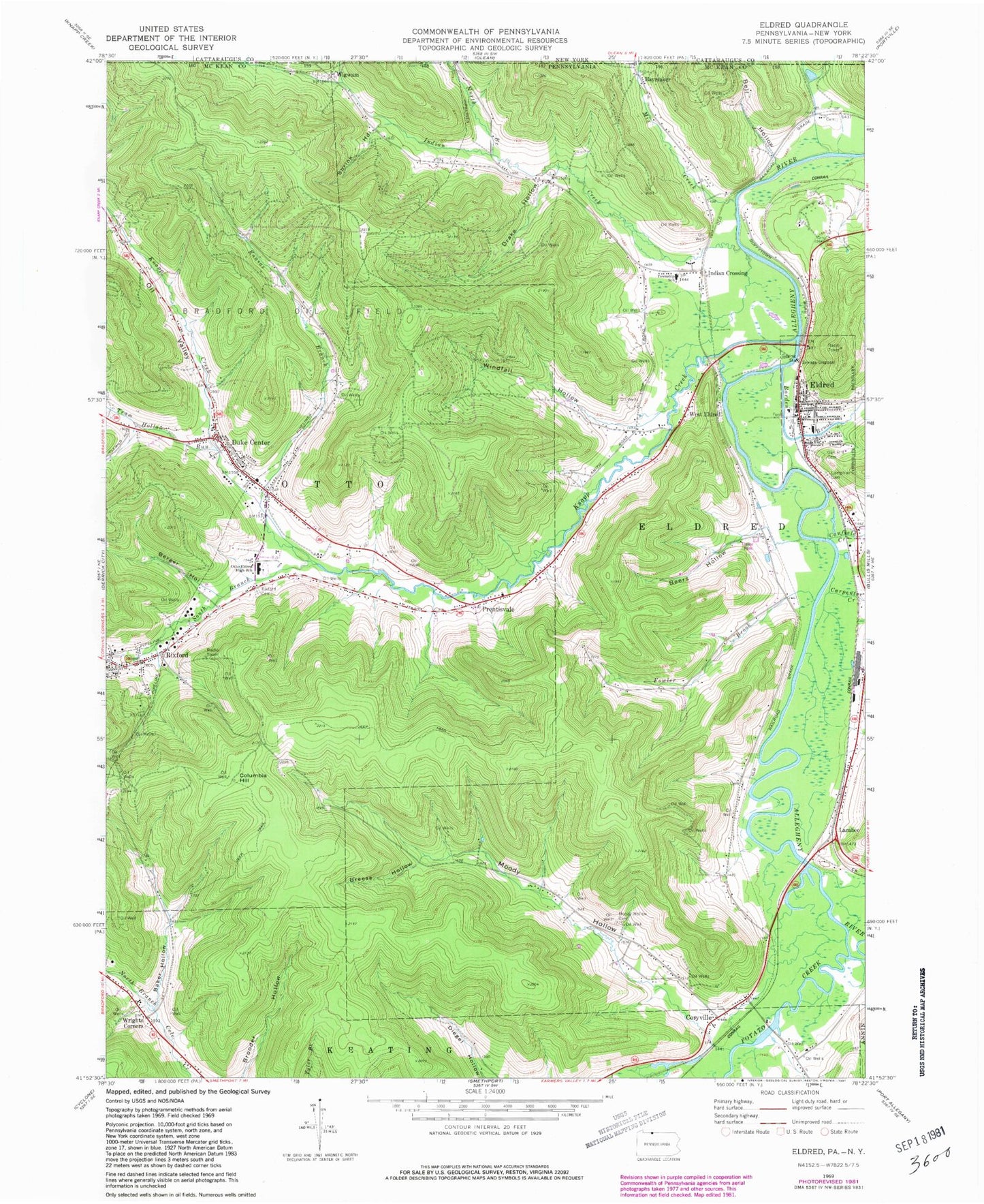
Classic USGS Eldred Pennsylvania 7.5'x7.5' Topo Map
Couldn't load pickup availability
Historical USGS topographic quad map of Eldred in the states of Pennsylvania, New York. Typical map scale is 1:24,000, but may vary for certain years, if available. Print size: 24" x 27"
This quadrangle is in the following counties: Cattaraugus, McKean.
The map contains contour lines, roads, rivers, towns, and lakes. Printed on high-quality waterproof paper with UV fade-resistant inks, and shipped rolled.
Contains the following named places: Bell Hollow, Big Loop Hollow, Indian Creek, Little Loop Hollow, Louds Creek, Baker Hollow, Barden Brook, Beers Hollow, Berger Hollow, Breese Hollow, Canfield Creek, Carpenter Creek, Columbia Hill, Coryville, Drake Hollow, Duke Center, Eldred, Fowler Brook, Haymaker, Indian Crossing, Kansas Branch, Lamphier Cemetery, Larabee, Moody Hollow, Moody Hollow Cemetery, Oak Hill Cemetery, Oil Valley, Otto-Eldred High School, Prentisvale, Rixford, Rixford Cemetery, Shrink Hollow, South Branch Knapp Creek, Tram Hollow Run, West Eldred, Wigwam, Windfall Hollow, Wrights Corners, Potato Creek, Fowler Brook Church (historical), Bonnet, Rices Creek, Borough of Eldred, Township of Eldred, Township of Otto, Eldred Township Volunteer Fire Department Station 18, Eldred Borough Volunteer Fire Department Station 4, Otto Township Volunteer Fire Company - Station 9, Eldred Volunteer Ambulance Association Station 4, Duke Center Post Office, Rixford Post Office, Eldred Post Office, Stulltown Cemetery, Cooks Cemetery, Artline Road Cemetery, Saint Raphael Cemetery, Duke Center Cemetery, Knapp Creek, Mix Creek, North Branch Indian Creek