MyTopo
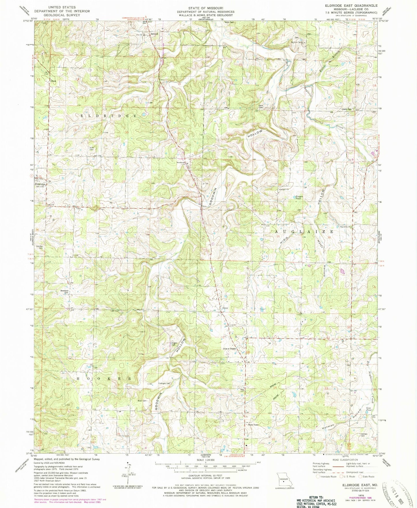
Classic USGS Eldridge East Missouri 7.5'x7.5' Topo Map
Couldn't load pickup availability
Historical USGS topographic quad map of Eldridge East in the state of Missouri. Map scale may vary for some years, but is generally around 1:24,000. Print size is approximately 24" x 27"
This quadrangle is in the following counties: Laclede.
The map contains contour lines, roads, rivers, towns, and lakes. Printed on high-quality waterproof paper with UV fade-resistant inks, and shipped rolled.
Contains the following named places: Alexander School, Bidwell, Bradshaw Cemetery, Butcher Cemetery, Capoferri Lake, Capoferri Lake Dam, Davis Cemetery, Dove, Dove Church, Dryglaize, Eldridge, Eldridge Post Office, Eldridge Volunteer Fire Department, Esther Branch, Friendship Church, Friendship School, Fulbright Cemetery, Goodwin Calvary Church, Goodwin Hollow, Goodwin Hollow Creek, Goodwin School, Goss Pond, Grace, High Hollow, Holman Cemetery, Holman Hollow, Hufft Cemetery, Hufft Hollow, Keener School, KIRK-FM (Lebanon), Liberty Church, Merchant School, Mizer Cemetery, North Liberty Cemetery, Reagan Church, Reagan Pond, Reagan School, Rogers - Allison - Davis Cemetery, Shith Cemetery, Township of Auglaize, Zion Church, Zion School