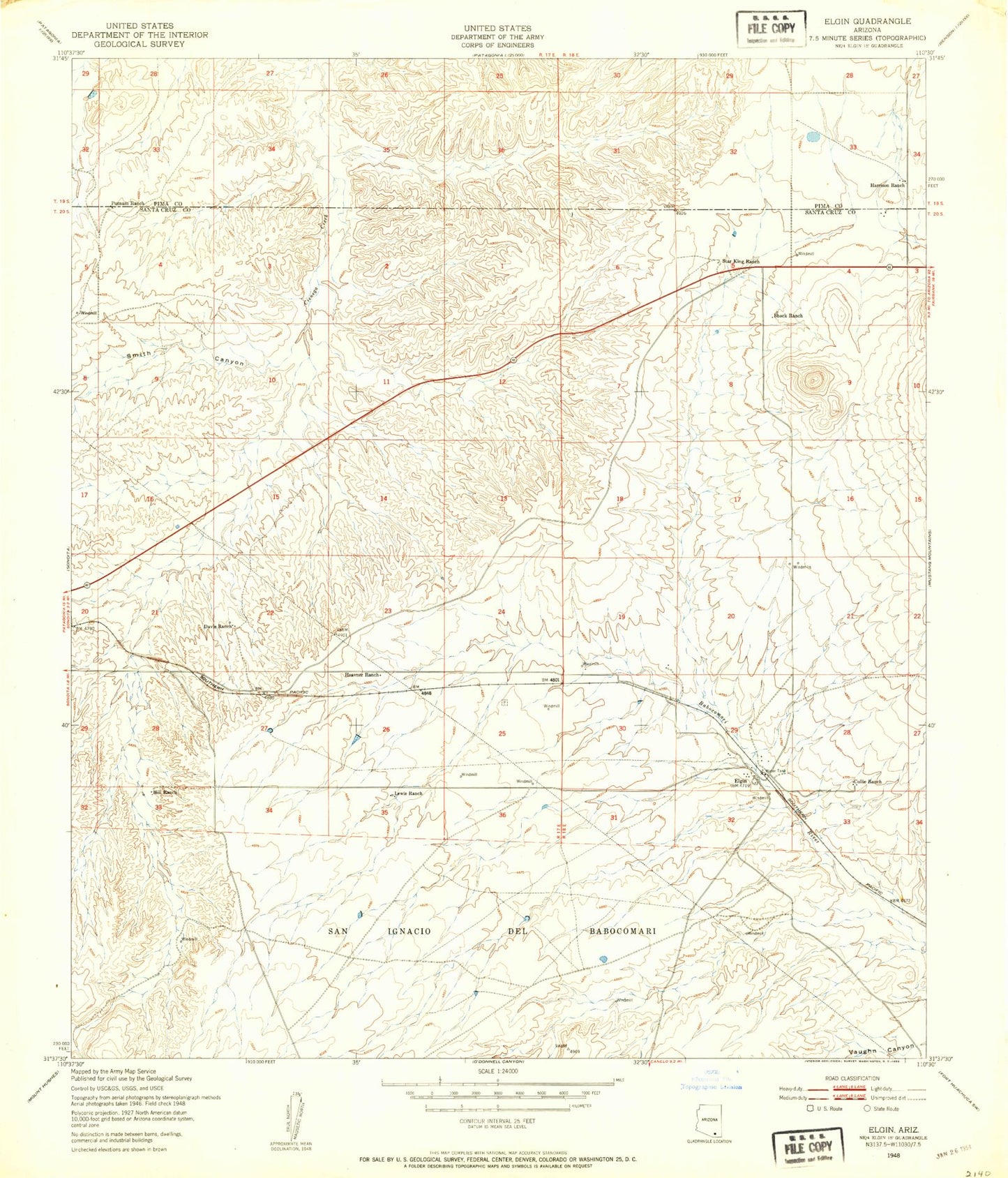
MyTopo
Classic USGS Elgin Arizona 7.5'x7.5' Topo Map
Regular price
$16.95
Regular price
Sale price
$16.95
Unit price
per
Couldn't load pickup availability
Historical USGS topographic quad map of Elgin in the state of Arizona. Map scale may vary for some years, but is generally around 1:24,000. Print size is approximately 24" x 27"
This quadrangle is in the following counties: Pima, Santa Cruz.
The map contains contour lines, roads, rivers, towns, and lakes. Printed on high-quality waterproof paper with UV fade-resistant inks, and shipped rolled.
Contains the following named places: Elgin, Elgin Census Designated Place, Elgin Elementary School, Fruitland Cemetery, Hay Canyon, Las Cienegas National Conservation Area, Lightning R Ranch, Rancho Costa Plente, S X Ranch, Smith Canyon, Sonoita - Elgin Landfill, Sonoita Hills Community Church, ZIP Code: 85611