MyTopo
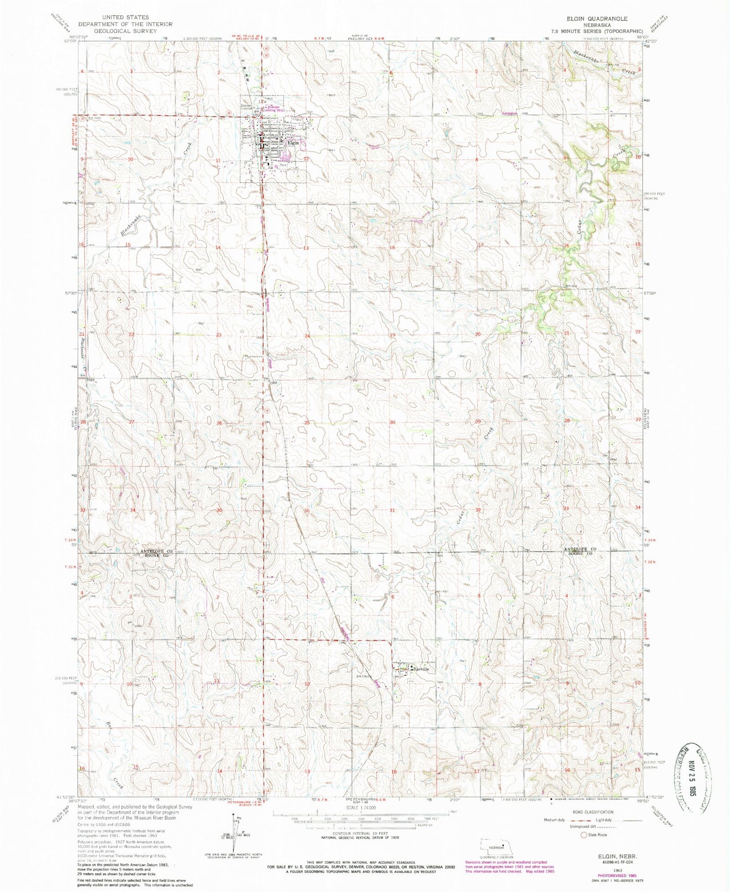
Classic USGS Elgin Nebraska 7.5'x7.5' Topo Map
Couldn't load pickup availability
Historical USGS topographic quad map of Elgin in the state of Nebraska. Map scale may vary for some years, but is generally around 1:24,000. Print size is approximately 24" x 27"
This quadrangle is in the following counties: Antelope, Boone.
The map contains contour lines, roads, rivers, towns, and lakes. Printed on high-quality waterproof paper with UV fade-resistant inks, and shipped rolled.
Contains the following named places: Antelope Memorial Hospital Elgin Clinic, Centennial Gardens, Central Farmers Cooperative Elevator, City of Elgin, Elgin, Elgin City Mall, Elgin Municipal Park, Elgin Municipal Park Campground, Elgin Police Department, Elgin Post Office, Elgin Public Library, Elgin Public Schools, Elgin Veterans Medical Clinic, Elgin Volunteer Fire Department, Koinzan Airport, Plantation House, Pope John XXIII High School, Raeville, Raeville Census Designated Place, Raeville Post Office, Saint Bonaventure Catholic Church, Saint Boniface Elementary School, Saint Boniface Parish, Township of Cedar, Township of Logan, Trinity Lutheran Church, United Methodist Church