MyTopo
Classic USGS Elizabeth Mountain Utah 7.5'x7.5' Topo Map
Regular price
$16.95
Regular price
Sale price
$16.95
Unit price
per
Couldn't load pickup availability
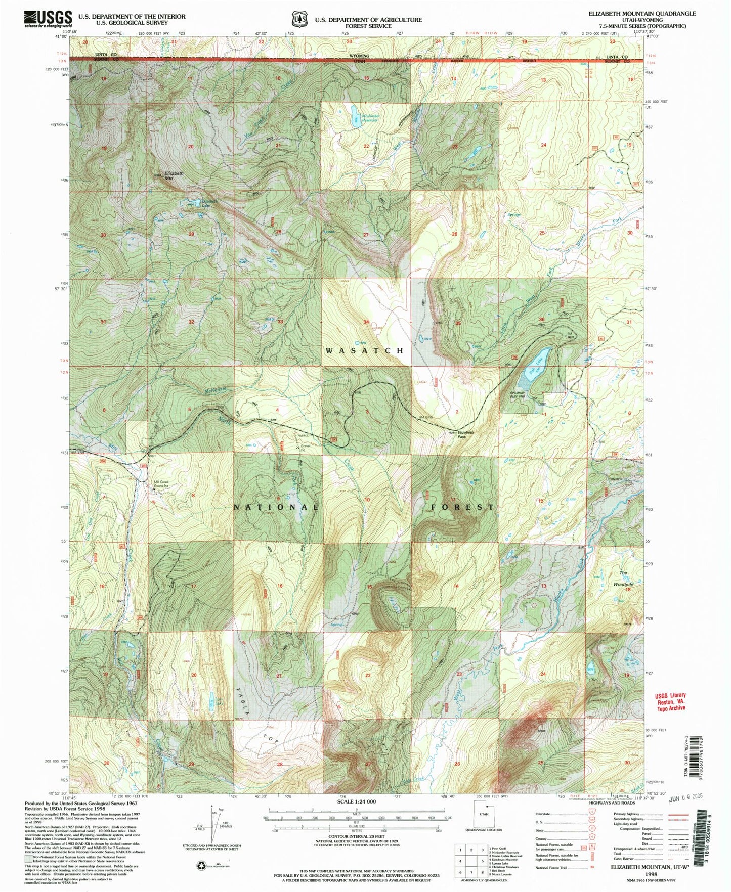
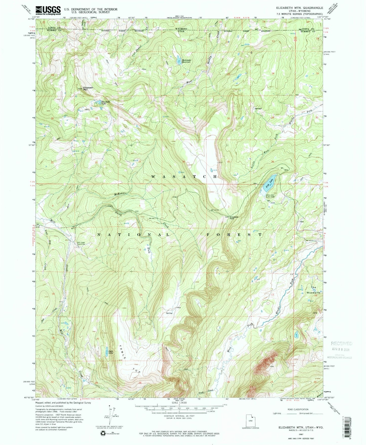
Historical USGS topographic quad map of Elizabeth Mountain in the state of Utah. Typical map scale is 1:24,000, but may vary for certain years, if available. Print size: 24" x 27"
This quadrangle is in the following counties: Summit, Uinta.
The map contains contour lines, roads, rivers, towns, and lakes. Printed on high-quality waterproof paper with UV fade-resistant inks, and shipped rolled.
Contains the following named places: Elizabeth Lake, Elizabeth Mountain, Elizabeth Pass, Fish Lake, Lost Dog Creek, Lym Lake, McKenzie Creek, Mill Creek Guard Station, Moslander Reservoir, North Fork Mill Creek, Plot Creek, Table Top, The Woodpile, Trail Creek, Moslander Reservoir, Moslander Dam