MyTopo
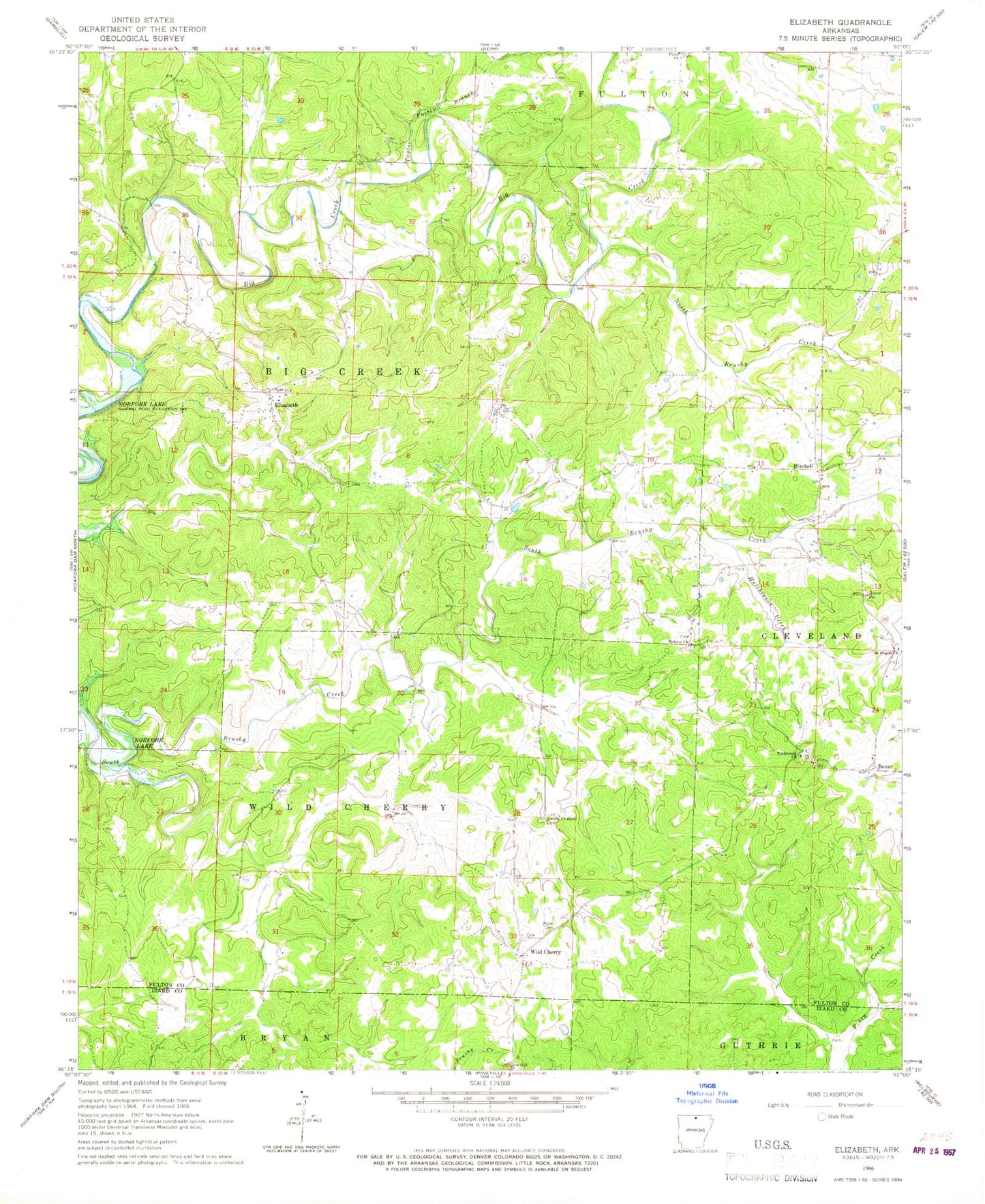
Classic USGS Elizabeth Arkansas 7.5'x7.5' Topo Map
Couldn't load pickup availability
Historical USGS topographic quad map of Elizabeth in the state of Arkansas. Map scale may vary for some years, but is generally around 1:24,000. Print size is approximately 24" x 27"
This quadrangle is in the following counties: Fulton, Izard.
The map contains contour lines, roads, rivers, towns, and lakes. Printed on high-quality waterproof paper with UV fade-resistant inks, and shipped rolled.
Contains the following named places: Elizabeth, Elizabeth Post Office, Flora Church, Fountain Lake, Fountain Lake Dam, Hebron Church, Hutchinson Creek, Mitchell, Mount Pisgah Church, Myse Cemetery, North Brushy Creek, Smith Chapel Cemetery, Taylor Foster Branch, Township of Big Creek, Township of Cleveland, Township of Wild Cherry, Wild Cherry, Wilderness Church, ZIP Code: 72515