MyTopo
Classic USGS Elizabethtown North North Carolina 7.5'x7.5' Topo Map
Couldn't load pickup availability
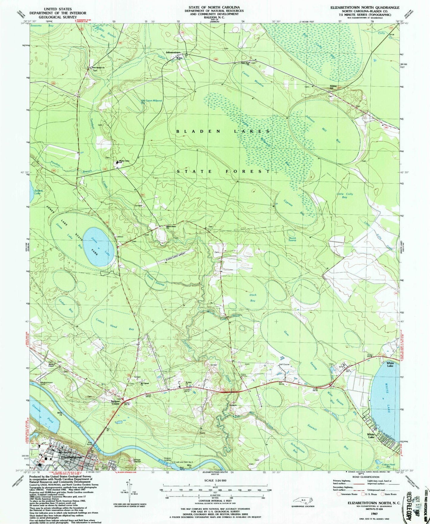
Historical USGS topographic quad map of Elizabethtown North in the state of North Carolina. Map scale may vary for some years, but is generally around 1:24,000. Print size is approximately 24" x 27"
This quadrangle is in the following counties: Bladen.
The map contains contour lines, roads, rivers, towns, and lakes. Printed on high-quality waterproof paper with UV fade-resistant inks, and shipped rolled.
Contains the following named places: Bladen County Sheriff's Office, Bladen County Water Rescue - White Lake, Bladen Lakes Airport, Bladen Lakes School, Bladen Lakes State Forest, Bloody Branch Bay, Briar Branch Church, Browns Creek, Browns Landing, Bureau of Investigation, Caney Meadow, Cedar Bay, Cotton Head Bay, Cypress Bay, Ditch Bay, Elizabethtown, Elizabethtown City Hall, Elizabethtown Dock, Elizabethtown Fire Department, Elizabethtown Junior High School, Elizabethtown Police Department, Elizabethtown Post Office, Greenes Pond, Greens Pond Dam, Gum Swamp, Indian Creek, Johnson Mill Bay, Johnsontown, Jones Lake, Jones Lake Bay, Jones Lake Lookout Tower, Little Colly Bay, Martins Chapel, Mount Carmel Church, Mount Zion Church, Olin Tatum Millpond Bay, Panther Branch, Prison Number 601, Saint John Church, Saint Rest Church, Sawmill Bay, Schoolhouse Bay, Smith Swamp, Susies Hill, Suttons Corner, Sweet Home Church, Tatum Millpond Bay, Thumb Swamp, Township of Central, Tub Mill Creek, US Lock and Dam Number 2, Wam Squam Bay, WBLA-AM (Elizabethtown), White Lake Drain, ZIP Code: 28337