
MyTopo
Classic USGS Elizabethtown South North Carolina 7.5'x7.5' Topo Map
Couldn't load pickup availability
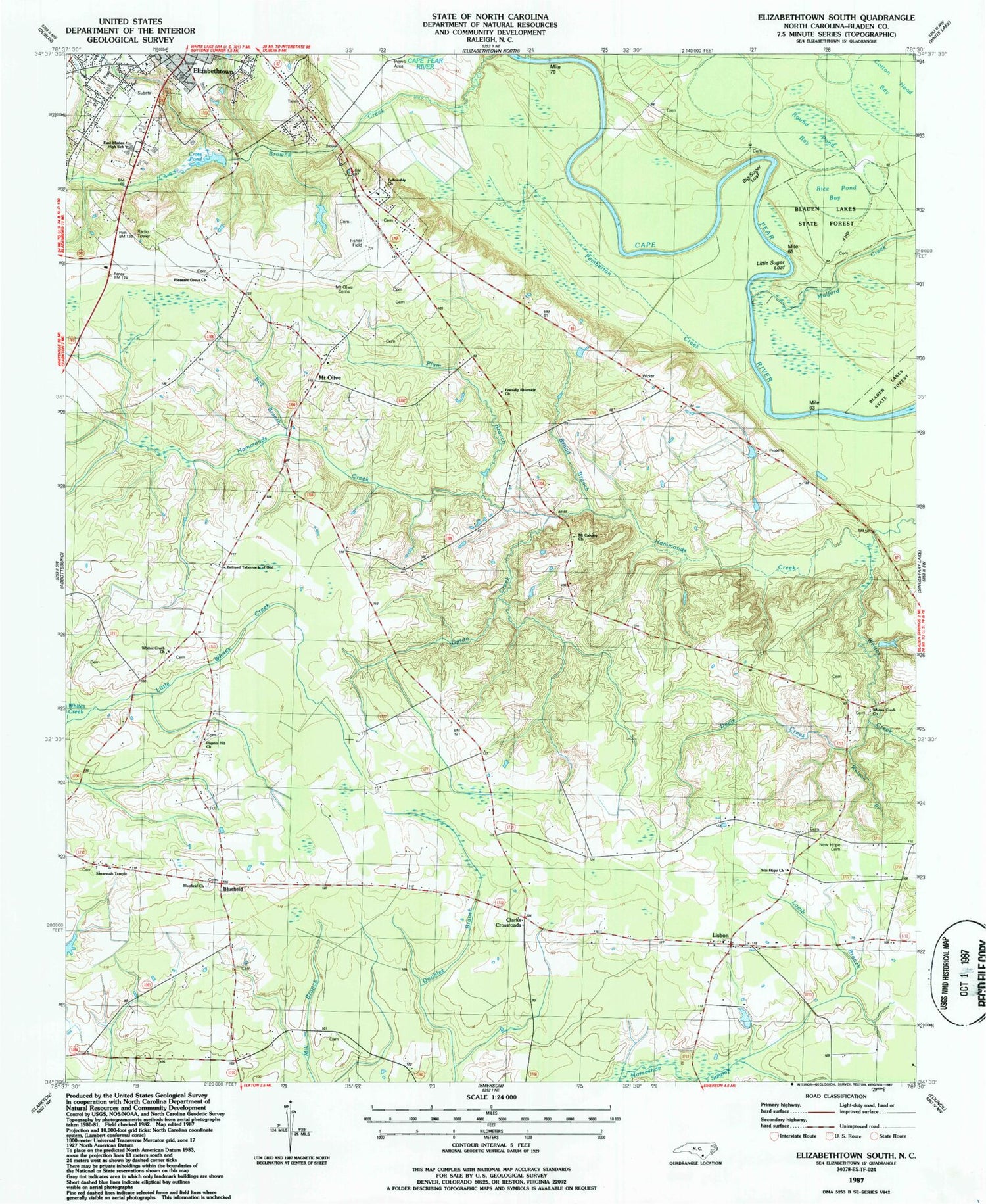
Historical USGS topographic quad map of Elizabethtown South in the state of North Carolina. Map scale may vary for some years, but is generally around 1:24,000. Print size is approximately 24" x 27"
This quadrangle is in the following counties: Bladen.
The map contains contour lines, roads, rivers, towns, and lakes. Printed on high-quality waterproof paper with UV fade-resistant inks, and shipped rolled.
Contains the following named places: Beloved Tabernacle of God, Big Sugar Loaf, Bladen County, Bladen County Hospital, Bluefield, Bluefield Church, Bog Branch, Broad Branch, Clarks Crossroads, Cotton Head Bay, Cross Pond, Cross Pond Dam, Curtis L Brown Jr Field, Davis Cemetery, Davis Creek, Doubles Branch, East Bladen High School, Elizabethtown Airport Industrial Park, Elizabethtown Nursing Center, Elizabethtown Rescue Squad, Fellowship Church, Friendly Riverside Church, Kemp Church, Lamb Branch, Lee Cemetery, Lisbon, Lisbon Baptist Church, Lisbon Volunteer Fire Department, Little Horseshoe Swamp, Little Sugar Loaf, Little Whites Creek, McCall Cemetery, McKoy Cemetery, Mears Cemetery, Mount Calvary Church, Mount Olive, Mount Olive Cemeteries, Mount Zion African Methodist Episcopal Zion Church, Mulford Creek, New Hope Cemetery, New Hope Church, Pemberton Creek, Pilgrim Hill Church, Pleasant Grove Church, Plum Branch, Rice Pond Bay, Riverside Church, Round Pond Bay, Savannah Temple Church, Sutton Cemetery, Town of Elizabethtown, Township of Elizabethtown, True Vine Holiness Church, Turnbull Creek, Unity Fellowship Christian Church, Upton Creek, Warson Cemetery, Watson Branch, Whites Creek, Whites Creek Church


