MyTopo
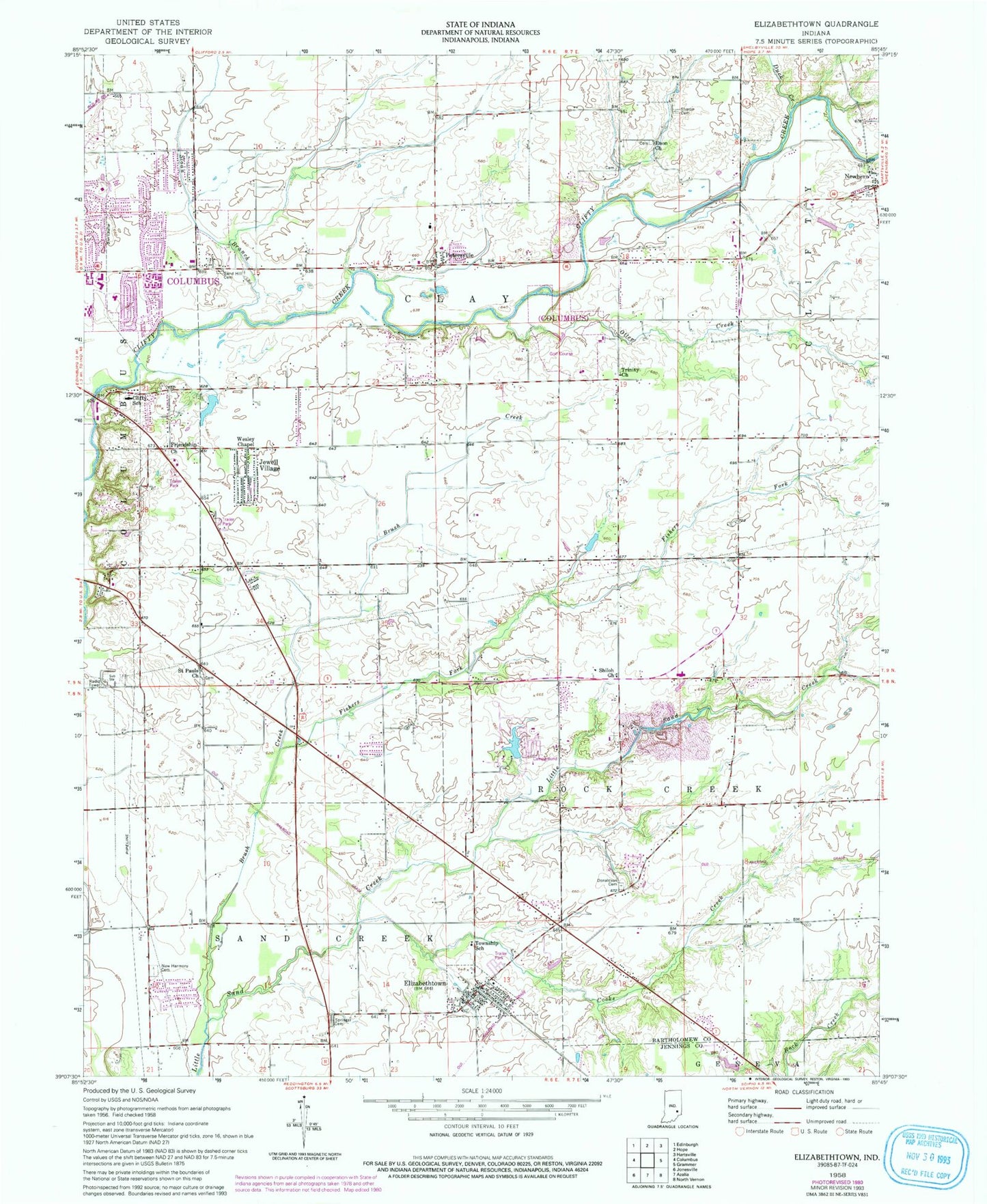
Classic USGS Elizabethtown Indiana 7.5'x7.5' Topo Map
Couldn't load pickup availability
Historical USGS topographic quad map of Elizabethtown in the state of Indiana. Map scale may vary for some years, but is generally around 1:24,000. Print size is approximately 24" x 27"
This quadrangle is in the following counties: Bartholomew, Jennings.
The map contains contour lines, roads, rivers, towns, and lakes. Printed on high-quality waterproof paper with UV fade-resistant inks, and shipped rolled.
Contains the following named places: Brush Creek, Clay Township Fire Department, Clifty Creek Elementary School, Columbus Fire Department Station 4, Cooks Creek, Donaldson Cemetery, Duck Creek, Elizabethtown, Elizabethtown Post Office, Elizabethtown Volunteer Fire Department, Enon Church, Fishers Fork, Friendship Church, Harmony Cemetery, Jewell Village, Meshberger Quarry, Newbern, Otter Creek, Petersville, Saint Pauls Church, Sand Hill Cemetery, Sharon Cemetery, Shiloh Church, Sloan Branch, Springer Cemetery, Suhre Lake, Suhre Lake Dam, Town of Elizabethtown, Township of Clay, Trinity Church, Wesley Chapel, ZIP Code: 47203