
MyTopo
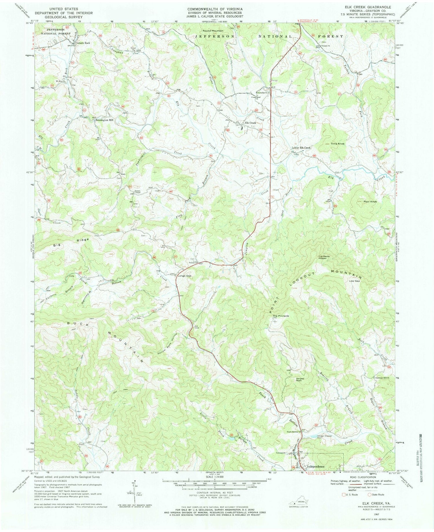
Classic USGS Elk Creek Virginia 7.5'x7.5' Topo Map
Couldn't load pickup availability
Historical USGS topographic quad map of Elk Creek in the state of Virginia. Map scale may vary for some years, but is generally around 1:24,000. Print size is approximately 24" x 27"
This quadrangle is in the following counties: Grayson.
The map contains contour lines, roads, rivers, towns, and lakes. Printed on high-quality waterproof paper with UV fade-resistant inks, and shipped rolled.
Contains the following named places: Bennington Mill, Big Ridge, Chestnut Hill Church, Chestnut Hill School, Comers Rock, Comers Rock Branch, Comers Rock School, Cross Road Church, Elk Creek, Elk Creek District, Elk Creek Elementary School, Elk Creek Post Office, Elk Creek Rescue Squad, Elk Creek Volunteer Fire Department, Farmers Branch, Fellowship Church, Flag Pond Branch, Forest Church, Forest School, Grayson County, Hollow Rock Hollow, Jumping Creek, Little Peach Bottom Creek, Longs Gap, Low Gap, Lower Elk Creek, Lund School, Maple Shade Church, Mount Zion Church, Point Lookout Mountain, Poor Knob, Powdermill Creek, Reverend J W Rader Memorial Bridge, Roaring Branch, Roger Branch, Rolling Acres Dairy, Round Mountain, Rudy School, Salem Church, Shop Branch, South Branch Elk Creek, Stone Creek, Stone School, Stones Chapel, Striped Rock, Sugarcamp Branch, The Devils Hopper, The Pinnacle, Tims Knob, Town of Independence, Turkey Fork, Union Church, Vaughn Branch, ZIP Codes: 24326, 24348


