MyTopo
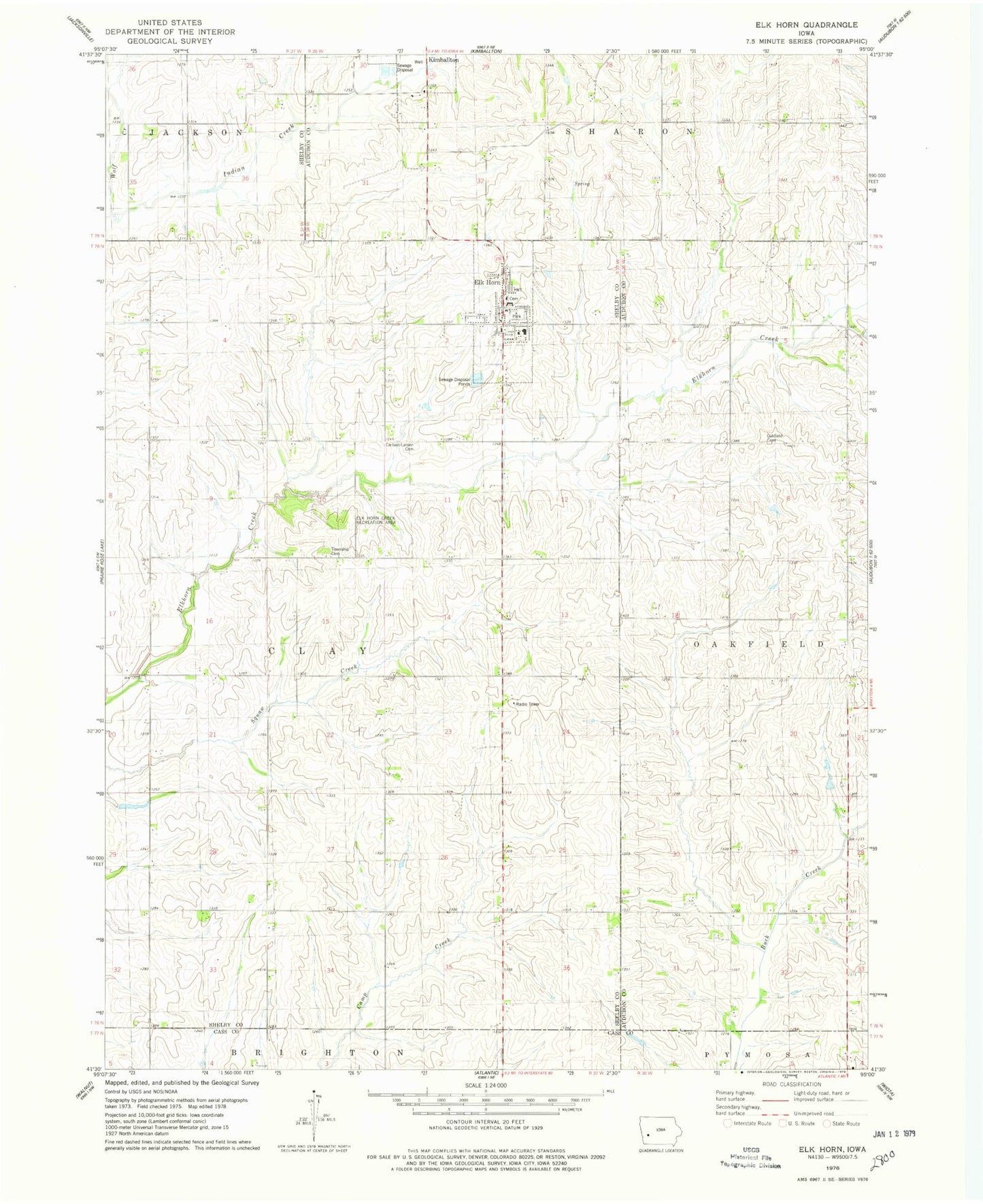
Classic USGS Elk Horn Iowa 7.5'x7.5' Topo Map
Couldn't load pickup availability
Historical USGS topographic quad map of Elk Horn in the state of Iowa. Map scale may vary for some years, but is generally around 1:24,000. Print size is approximately 24" x 27"
This quadrangle is in the following counties: Audubon, Cass, Shelby.
The map contains contour lines, roads, rivers, towns, and lakes. Printed on high-quality waterproof paper with UV fade-resistant inks, and shipped rolled.
Contains the following named places: Bedstemor's House, Carlsen - Larsen Cemetery, City of Elk Horn, Clay Township Cemetery, Danish Immigrant Museum, Danish Windmill Museum and Welcome Center, Elk Horn, Elk Horn Cemetery, Elk Horn City Park, Elk Horn Creek Recreation Area, Elk Horn Elevator, Elk Horn Fire Department, Elk Horn Lutheran Church, Elk Horn Post Office, Elk Horn Public Library, Elk Horn Town Hall, Exira - Elk Horn - Kimballton Elementary School, Exira - Elk Horn - Kimballton High School, First Baptist Church, GE Larson Medical Center, Gurley Post Office, Lyons, Oakfield Cemetery, Petersen Nature Preserve, Township of Clay, Wheatley Farms Airport, Wolf Creek, ZIP Code: 51531