MyTopo
Classic USGS Elk Meadow Idaho 7.5'x7.5' Topo Map
Couldn't load pickup availability
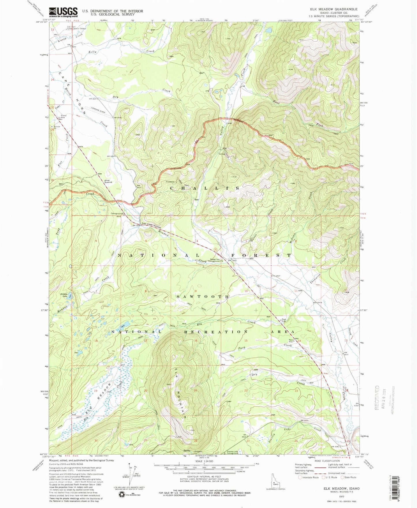
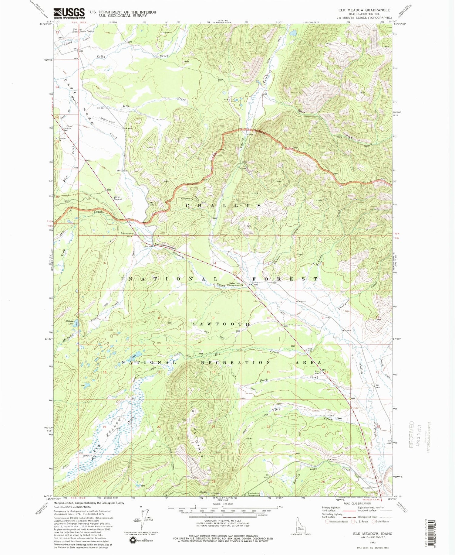
Historical USGS topographic quad map of Elk Meadow in the state of Idaho. Map scale may vary for some years, but is generally around 1:24,000. Print size is approximately 24" x 27"
This quadrangle is in the following counties: Custer.
The map contains contour lines, roads, rivers, towns, and lakes. Printed on high-quality waterproof paper with UV fade-resistant inks, and shipped rolled.
Contains the following named places: Blind Summit, Cape Horn, Cape Horn Guard Station, Dry Creek, East Fork Valley Creek, Elk Creek, Elk Creek Rest Area, Elk Meadow, Elk Mountain, Flat Creek, Hanna Creek, Hidden Lake, McGown Creek, Meadow Creek, Park Creek, Park Creek Overlook, Sheep Trail Campground, Silva Ranch Airport, Stanley Creek, Stanley Lake Creek, Thompson Creek, Trap Creek, Trap Creek Narrows, Trap Creek Rest Area, Vader Creek, Vader Creek Rest Area