MyTopo
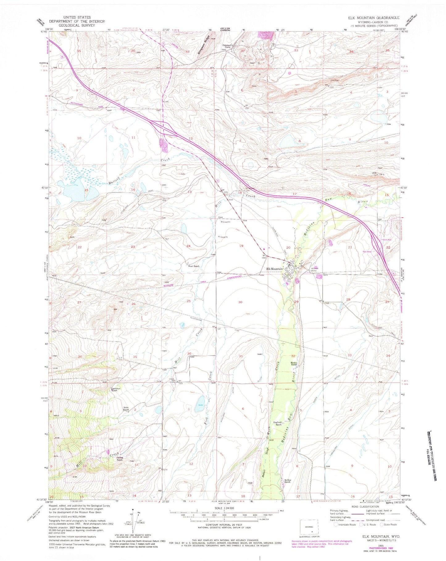
Classic USGS Elk Mountain Wyoming 7.5'x7.5' Topo Map
Couldn't load pickup availability
Historical USGS topographic quad map of Elk Mountain in the state of Wyoming. Map scale may vary for some years, but is generally around 1:24,000. Print size is approximately 24" x 27"
This quadrangle is in the following counties: Carbon.
The map contains contour lines, roads, rivers, towns, and lakes. Printed on high-quality waterproof paper with UV fade-resistant inks, and shipped rolled.
Contains the following named places: Big Draw, Boles Ranch, Carbon County Mine, Dolling Ranch, Elk Mountain, Elk Mountain Cemetery, Elk Mountain Post Office, Elk Mountain Prospect, Elk Mountain School, Elk Mountain Strip Mine Number Five, Elk Mountain Strip Mine Number Four, Elk Mountain Strip Mine Number One, Elk Mountain Strip Mine Number Three, Elk Mountain Valley Strip Mine, Elk Mountain Volunteer Fire Department, Fish Creek, Garey Mine, Garretson Ranch, Gebhart Mine, Hadsell Slough, Haglund Ranch, Halleck Creek, Johnson Mine, McKee Ranch, Menke Ranch, Mill Creek, O'Mara Creek, Peterson Camp, Saddleback Hills, Tableland Ditch, Town of Elk Mountain, West Mine, West Ranch, Wyoming Highway Patrol District 1 Division P, ZIP Code: 82324