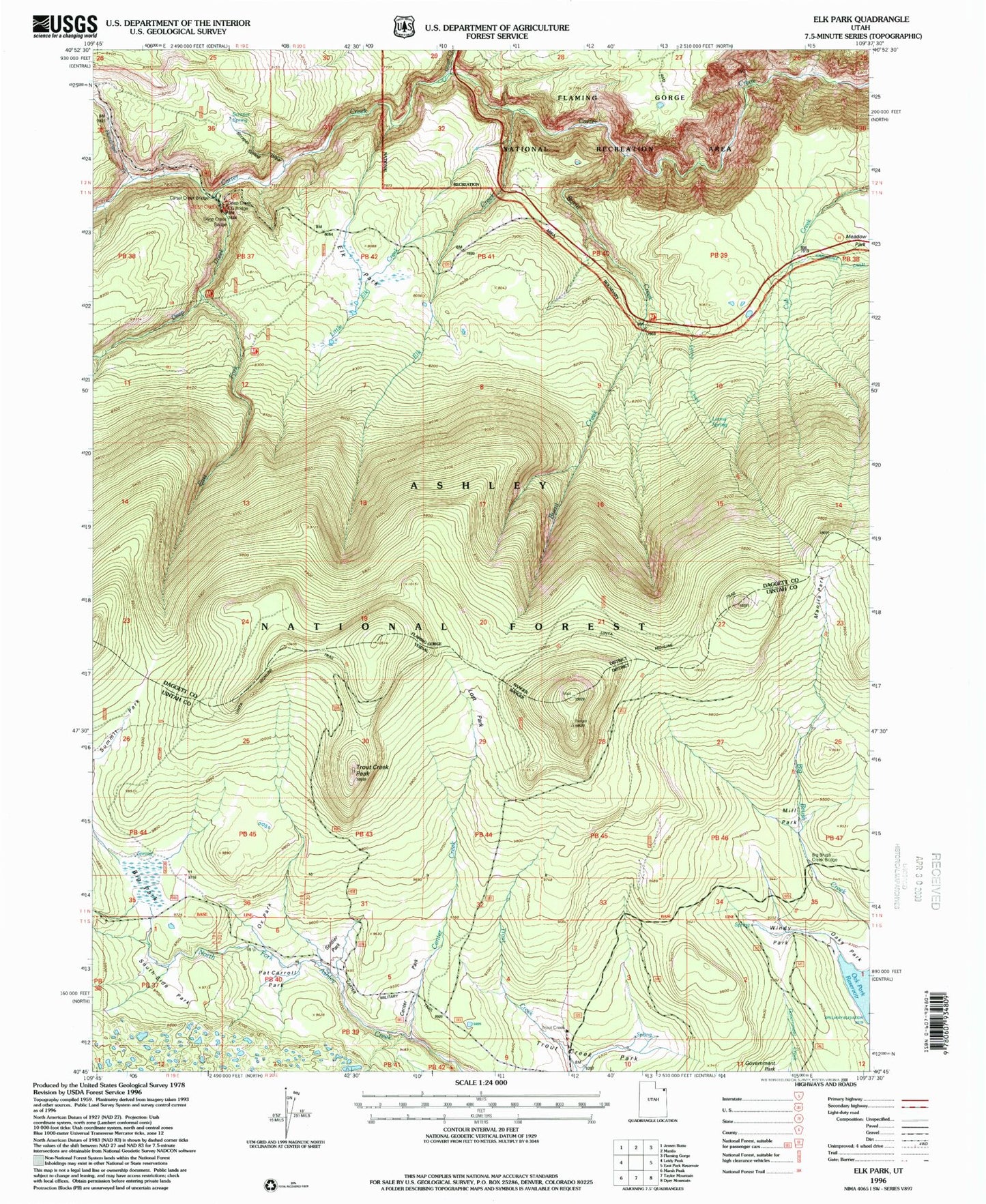
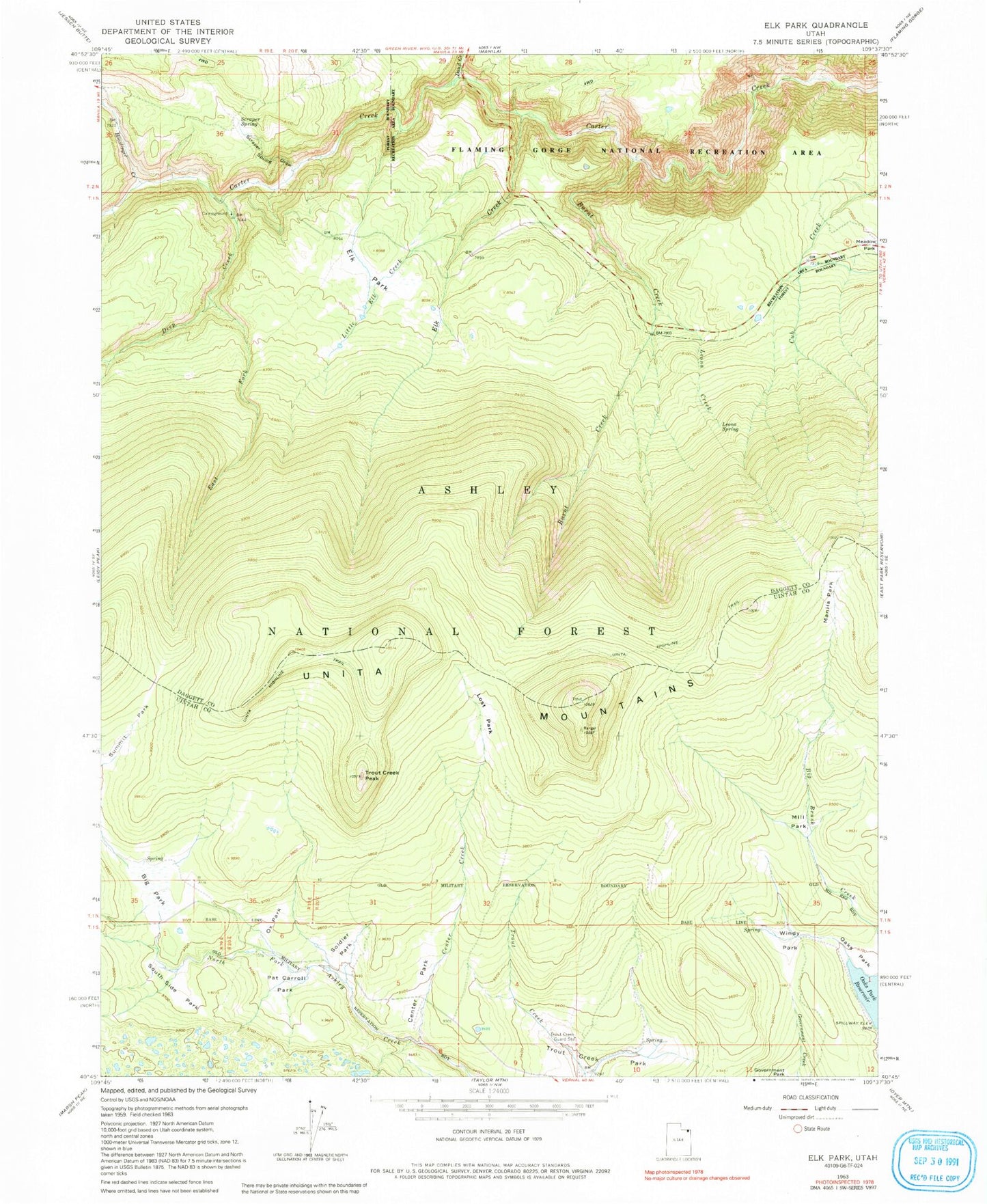
MyTopo
Classic USGS Elk Park Utah 7.5'x7.5' Topo Map
Couldn't load pickup availability
Historical USGS topographic quad map of Elk Park in the state of Utah. Map scale may vary for some years, but is generally around 1:24,000. Print size is approximately 24" x 27"
This quadrangle is in the following counties: Daggett, Uintah.
The map contains contour lines, roads, rivers, towns, and lakes. Printed on high-quality waterproof paper with UV fade-resistant inks, and shipped rolled.
Contains the following named places: Big Park, Burnt Creek, Carter Creek Bridge, Center Creek, Center Park, Deep Creek, Deep Creek Bridge, Deep Creek Campground, Deep Creek Campground Bridge, Dowd Creek, East Fork Deep Creek, Elk Creek, Elk Park, Honslinger Creek, Leona Creek, Leona Spring, Little Elk Creek, Lost Park, Manila Park, Mill Park, Oaks Park, Ox Park, Pat Carroll Park, Scraper Spring, Scraper Spring Draw, Soldier Park, South Side Park, Trout Creek Guard Station, Trout Creek Park, Trout Creek Peak, Uinta Highline Trail, Windy Park