MyTopo
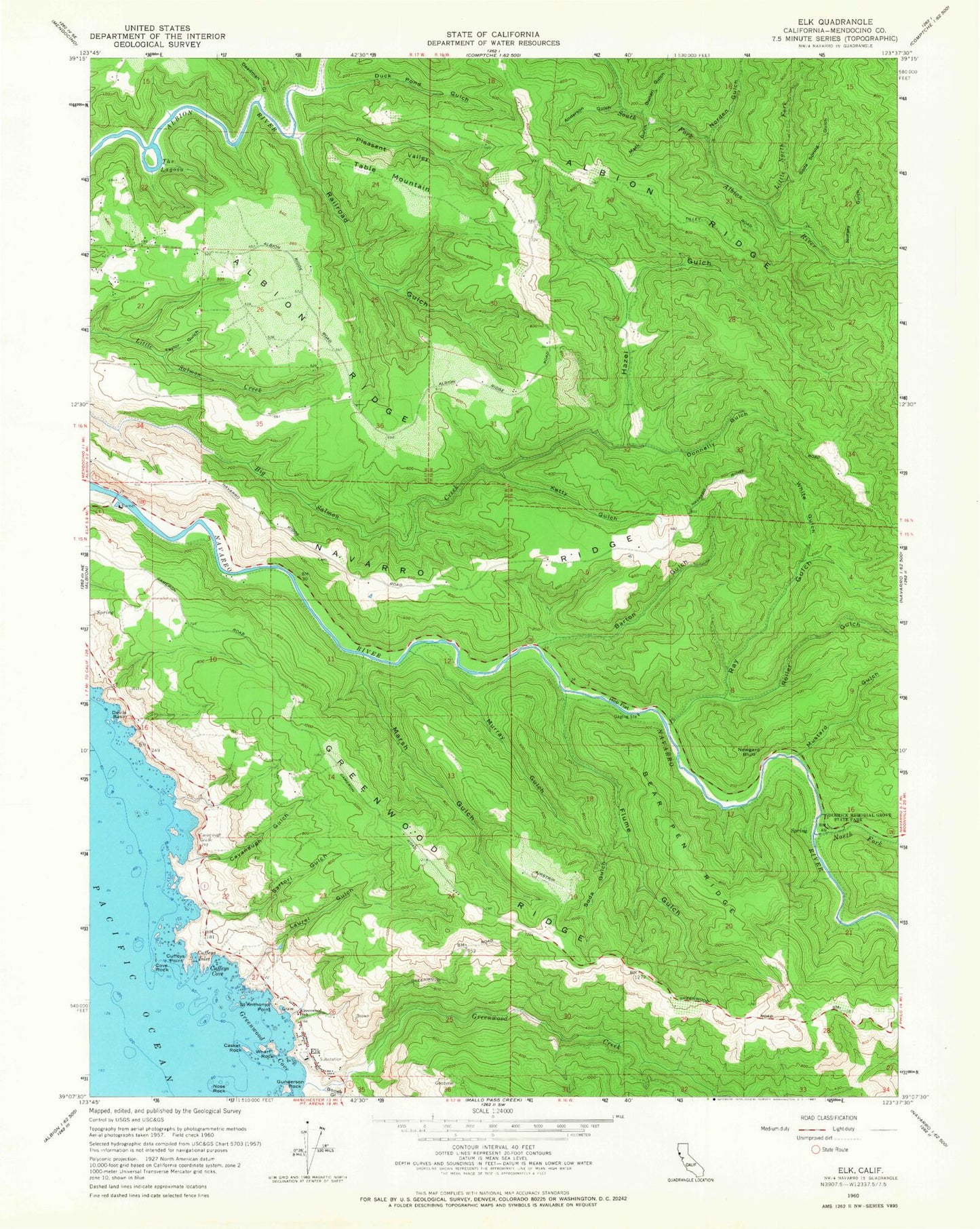
Classic USGS Elk California 7.5'x7.5' Topo Map
Couldn't load pickup availability
Historical USGS topographic quad map of Elk in the state of California. Typical map scale is 1:24,000, but may vary for certain years, if available. Print size: 24" x 27"
This quadrangle is in the following counties: Mendocino.
The map contains contour lines, roads, rivers, towns, and lakes. Printed on high-quality waterproof paper with UV fade-resistant inks, and shipped rolled.
Contains the following named places: Albion Ridge, Anderson Gulch, Barton Gulch, Bear Pen Ridge, Casket Rock, Cavanaugh Grade, Cavanaugh Gulch, Cove Rock, Cuffeys Inlet, Cuffeys Point, Deadman Gulch, Devils Basin, Dimmick Memorial Grove State Park (historical), Donnelly Gulch, Duck Pond Gulch, Flume Gulch, Greenwood Cove, Greenwood Elementary School, Gunderson Rock, Hazel Gulch, Hop Flat, Ketty Gulch, Laurel Gulch, Little North Fork Albion River, Mack Gulch, Marsh Gulch, Murray Gulch, Mustard Gulch, Navarro Ridge, Newgard Bluff, Norden Gulch, Nose Rock, Nursey Gulch, Pleasant Valley, Railroad Gulch, Ray Gulch, Saint Anthonys Point, Sartori Gulch, Bonee Gulch, Greenwood Creek, North Fork Navarro River, Roller Gulch, Soda Gulch, Soda Spring Gulch, Taylor Gulch, The Lagoon, Wharf Rock, White Gulch, Cuffeys Cove, Gunari Gulch, Cape Horn, Donahue Ranch, Frasier Ranch, Herbert Ranch, McMaster Ranch, Navarro Ridge School House (historical), Table Mountain Ranch, Williams Ranch, Elk, Greenwood State Beach, Navarro River Redwoods State Park, Albion School, Elk Volunteer Fire Department Station 711, Albion Little River Volunteer Fire Department Station 811, Wharf Rock West Arch, Wharf Rock East Arch, Devils Pitchfork, Cuffeys Cove Catholic Cemetery, Cuffeys Cove Community Cemetery, Druids Cemetery, Elk Post Office